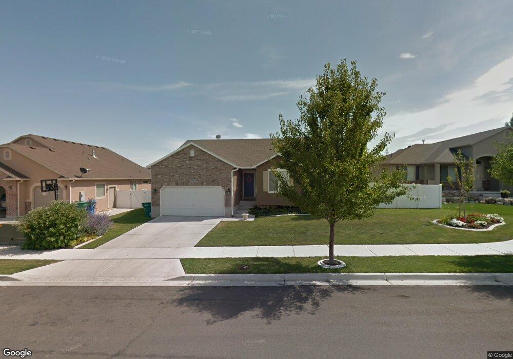
4507 W Kootenai St Unit Lt 433 Riverton, UT 84096
Estimated Value: $658,962 - $697,000
3
Beds
2
Baths
2,868
Sq Ft
$234/Sq Ft
Est. Value
About This Home
This home is located at 4507 W Kootenai St Unit Lt 433, Riverton, UT 84096 and is currently estimated at $671,991, approximately $234 per square foot. 4507 W Kootenai St Unit Lt 433 is a home located in Salt Lake County with nearby schools including Midas Creek Elementary School, Oquirrh Hills Middle School, and Riverton High School.
Ownership History
Date
Name
Owned For
Owner Type
Purchase Details
Closed on
Feb 20, 2020
Sold by
Swenson Gavin L and Swenson Jessica C
Bought by
Vaineo Amber and Vaineo Michael
Current Estimated Value
Home Financials for this Owner
Home Financials are based on the most recent Mortgage that was taken out on this home.
Original Mortgage
$404,910
Outstanding Balance
$358,519
Interest Rate
3.6%
Mortgage Type
New Conventional
Estimated Equity
$313,472
Purchase Details
Closed on
Jun 16, 2009
Sold by
Bach Homes Llc
Bought by
Swenson Gavin L and Swenson Jessica C
Home Financials for this Owner
Home Financials are based on the most recent Mortgage that was taken out on this home.
Original Mortgage
$206,800
Interest Rate
4.82%
Mortgage Type
Purchase Money Mortgage
Create a Home Valuation Report for This Property
The Home Valuation Report is an in-depth analysis detailing your home's value as well as a comparison with similar homes in the area
Home Values in the Area
Average Home Value in this Area
Purchase History
| Date | Buyer | Sale Price | Title Company |
|---|---|---|---|
| Vaineo Amber | -- | First American Title Ins Api | |
| Swenson Gavin L | -- | Meridian Title |
Source: Public Records
Mortgage History
| Date | Status | Borrower | Loan Amount |
|---|---|---|---|
| Open | Vaineo Amber | $404,910 | |
| Previous Owner | Swenson Gavin L | $206,800 |
Source: Public Records
Tax History Compared to Growth
Tax History
| Year | Tax Paid | Tax Assessment Tax Assessment Total Assessment is a certain percentage of the fair market value that is determined by local assessors to be the total taxable value of land and additions on the property. | Land | Improvement |
|---|---|---|---|---|
| 2025 | $3,701 | $659,500 | $167,100 | $492,400 |
| 2024 | $3,701 | $640,500 | $162,000 | $478,500 |
| 2023 | $3,701 | $613,400 | $156,700 | $456,700 |
| 2022 | $3,893 | $623,100 | $153,600 | $469,500 |
| 2021 | $3,307 | $471,300 | $124,800 | $346,500 |
| 2020 | $2,627 | $349,000 | $99,800 | $249,200 |
| 2019 | $2,663 | $347,900 | $99,800 | $248,100 |
| 2018 | $2,519 | $324,000 | $96,800 | $227,200 |
| 2017 | $2,432 | $304,800 | $96,800 | $208,000 |
| 2016 | $2,358 | $283,600 | $96,800 | $186,800 |
| 2015 | $2,312 | $269,600 | $98,600 | $171,000 |
| 2014 | $2,225 | $254,300 | $94,000 | $160,300 |
Source: Public Records
Map
Nearby Homes
- 4494 W Osage Rd
- 4587 W Flintlock Way
- 12501 S Huron Rd
- 12284 S Flintlock Way
- 12339 Black Foot St
- 12693 S Lincoln Peak Ln
- 12687 S Lincoln Peak Ln Unit 126
- 12687 S Lincoln Peak Ln
- 12694 S Lincoln Peak Ln Unit 116
- 12694 S Lincoln Peak Ln
- 12688 S Lincoln Peak Ln Unit 115
- 12688 S Lincoln Peak Ln
- 12686 Lincoln Peak Ln
- 12682 S Lincoln Peak Ln
- 12682 S Lincoln Peak Ln Unit 113
- 12671 S Lincoln Peak Ln Unit 131
- 12671 S Lincoln Peak Ln
- 12676 S Lincoln Peak Ln
- 12676 S Lincoln Peak Ln Unit 112
- 12674 S Lincoln Peak Ln
- 4507 W Kootenai St
- 4507 W Kootenai St
- 4519 W Kootenai St
- 4519 W Kootenai St
- 4519 W Kootenai St Unit LOT434
- 4493 Kootenai St
- 4518 Gladstone Cir
- 4518 W Gladstone Cir
- 4487 W Sacajewa St
- 4487 Sacajewa St
- 4512 Gladstone Cir
- 4527 W Kootenai St
- 4522 Gladstone Cir
- 4522 W Gladstone Cir
- 4527 W Kootenai St
- 12343 S Black Canyon Rd Unit LOT432
- 12343 S Black Canyon Rd
- 12344 Sacajewa St
- 4508 Gladstone Cir
- 12344 S Sacajewa St