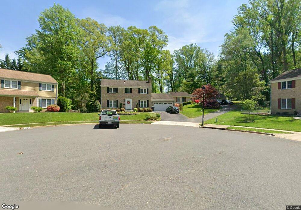
4508 Buffalo Trace Annandale, VA 22003
Estimated Value: $872,000 - $992,000
5
Beds
3
Baths
1,800
Sq Ft
$511/Sq Ft
Est. Value
About This Home
This home is located at 4508 Buffalo Trace, Annandale, VA 22003 and is currently estimated at $919,655, approximately $510 per square foot. 4508 Buffalo Trace is a home located in Fairfax County with nearby schools including Wakefield Forest Elementary School, Frost Middle School, and W. T. Woodson High School.
Ownership History
Date
Name
Owned For
Owner Type
Purchase Details
Closed on
Oct 21, 2021
Sold by
Mckenzie Dexter and Mckenzie Anne
Bought by
Mckenzie Dexter and Mckenzie Anne
Current Estimated Value
Purchase Details
Closed on
Aug 31, 1998
Sold by
Hathaway Don L
Bought by
Mckenzie Dexter L
Home Financials for this Owner
Home Financials are based on the most recent Mortgage that was taken out on this home.
Original Mortgage
$214,000
Outstanding Balance
$45,713
Interest Rate
6.9%
Estimated Equity
$873,942
Create a Home Valuation Report for This Property
The Home Valuation Report is an in-depth analysis detailing your home's value as well as a comparison with similar homes in the area
Home Values in the Area
Average Home Value in this Area
Purchase History
| Date | Buyer | Sale Price | Title Company |
|---|---|---|---|
| Mckenzie Dexter | -- | None Available | |
| Mckenzie Dexter L | $267,000 | -- |
Source: Public Records
Mortgage History
| Date | Status | Borrower | Loan Amount |
|---|---|---|---|
| Open | Mckenzie Dexter L | $214,000 |
Source: Public Records
Tax History
| Year | Tax Paid | Tax Assessment Tax Assessment Total Assessment is a certain percentage of the fair market value that is determined by local assessors to be the total taxable value of land and additions on the property. | Land | Improvement |
|---|---|---|---|---|
| 2025 | $9,029 | $852,290 | $310,000 | $542,290 |
| 2024 | $9,029 | $779,360 | $275,000 | $504,360 |
| 2023 | $8,911 | $789,670 | $275,000 | $514,670 |
| 2022 | $8,743 | $764,570 | $255,000 | $509,570 |
| 2021 | $7,896 | $672,900 | $215,000 | $457,900 |
| 2020 | $7,598 | $641,980 | $210,000 | $431,980 |
| 2019 | $7,598 | $641,980 | $210,000 | $431,980 |
| 2018 | $6,931 | $602,710 | $210,000 | $392,710 |
| 2017 | $6,997 | $602,710 | $210,000 | $392,710 |
| 2016 | $6,982 | $602,710 | $210,000 | $392,710 |
Source: Public Records
Map
Nearby Homes
- 8623 Pappas Way
- 8625 Appleton Ct
- 8527 Pappas Way
- 8706 Braeburn Dr
- 4403 Wakefield Dr
- 4815 Wakefield Chapel Rd
- 8921 Braeburn Dr
- 8311 Chapel Lake Ct
- 4204 Wakefield Dr
- 8320 Briar Creek Dr
- 4353 Starr Jordan Dr
- 4226 Holborn Ave
- 8130 Briar Creek Dr
- 4901 Red Fox Dr
- 8312 Upper Spring Ln
- 8310 Upper Spring Ln
- 8309 Highcliffe Ct
- 8317 Little River Turnpike
- 8405 Thames St
- 8721 Little River Turnpike
- 4510 Buffalo Trace
- 4506 Buffalo Trace
- 4509 Buffalo Trace
- 4632 Lescot Place
- 4606 Ordinary Ct
- 4504 Buffalo Trace
- 4634 Lescot Place
- 4507 Buffalo Trace
- 8612 Pappas Way
- 8614 Pappas Way
- 4630 Lescot Place
- 8610 Pappas Way
- 4604 Ordinary Ct
- 4505 Buffalo Trace
- 8618 Pappas Way
- 4608 Ordinary Ct
- 8608 Pappas Way
- 8620 Pappas Way
- 4502 Buffalo Trace
- 4503 Buffalo Trace
Your Personal Tour Guide
Ask me questions while you tour the home.