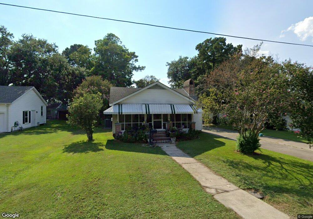
451 7th St Port Allen, LA 70767
Estimated Value: $181,000 - $218,000
--
Bed
--
Bath
1,758
Sq Ft
$114/Sq Ft
Est. Value
About This Home
This home is located at 451 7th St, Port Allen, LA 70767 and is currently estimated at $200,450, approximately $114 per square foot. 451 7th St is a home located in West Baton Rouge Parish with nearby schools including Port Allen Elementary School, Cohn Elementary School, and Port Allen Middle School.
Ownership History
Date
Name
Owned For
Owner Type
Purchase Details
Closed on
Jan 16, 2025
Sold by
Rizzutto James Harold and Rizzutto Theresa Cooper
Bought by
James And Theresa Rizzutto Living Trust
Current Estimated Value
Purchase Details
Closed on
Apr 21, 2010
Sold by
Rizzutto Pino Myrtle and Pina Edgar Allen
Bought by
Rizzutto James H and Rizzutto Theresa C
Home Financials for this Owner
Home Financials are based on the most recent Mortgage that was taken out on this home.
Original Mortgage
$100,000
Interest Rate
5.02%
Mortgage Type
New Conventional
Create a Home Valuation Report for This Property
The Home Valuation Report is an in-depth analysis detailing your home's value as well as a comparison with similar homes in the area
Home Values in the Area
Average Home Value in this Area
Purchase History
| Date | Buyer | Sale Price | Title Company |
|---|---|---|---|
| James And Theresa Rizzutto Living Trust | -- | None Listed On Document | |
| Rizzutto James H | $100,000 | None Available |
Source: Public Records
Mortgage History
| Date | Status | Borrower | Loan Amount |
|---|---|---|---|
| Previous Owner | Rizzutto James H | $100,000 |
Source: Public Records
Tax History Compared to Growth
Tax History
| Year | Tax Paid | Tax Assessment Tax Assessment Total Assessment is a certain percentage of the fair market value that is determined by local assessors to be the total taxable value of land and additions on the property. | Land | Improvement |
|---|---|---|---|---|
| 2024 | $1,146 | $17,170 | $5,230 | $11,940 |
| 2023 | $853 | $14,060 | $3,570 | $10,490 |
| 2022 | $1,646 | $14,060 | $3,570 | $10,490 |
| 2021 | $1,679 | $14,060 | $3,570 | $10,490 |
| 2020 | $1,525 | $12,650 | $3,210 | $9,440 |
| 2019 | $1,476 | $11,740 | $2,630 | $9,110 |
| 2018 | $1,500 | $11,740 | $2,630 | $9,110 |
| 2017 | $1,397 | $11,740 | $2,630 | $9,110 |
| 2015 | $1,136 | $11,490 | $2,380 | $9,110 |
| 2014 | $1,122 | $11,490 | $2,380 | $9,110 |
| 2013 | $1,122 | $11,490 | $2,380 | $9,110 |
Source: Public Records
Map
Nearby Homes
- 755 Maryland Ave
- 235 N Jefferson Ave
- 330 Magnolia St
- 238 Whitehead Blvd
- 348 Michigan Ave
- 926 Louisiana Ave
- 1272 Georgia Ave
- 309 N 14th St
- 332 Gladiolus St
- TBD River Rd
- 402 Melissa Dr
- 289 Melissa Dr
- 245 Melissa Dr
- 3459 Louisiana 1
- 1702 Court St
- 131 W Main St
- 2105 Taylor Dr
- 15722 Maxwell Dr
- 15714 Jack St
- 2045 N 3rd St Unit 313