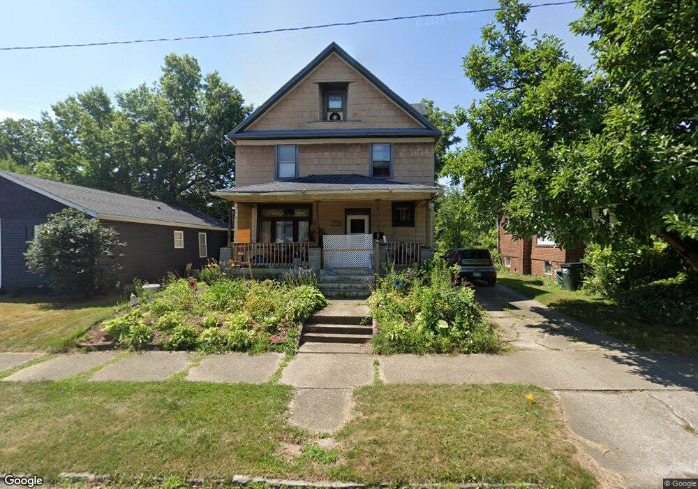
451 E College St Alliance, OH 44601
Estimated Value: $80,000 - $126,000
4
Beds
1
Bath
1,701
Sq Ft
$60/Sq Ft
Est. Value
About This Home
This home is located at 451 E College St, Alliance, OH 44601 and is currently estimated at $101,673, approximately $59 per square foot. 451 E College St is a home located in Stark County with nearby schools including Alliance Elementary School at Rockhill, Alliance Intermediate School at Northside, and Alliance Middle School.
Ownership History
Date
Name
Owned For
Owner Type
Purchase Details
Closed on
Oct 18, 2023
Sold by
Hughes Larry R and Hughes Deborah S
Bought by
Hughes Danielle J
Current Estimated Value
Purchase Details
Closed on
Aug 11, 2009
Sold by
Hines Susan J
Bought by
Hughes Larry R and Hughes Deborah S
Purchase Details
Closed on
Sep 29, 1992
Purchase Details
Closed on
Aug 24, 1992
Create a Home Valuation Report for This Property
The Home Valuation Report is an in-depth analysis detailing your home's value as well as a comparison with similar homes in the area
Home Values in the Area
Average Home Value in this Area
Purchase History
| Date | Buyer | Sale Price | Title Company |
|---|---|---|---|
| Hughes Danielle J | -- | None Listed On Document | |
| Hughes Larry R | -- | Attorney | |
| -- | $30,000 | -- | |
| -- | -- | -- |
Source: Public Records
Tax History
| Year | Tax Paid | Tax Assessment Tax Assessment Total Assessment is a certain percentage of the fair market value that is determined by local assessors to be the total taxable value of land and additions on the property. | Land | Improvement |
|---|---|---|---|---|
| 2025 | -- | $12,290 | $6,860 | $5,430 |
| 2024 | -- | $12,290 | $6,860 | $5,430 |
| 2023 | $560 | $13,940 | $5,430 | $8,510 |
| 2022 | $564 | $13,940 | $5,430 | $8,510 |
| 2021 | $564 | $13,940 | $5,430 | $8,510 |
| 2020 | $527 | $12,150 | $4,690 | $7,460 |
| 2019 | $519 | $12,150 | $4,690 | $7,460 |
Source: Public Records
Map
Nearby Homes
- 1841 S Freedom Ave
- 624 E College St
- 1511 Grace St
- 225 Shadyside Ct
- 834 Devine St
- 1350 S Freedom Ave
- 1522 Wade Ave
- 2135 Cherry Ave
- 2145 Cherry Ave
- 2464 S Freedom Ave
- 167 11th St
- 134 11th St
- 231 Rosenberry St
- 853 Fairway Dr
- 900 S Seneca Ave
- 234 Rosenberry St
- 555 E Milton St
- 46 Rosenberry St
- 452 E Summit St
- 807 S Union Ave
- 459 E College St
- 443 E College St
- 427 E College St
- 1805 S Freedom Ave
- 505 E College St
- 411 E College St
- 515 E College St
- 450 E College St
- 444 E College St
- 464 E College St
- 434 E College St
- 1734 S Freedom Ave
- 403 E College St
- 1746 S Linden Ave
- 424 E College St
- 1690 S Freedom Ave
- 1806 S Freedom Ave
- 416 E College St
- 516 E College St
- 531 E College St
Your Personal Tour Guide
Ask me questions while you tour the home.