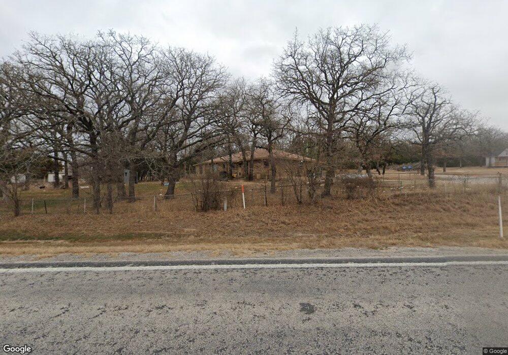
451 Farm To Market Road 1655 Alvord, TX 76225
Estimated Value: $293,000 - $378,000
2
Beds
2
Baths
1,323
Sq Ft
$252/Sq Ft
Est. Value
About This Home
This home is located at 451 Farm To Market Road 1655, Alvord, TX 76225 and is currently estimated at $333,037, approximately $251 per square foot. 451 Farm To Market Road 1655 is a home located in Wise County with nearby schools including Alvord Elementary School, Alvord Middle School, and Alvord High School.
Ownership History
Date
Name
Owned For
Owner Type
Purchase Details
Closed on
May 15, 2020
Sold by
Brown Terry Dan and Brown Judy Marie
Bought by
Elam Carson and Elam Joshua
Current Estimated Value
Home Financials for this Owner
Home Financials are based on the most recent Mortgage that was taken out on this home.
Original Mortgage
$200,000
Outstanding Balance
$139,895
Interest Rate
3.3%
Mortgage Type
Seller Take Back
Estimated Equity
$193,142
Purchase Details
Closed on
Mar 20, 2006
Sold by
Dodd Pat Anthony and Dodd Carla Jeanne
Bought by
Brown Terry Dan and Brown Judy Marie
Home Financials for this Owner
Home Financials are based on the most recent Mortgage that was taken out on this home.
Original Mortgage
$73,500
Interest Rate
6.21%
Purchase Details
Closed on
Mar 17, 2003
Sold by
Denney Leonard
Bought by
Brown Terry and Brown Judy
Purchase Details
Closed on
Mar 4, 2003
Sold by
Dodd Pat and Alva Denney
Bought by
Brown Terry and Brown Judy
Purchase Details
Closed on
Jan 1, 1901
Bought by
Brown Terry and Brown Judy
Create a Home Valuation Report for This Property
The Home Valuation Report is an in-depth analysis detailing your home's value as well as a comparison with similar homes in the area
Home Values in the Area
Average Home Value in this Area
Purchase History
| Date | Buyer | Sale Price | Title Company |
|---|---|---|---|
| Elam Carson | -- | Title Resources | |
| Brown Terry Dan | -- | None Available | |
| Brown Terry | -- | -- | |
| Brown Terry | -- | -- | |
| Brown Terry | -- | -- |
Source: Public Records
Mortgage History
| Date | Status | Borrower | Loan Amount |
|---|---|---|---|
| Open | Elam Carson | $200,000 | |
| Previous Owner | Brown Terry Dan | $73,500 |
Source: Public Records
Tax History Compared to Growth
Tax History
| Year | Tax Paid | Tax Assessment Tax Assessment Total Assessment is a certain percentage of the fair market value that is determined by local assessors to be the total taxable value of land and additions on the property. | Land | Improvement |
|---|---|---|---|---|
| 2025 | $2,233 | $308,553 | $113,725 | $194,828 |
| 2024 | $2,233 | $273,217 | $0 | $0 |
| 2023 | $2,949 | $248,379 | $0 | $0 |
| 2022 | $3,484 | $225,799 | $0 | $0 |
| 2021 | $3,370 | $205,270 | $63,750 | $141,520 |
| 2020 | $2,065 | $124,750 | $15,000 | $109,750 |
| 2019 | $1,976 | $111,790 | $7,170 | $104,620 |
| 2018 | $1,896 | $105,970 | $7,170 | $98,800 |
| 2017 | $1,753 | $98,000 | $6,590 | $91,410 |
| 2016 | $1,796 | $98,000 | $6,590 | $91,410 |
| 2015 | -- | $92,630 | $6,590 | $86,040 |
| 2014 | -- | $92,630 | $6,590 | $86,040 |
Source: Public Records
Map
Nearby Homes
- TBD Cr-2690 Rd
- 4519 County Road 2690
- 4507 County Road 2690
- 711 Denver St
- 4519 Cr 2690
- 510 N Proctor St
- 511 Denver St
- Roosevelt Plan at Whispering Winds - Liberty Series
- Lincoln Plan at Whispering Winds - Liberty Series
- Madison Plan at Whispering Winds - Liberty Series
- Harrison Plan at Whispering Winds - Liberty Series
- Jackson Plan at Whispering Winds - Liberty Series
- 207 N Oneil St
- 209 N Wickham St
- 179 Sienna Dr
- 159 Sienna Dr
- 171 Sienna Dr
- 155 Sienna Dr
- 175 Sienna Dr
- 167 Sienna Dr
- 410 N Fm 1655
- 287 N Fm 1655
- 414 Private Road 2693
- 543 N Fm 1655
- 196 Brown Ct
- 518 N Fm 1655
- 4784 County Road 2690
- 1209 N Wickham St
- 0000 Fm 1655
- 138 N Fm 1655
- 649 N Fm 1655
- 4798 County Road 2690
- TBD Denver St
- 908 Denver St
- 907 Denver St
- 204 Summit St
- 210 Summit St
- 201 Summit St
- 903 Denver St
- 207 Summit St