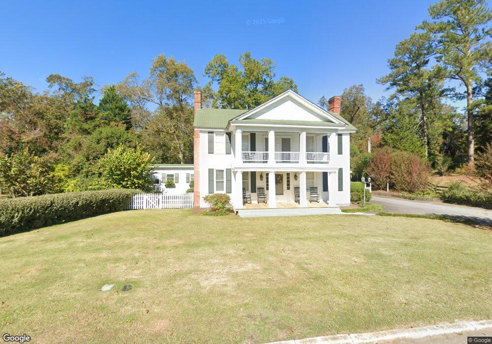
451 Lagrange St Greenville, GA 30222
Estimated Value: $251,295 - $281,000
3
Beds
2
Baths
2,654
Sq Ft
$101/Sq Ft
Est. Value
About This Home
This home is located at 451 Lagrange St, Greenville, GA 30222 and is currently estimated at $268,324, approximately $101 per square foot. 451 Lagrange St is a home located in Meriwether County with nearby schools including George E. Washington Elementary School.
Ownership History
Date
Name
Owned For
Owner Type
Purchase Details
Closed on
Jul 2, 2020
Sold by
Comerica Bank And Trust Trustee
Bought by
Hill Jack Pinson
Current Estimated Value
Purchase Details
Closed on
Oct 22, 2008
Sold by
Not Provided
Bought by
Citi Group Trust
Purchase Details
Closed on
May 16, 2000
Sold by
Mcleod Raymond E and Mcleod M
Bought by
Hill W P
Purchase Details
Closed on
Apr 20, 1995
Sold by
Atlanta Postal Credi
Bought by
Mcleod Raymond E and Mcleod M
Purchase Details
Closed on
Feb 1, 1995
Sold by
Low William C
Bought by
Atlanta Postal Credi
Purchase Details
Closed on
Jan 1, 1985
Sold by
Hill J Render
Bought by
Low William C
Create a Home Valuation Report for This Property
The Home Valuation Report is an in-depth analysis detailing your home's value as well as a comparison with similar homes in the area
Home Values in the Area
Average Home Value in this Area
Purchase History
| Date | Buyer | Sale Price | Title Company |
|---|---|---|---|
| Hill Jack Pinson | -- | -- | |
| Citi Group Trust | -- | -- | |
| Hill W P | $140,000 | -- | |
| Mcleod Raymond E | $39,000 | -- | |
| Atlanta Postal Credi | $37,000 | -- | |
| Low William C | $48,000 | -- |
Source: Public Records
Tax History Compared to Growth
Tax History
| Year | Tax Paid | Tax Assessment Tax Assessment Total Assessment is a certain percentage of the fair market value that is determined by local assessors to be the total taxable value of land and additions on the property. | Land | Improvement |
|---|---|---|---|---|
| 2024 | $4,625 | $95,160 | $7,400 | $87,760 |
| 2023 | $3,127 | $62,320 | $7,400 | $54,920 |
| 2022 | $2,151 | $62,320 | $7,400 | $54,920 |
| 2021 | $2,185 | $62,320 | $7,400 | $54,920 |
| 2020 | $2,202 | $62,320 | $7,400 | $54,920 |
| 2019 | $2,209 | $62,320 | $7,400 | $54,920 |
| 2018 | $2,229 | $62,320 | $7,400 | $54,920 |
| 2017 | $2,255 | $62,320 | $7,400 | $54,920 |
| 2016 | $2,052 | $62,320 | $7,400 | $54,920 |
| 2015 | $2,054 | $62,320 | $7,400 | $54,920 |
| 2014 | $2,055 | $62,320 | $7,400 | $54,920 |
| 2013 | -- | $62,320 | $7,400 | $54,920 |
Source: Public Records
Map
Nearby Homes
- 330 Stovall Rd
- 934 R D Hill St
- 421 Lagrange St
- 568 S Talbotton St
- 1100 Reville
- 570 Gay Connector Rd
- 1152 Old Durand Rd
- 77 Perdue Rd
- 18760 Roosevelt Hwy
- 909 Threadgill Rd
- 4444 Lagrange Hwy
- 2638 Jarrell Rd
- 2001 Threadgill Rd
- 2067 Threadgill Rd
- 75 Lee Ln
- 854 Lee Ln
- 0 Winter Rd Unit 10499103
- 3860 Cedar Rock Rd
- 5582 Georgia 100
- 0 Owens Rd Unit 219685
- 455 Lagrange St
- 457 Lagrange St
- 180 Stovall Rd
- 445 Lagrange St
- 61 Stovall Rd
- 0 Stovall Rd Unit 8436365
- 0 Stovall Rd Unit 8312108
- 0 Stovall Rd Unit LOT 8 3104621
- 0 Stovall Rd Unit 3118802
- 0 Stovall Rd Unit TRACT 8 7513105
- 0 Stovall Rd Unit 10350297
- 0 Stovall Rd Unit 20179685
- 0 Stovall Rd Unit 20142627
- 0 Stovall Rd Unit 7075175
- 0 Stovall Rd Unit 20035131
- 0 Stovall Rd Unit 23.91 ACRES 8028185
- 0 Stovall Rd Unit 8414170
- 0 Stovall Rd Unit 9059714
- 0 Stovall Rd Unit 9019631
- 0 Stovall Rd Unit 9019666