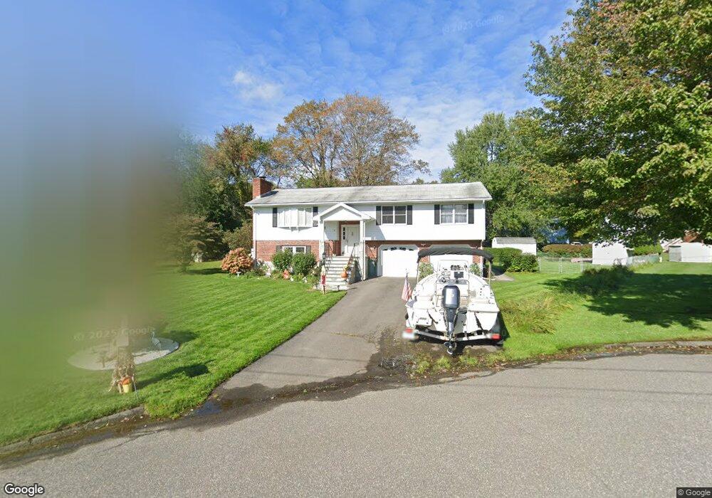
451 Maybrook Rd Waterbury, CT 06708
West End District NeighborhoodEstimated Value: $358,000 - $501,000
3
Beds
2
Baths
1,488
Sq Ft
$277/Sq Ft
Est. Value
About This Home
This home is located at 451 Maybrook Rd, Waterbury, CT 06708 and is currently estimated at $411,936, approximately $276 per square foot. 451 Maybrook Rd is a home located in New Haven County with nearby schools including B.W. Tinker School, West Side Middle School, and John F. Kennedy High School.
Ownership History
Date
Name
Owned For
Owner Type
Purchase Details
Closed on
Jul 15, 1999
Sold by
Albini Carlo and Albini Elena
Bought by
Rizk Fadi and Rizk Karen T
Current Estimated Value
Home Financials for this Owner
Home Financials are based on the most recent Mortgage that was taken out on this home.
Original Mortgage
$100,000
Outstanding Balance
$27,635
Interest Rate
7.39%
Mortgage Type
Purchase Money Mortgage
Estimated Equity
$384,301
Purchase Details
Closed on
Sep 27, 1989
Sold by
Bastista Antonio C
Bought by
Albini Carlo
Create a Home Valuation Report for This Property
The Home Valuation Report is an in-depth analysis detailing your home's value as well as a comparison with similar homes in the area
Home Values in the Area
Average Home Value in this Area
Purchase History
| Date | Buyer | Sale Price | Title Company |
|---|---|---|---|
| Rizk Fadi | $165,000 | -- | |
| Albini Carlo | $185,000 | -- |
Source: Public Records
Mortgage History
| Date | Status | Borrower | Loan Amount |
|---|---|---|---|
| Closed | Albini Carlo | $53,000 | |
| Open | Albini Carlo | $100,000 | |
| Previous Owner | Albini Carlo | $25,000 | |
| Previous Owner | Albini Carlo | $128,500 |
Source: Public Records
Tax History Compared to Growth
Tax History
| Year | Tax Paid | Tax Assessment Tax Assessment Total Assessment is a certain percentage of the fair market value that is determined by local assessors to be the total taxable value of land and additions on the property. | Land | Improvement |
|---|---|---|---|---|
| 2025 | $8,303 | $184,590 | $31,010 | $153,580 |
| 2024 | $9,126 | $184,590 | $31,010 | $153,580 |
| 2023 | $10,003 | $184,590 | $31,010 | $153,580 |
| 2022 | $6,299 | $104,620 | $31,010 | $73,610 |
| 2021 | $6,299 | $104,620 | $31,010 | $73,610 |
| 2020 | $6,299 | $104,620 | $31,010 | $73,610 |
| 2019 | $6,299 | $104,620 | $31,010 | $73,610 |
| 2018 | $6,299 | $104,620 | $31,010 | $73,610 |
| 2017 | $6,940 | $115,260 | $31,000 | $84,260 |
| 2016 | $6,940 | $115,260 | $31,000 | $84,260 |
| 2015 | $6,710 | $115,260 | $31,000 | $84,260 |
| 2014 | $6,710 | $115,260 | $31,000 | $84,260 |
Source: Public Records
Map
Nearby Homes
- 55 Eastfield Rd
- 77 Eastfield Rd
- 49 Southridge Dr
- 120 Mason Ave
- 0 Mason Ave
- 25 Parkwood Ave
- 110 Wooster Ave
- 61 Campfield Rd
- 149 Lakeside Blvd E
- 141 Joshua Town Rd
- 1 Ruth Parsons Dr
- 10 Old Waterbury Rd
- 197 Hickory Hill Dr
- 26 Oakleaf Dr
- 0 Ferndale Ave
- 69 Tree Hill Rd
- 804 Washington Avenue Extension
- 165 Birchwood St
- 67 Barrington Ln
- 29 Tree Hill Rd
- 443 Maybrook Rd
- 459 Maybrook Rd
- 452 Maybrook Rd
- 458 Maybrook Rd
- 440 Maybrook Rd
- 15 Thendara Dr
- 9 Thendara Dr
- 513 Country Club Rd
- 521 Country Club Rd
- 5 Thendara Dr
- 493 Country Club Rd
- 25 Thendara Dr
- 16 Thendara Dr
- 46 Middleway E
- 483 Country Club Rd
- 42 Middleway E
- 38 Middleway E
- 4 Thendara Dr
- 506 Country Club Rd
- 29 Thendara Dr