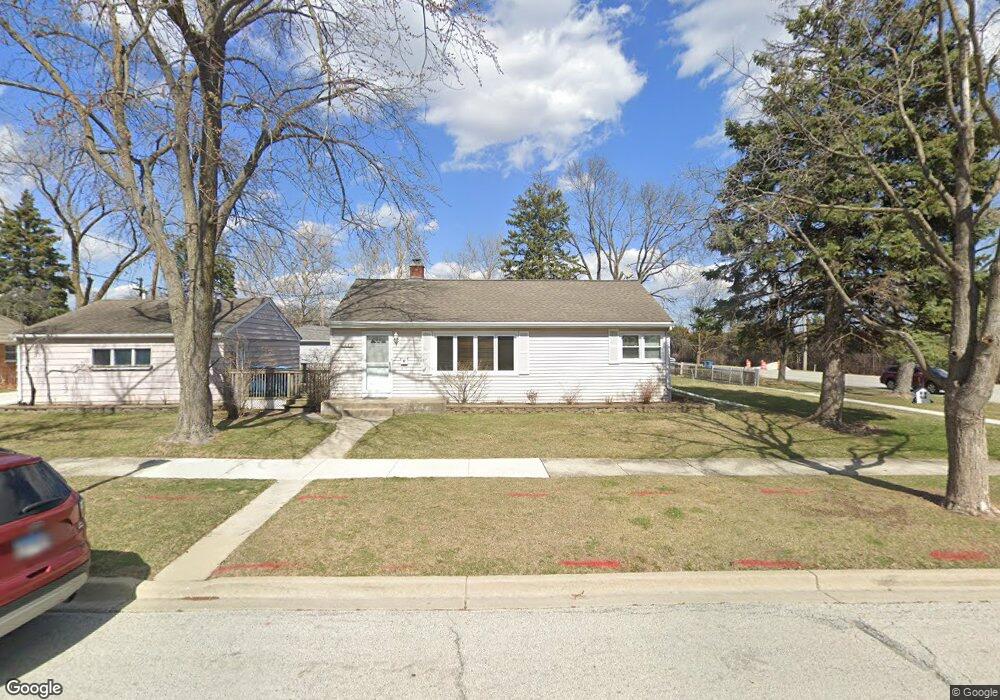
451 W Butterfield Rd Elmhurst, IL 60126
Estimated Value: $326,939 - $417,000
--
Bed
--
Bath
912
Sq Ft
$396/Sq Ft
Est. Value
About This Home
This home is located at 451 W Butterfield Rd, Elmhurst, IL 60126 and is currently estimated at $361,485, approximately $396 per square foot. 451 W Butterfield Rd is a home located in DuPage County with nearby schools including Salt Creek Elementary School, Stella May Swartz Elementary School, and John E Albright Middle School.
Ownership History
Date
Name
Owned For
Owner Type
Purchase Details
Closed on
Jun 9, 2004
Sold by
Johnson F Thomas and Johnson Kim J
Bought by
Odea Michael G and Odea Regina C
Current Estimated Value
Home Financials for this Owner
Home Financials are based on the most recent Mortgage that was taken out on this home.
Original Mortgage
$251,550
Interest Rate
6.4%
Mortgage Type
Purchase Money Mortgage
Purchase Details
Closed on
Dec 7, 1998
Sold by
Matuszewski Helen C
Bought by
Johnson F Thomas and Johnson Kim J
Home Financials for this Owner
Home Financials are based on the most recent Mortgage that was taken out on this home.
Original Mortgage
$132,525
Interest Rate
6.93%
Create a Home Valuation Report for This Property
The Home Valuation Report is an in-depth analysis detailing your home's value as well as a comparison with similar homes in the area
Home Values in the Area
Average Home Value in this Area
Purchase History
| Date | Buyer | Sale Price | Title Company |
|---|---|---|---|
| Odea Michael G | $279,500 | Ticor | |
| Johnson F Thomas | $139,500 | -- |
Source: Public Records
Mortgage History
| Date | Status | Borrower | Loan Amount |
|---|---|---|---|
| Previous Owner | Odea Michael G | $251,550 | |
| Previous Owner | Johnson F Thomas | $132,525 |
Source: Public Records
Tax History Compared to Growth
Tax History
| Year | Tax Paid | Tax Assessment Tax Assessment Total Assessment is a certain percentage of the fair market value that is determined by local assessors to be the total taxable value of land and additions on the property. | Land | Improvement |
|---|---|---|---|---|
| 2024 | $3,783 | $85,895 | $25,499 | $60,396 |
| 2023 | $3,200 | $79,430 | $23,580 | $55,850 |
| 2022 | $3,244 | $76,360 | $22,680 | $53,680 |
| 2021 | $3,291 | $74,460 | $22,120 | $52,340 |
| 2020 | $3,246 | $72,820 | $21,630 | $51,190 |
| 2019 | $3,099 | $69,230 | $20,560 | $48,670 |
| 2018 | $3,024 | $66,330 | $19,480 | $46,850 |
| 2017 | $3,239 | $63,200 | $18,560 | $44,640 |
| 2016 | $3,041 | $59,530 | $17,480 | $42,050 |
| 2015 | $2,986 | $55,450 | $16,280 | $39,170 |
| 2014 | $3,241 | $57,180 | $13,370 | $43,810 |
| 2013 | $3,210 | $57,990 | $13,560 | $44,430 |
Source: Public Records
Map
Nearby Homes
- 1S045 Spring Rd Unit 1D
- 1S150 Spring Rd Unit 5B
- 1S150 Spring Rd Unit 4L
- 2 S Atrium Way Unit 203
- 3 Oak Brook Club Dr Unit E207
- 274 Timber View Dr
- 130 Crab Apple Ln
- 1200 S Prospect Ave Unit 303
- 1200 S Prospect Ave Unit 108
- 1 Oak Brook Club Dr Unit A301
- 1 Oak Brook Club Dr Unit A312
- 995 S Swain Ave
- 963 S Saylor Ave
- 175 W Brush Hill Rd Unit 404
- 1046 E Van Buren St
- 936 S Mitchell Ave
- 625 E Van Buren St
- 110 W Butterfield Rd Unit 502S
- 814 S Saylor Ave
- 805 S Spring Rd
- 447 W Butterfield Rd
- 413 W Verret St
- 443 W Butterfield Rd
- 417 W Verret St
- 439 W Butterfield Rd
- 459 W Butterfield Rd
- 414 W Verret St
- 465 W Butterfield Rd
- 435 W Butterfield Rd
- 390 W Avery St
- 418 W Verret St
- 422 W Verret St
- 382 W Avery St
- 394 W Avery St
- 469 W Butterfield Rd
- 425 W Verret St
- 426 W Verret St
- 398 W Avery St
- 429 W Verret St
- 430 W Verret St