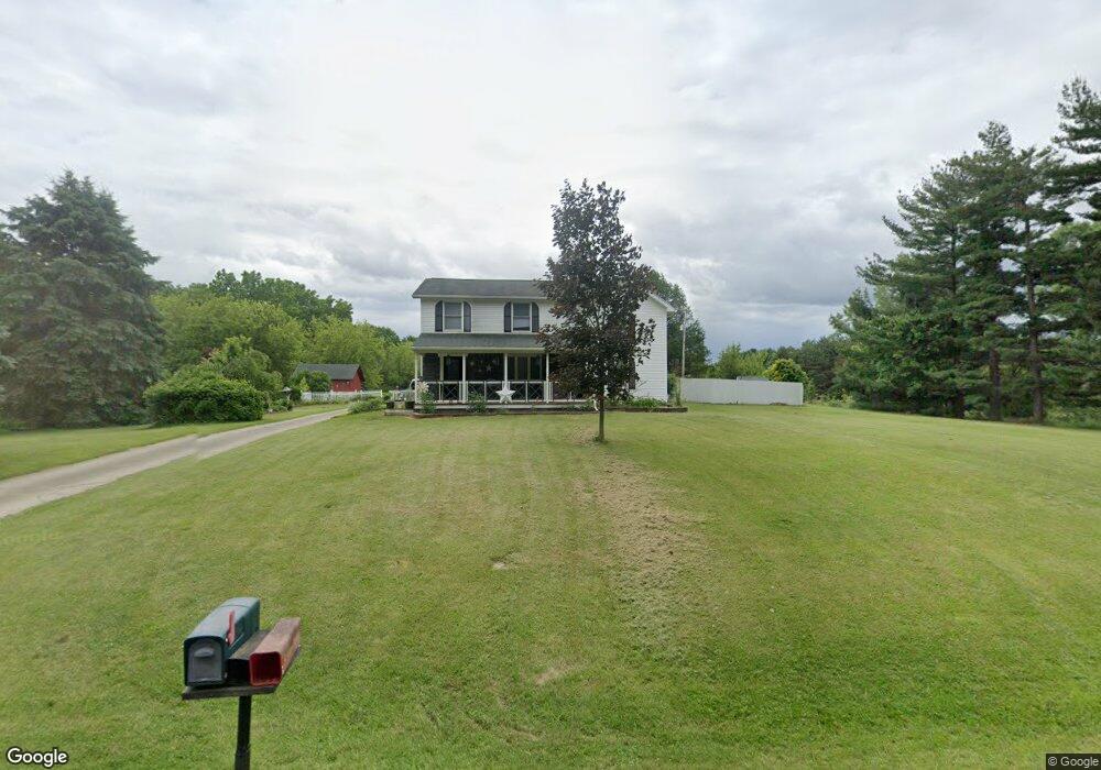
451 W Dewey Rd Owosso, MI 48867
Estimated Value: $174,000 - $298,000
Studio
--
Bath
--
Sq Ft
91,476
Sq Ft Lot
About This Home
This home is located at 451 W Dewey Rd, Owosso, MI 48867 and is currently estimated at $250,871. 451 W Dewey Rd is a home located in Shiawassee County with nearby schools including Owosso High School, Salem Lutheran School, and Owosso Christian School.
Ownership History
Date
Name
Owned For
Owner Type
Purchase Details
Closed on
May 9, 2025
Sold by
Hunt Daniel Michael
Bought by
Hunt Ezekeyial and Hunt Lindsay
Current Estimated Value
Home Financials for this Owner
Home Financials are based on the most recent Mortgage that was taken out on this home.
Original Mortgage
$180,000
Outstanding Balance
$178,708
Interest Rate
6.64%
Mortgage Type
New Conventional
Estimated Equity
$72,163
Purchase Details
Closed on
Dec 5, 2024
Sold by
Hunt Darla G
Bought by
Hunt Daniel Michael
Home Financials for this Owner
Home Financials are based on the most recent Mortgage that was taken out on this home.
Original Mortgage
$183,000
Interest Rate
6.72%
Mortgage Type
New Conventional
Create a Home Valuation Report for This Property
The Home Valuation Report is an in-depth analysis detailing your home's value as well as a comparison with similar homes in the area
Home Values in the Area
Average Home Value in this Area
Purchase History
| Date | Buyer | Sale Price | Title Company |
|---|---|---|---|
| Hunt Ezekeyial | $180,000 | Ata National Title Group | |
| Hunt Ezekeyial | $180,000 | Ata National Title Group | |
| Hunt Daniel Michael | -- | None Listed On Document |
Source: Public Records
Mortgage History
| Date | Status | Borrower | Loan Amount |
|---|---|---|---|
| Open | Hunt Ezekeyial | $180,000 | |
| Closed | Hunt Ezekeyial | $180,000 | |
| Previous Owner | Hunt Daniel Michael | $183,000 |
Source: Public Records
Tax History
| Year | Tax Paid | Tax Assessment Tax Assessment Total Assessment is a certain percentage of the fair market value that is determined by local assessors to be the total taxable value of land and additions on the property. | Land | Improvement |
|---|---|---|---|---|
| 2025 | $2,096 | $130,900 | $0 | $0 |
| 2024 | $2,135 | $115,700 | $0 | $0 |
| 2023 | $751 | $107,800 | $0 | $0 |
| 2022 | $715 | $97,500 | $0 | $0 |
| 2021 | $1,890 | $82,100 | $0 | $0 |
| 2020 | $1,891 | $78,700 | $0 | $0 |
| 2019 | $1,860 | $67,800 | $0 | $0 |
| 2018 | $1,881 | $66,600 | $0 | $0 |
| 2017 | $1,543 | $63,200 | $0 | $0 |
| 2016 | -- | $63,200 | $0 | $0 |
| 2015 | -- | $58,700 | $0 | $0 |
| 2014 | $7 | $54,700 | $0 | $0 |
Source: Public Records
Map
Nearby Homes
- 1627 Michigan 52
- 1585 Michigan 52
- 1648 S M 52
- 2590 S Morrice Rd
- 539 W Wildwood Dr
- 1610 W South St
- V/L W South St
- V/l # 11 W South St
- 1236 Walnut St
- 1131 S Shiawassee St
- 421 Prindle St
- 1046 S Pearce St
- 1105 Palmer Ave
- 315 Prindle St
- 414 Prindle St
- 1116 State St
- 902 Glenwood Ave
- 802 Woodlawn Ave
- 1002 S Shiawassee St
- 906 Michigan Ave
Your Personal Tour Guide
Ask me questions while you tour the home.