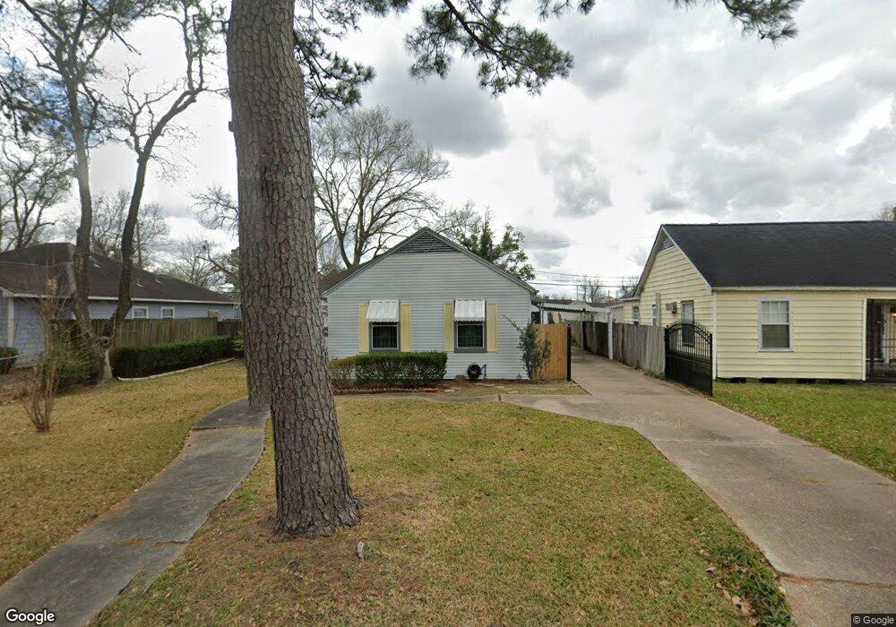
4510 Dixie Dr Houston, TX 77021
OST-South Union NeighborhoodEstimated Value: $226,454 - $262,000
3
Beds
2
Baths
1,788
Sq Ft
$133/Sq Ft
Est. Value
About This Home
This home is located at 4510 Dixie Dr, Houston, TX 77021 and is currently estimated at $237,864, approximately $133 per square foot. 4510 Dixie Dr is a home located in Harris County with nearby schools including Peck Elementary School, Cullen Middle School, and Yates High School.
Ownership History
Date
Name
Owned For
Owner Type
Purchase Details
Closed on
Apr 25, 2022
Sold by
Corinthia Jackson
Bought by
Linzer Rickie R and Allen Corlis M
Current Estimated Value
Purchase Details
Closed on
Sep 10, 1995
Sold by
Pope Dougal C
Bought by
Jackson Christopher and Jackson Corinthia
Home Financials for this Owner
Home Financials are based on the most recent Mortgage that was taken out on this home.
Original Mortgage
$8,491
Interest Rate
7.77%
Mortgage Type
Seller Take Back
Create a Home Valuation Report for This Property
The Home Valuation Report is an in-depth analysis detailing your home's value as well as a comparison with similar homes in the area
Home Values in the Area
Average Home Value in this Area
Purchase History
| Date | Buyer | Sale Price | Title Company |
|---|---|---|---|
| Linzer Rickie R | -- | None Listed On Document | |
| Jackson Christopher | -- | -- |
Source: Public Records
Mortgage History
| Date | Status | Borrower | Loan Amount |
|---|---|---|---|
| Previous Owner | Jackson Christopher | $8,491 |
Source: Public Records
Tax History
| Year | Tax Paid | Tax Assessment Tax Assessment Total Assessment is a certain percentage of the fair market value that is determined by local assessors to be the total taxable value of land and additions on the property. | Land | Improvement |
|---|---|---|---|---|
| 2025 | $2,159 | $205,523 | $106,021 | $99,502 |
| 2024 | $2,159 | $205,523 | $106,021 | $99,502 |
| 2023 | $2,159 | $205,837 | $96,666 | $109,171 |
| 2022 | $2,145 | $180,623 | $87,311 | $93,312 |
| 2021 | $2,064 | $111,285 | $53,010 | $58,275 |
| 2020 | $1,949 | $89,077 | $34,301 | $54,776 |
| 2019 | $1,852 | $82,015 | $34,301 | $47,714 |
| 2018 | $0 | $66,527 | $28,064 | $38,463 |
| 2017 | $1,682 | $66,527 | $28,064 | $38,463 |
| 2016 | $1,682 | $66,527 | $28,064 | $38,463 |
| 2015 | $23 | $66,527 | $28,064 | $38,463 |
| 2014 | $23 | $58,522 | $15,591 | $42,931 |
Source: Public Records
Map
Nearby Homes
- 4509 Kingsbury St
- 4504 Kingsbury St
- 4516 Normandy Way
- 4522 Dixie Dr
- 5914 Cullen Blvd
- 4503 Dewberry St
- 4603 Keystone St
- 4522 Dewberry St
- 4509 Perry St
- 4505 Perry St
- 4604 Keystone St
- 5811 Eastwood St
- 0 New York St
- 4516 Perry St
- 5229 Griggs Rd
- 6325 Cullen Blvd
- 4608 Dewberry St
- 4613 Dewberry St
- 6320 Paris St
- 6135 Sidney St
- 4508 Dixie Dr
- 4512 Dixie Dr
- 4506 Dixie Dr
- 4514 Dixie Dr
- 4507 Kingsbury St
- 4511 Kingsbury St
- 4505 Kingsbury St
- 4513 Kingsbury St
- 4504 Dixie Dr
- 4516 Dixie Dr
- 4507 Dixie Dr
- 4511 Dixie Dr
- 4503 Kingsbury St
- 4505 Dixie Dr
- 4515 Kingsbury St
- 4513 Dixie Dr
- 4502 Dixie Dr
- 4518 Dixie Dr
- 4503 Dixie Dr
- 4501 Kingsbury St
Your Personal Tour Guide
Ask me questions while you tour the home.