Estimated Value: $340,000 - $370,000
3
Beds
2
Baths
1,709
Sq Ft
$207/Sq Ft
Est. Value
About This Home
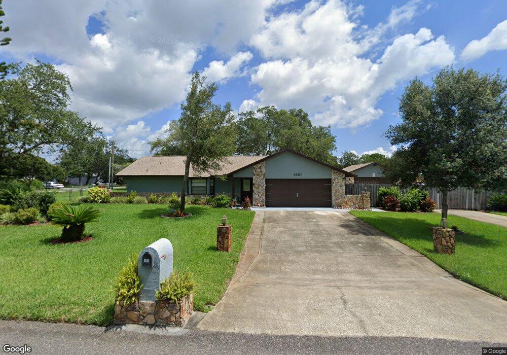
This home is located at 4510 Robert St, Cocoa, FL 32927 and is currently estimated at $354,287, approximately $207 per square foot. 4510 Robert St is a home located in Brevard County with nearby schools including Challenger 7 Elementary School, Space Coast Junior/Senior High School, and East Atlantic Prep of Brevard County.
Ownership History
Date
Name
Owned For
Owner Type
Purchase Details
Closed on
Sep 30, 1997
Sold by
Barton Harry P and Barton Elizabeth L
Bought by
Heacock Jeffrey A
Current Estimated Value
Home Financials for this Owner
Home Financials are based on the most recent Mortgage that was taken out on this home.
Original Mortgage
$82,464
Outstanding Balance
$13,260
Interest Rate
7.46%
Estimated Equity
$341,027
Purchase Details
Closed on
Jun 28, 1996
Sold by
Teague Charles D and Teague Elizabeth L
Bought by
Barton Harry P and Barton Elizabeth L
Create a Home Valuation Report for This Property
The Home Valuation Report is an in-depth analysis detailing your home's value as well as a comparison with similar homes in the area
Home Values in the Area
Average Home Value in this Area
Purchase History
| Date | Buyer | Sale Price | Title Company |
|---|---|---|---|
| Heacock Jeffrey A | $83,000 | -- | |
| Barton Harry P | $80,000 | -- |
Source: Public Records
Mortgage History
| Date | Status | Borrower | Loan Amount |
|---|---|---|---|
| Open | Heacock Jeffrey A | $82,464 |
Source: Public Records
Tax History
| Year | Tax Paid | Tax Assessment Tax Assessment Total Assessment is a certain percentage of the fair market value that is determined by local assessors to be the total taxable value of land and additions on the property. | Land | Improvement |
|---|---|---|---|---|
| 2025 | $1,526 | $112,150 | -- | -- |
| 2024 | $1,488 | $108,990 | -- | -- |
| 2023 | $1,488 | $105,820 | -- | -- |
| 2022 | $1,388 | $102,740 | $0 | $0 |
| 2021 | $1,389 | $99,750 | $0 | $0 |
| 2020 | $1,327 | $98,380 | $0 | $0 |
| 2019 | $1,263 | $96,170 | $0 | $0 |
| 2018 | $1,256 | $94,380 | $0 | $0 |
| 2017 | $1,250 | $92,440 | $0 | $0 |
| 2016 | $1,252 | $90,540 | $36,000 | $54,540 |
| 2015 | $1,267 | $89,920 | $30,000 | $59,920 |
| 2014 | $1,268 | $89,210 | $22,000 | $67,210 |
Source: Public Records
Map
Nearby Homes
- 6074 Aires Ave
- 4545 Rosebud St
- 5915 Clearfield Ave
- 4550 Piedras St
- 4440 Fay Blvd
- 4470 Ponds Dr
- 4590 Ponds Dr
- 4905 Bridge Rd
- 6260 Marcy St
- 6275 Marcy St
- 4300 Fay Blvd
- 6310 Depot Ave
- 5914 Stillwater Ave
- 5265 Fay Blvd
- 6499 Pleasant Ave
- 4240 Ponds Dr
- 4688 Fairsun St
- 4975 Fay Blvd
- 0 Unassigned Unit MFRTB8466891
- 6094 Cardiff Ave
- 6065 Clearfield Ave
- 6060 Aires Ave
- 6095 Clearfield Ave
- 4530 Robert St
- 6075 Clearfield Ave
- 6060 Clearfield Ave
- 4540 Robert St
- 6070 Clearfield Ave
- 6085 Clearfield Ave
- 6059 Aires Ave
- 6005 Clearfield Ave
- 6073 Aires Ave
- 6114 Aires Ave
- 6045 Aires Ave
- 6080 Clearfield Ave
- 6065 Wilderness Ave
- 4550 Robert St
- 6031 Aires Ave
- 6101 Aires Ave Unit 3
- 6101 Aires Ave
Your Personal Tour Guide
Ask me questions while you tour the home.