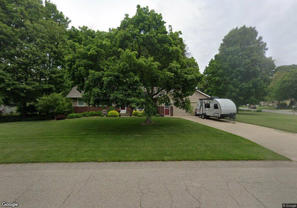
4511 Lancaster Dr Hudsonville, MI 49426
Estimated Value: $407,000 - $435,000
4
Beds
2
Baths
2,411
Sq Ft
$177/Sq Ft
Est. Value
About This Home
This home is located at 4511 Lancaster Dr, Hudsonville, MI 49426 and is currently estimated at $426,607, approximately $176 per square foot. 4511 Lancaster Dr is a home located in Ottawa County with nearby schools including Baldwin Street Middle School, Hudsonville Freshman Campus, and Hudsonville High School.
Ownership History
Date
Name
Owned For
Owner Type
Purchase Details
Closed on
Jun 8, 2011
Sold by
Weeda Jacob and Weeda Linda
Bought by
Weeda Jacob C and Weeda Linda M
Current Estimated Value
Home Financials for this Owner
Home Financials are based on the most recent Mortgage that was taken out on this home.
Original Mortgage
$69,000
Interest Rate
4.52%
Mortgage Type
New Conventional
Purchase Details
Closed on
Sep 17, 2007
Sold by
Boomstra Timothy and Boomstra Barbara L
Bought by
Timothy Allen Boomstra Trust
Create a Home Valuation Report for This Property
The Home Valuation Report is an in-depth analysis detailing your home's value as well as a comparison with similar homes in the area
Home Values in the Area
Average Home Value in this Area
Purchase History
| Date | Buyer | Sale Price | Title Company |
|---|---|---|---|
| Weeda Jacob C | -- | None Available | |
| Weeda Jacob | $154,000 | Chicago Title | |
| Timothy Allen Boomstra Trust | -- | None Available |
Source: Public Records
Mortgage History
| Date | Status | Borrower | Loan Amount |
|---|---|---|---|
| Previous Owner | Weeda Jacob | $69,000 |
Source: Public Records
Tax History Compared to Growth
Tax History
| Year | Tax Paid | Tax Assessment Tax Assessment Total Assessment is a certain percentage of the fair market value that is determined by local assessors to be the total taxable value of land and additions on the property. | Land | Improvement |
|---|---|---|---|---|
| 2025 | $3,064 | $190,800 | $0 | $0 |
| 2024 | $2,651 | $193,900 | $0 | $0 |
| 2023 | $2,532 | $172,100 | $0 | $0 |
| 2022 | $2,783 | $156,500 | $0 | $0 |
| 2021 | $2,703 | $138,600 | $0 | $0 |
| 2020 | $2,675 | $126,500 | $0 | $0 |
| 2019 | $2,679 | $114,100 | $0 | $0 |
| 2018 | $2,498 | $106,500 | $0 | $0 |
| 2017 | $2,452 | $106,300 | $0 | $0 |
| 2016 | $2,438 | $103,300 | $0 | $0 |
| 2015 | $2,327 | $99,400 | $0 | $0 |
| 2014 | $2,327 | $92,300 | $0 | $0 |
Source: Public Records
Map
Nearby Homes
- 6863 Bridgeport Dr
- 6821 Bridgeport Dr
- 4372 Shady Oak Ct
- 7114 Tory Dr
- 4106 Blair St
- 6950 Meadowcreek Dr
- 6584 Moss Lake Dr
- 6530 Van Dam Ave Unit 3
- 6561 Van Dam Ave
- 6500 Van Dam Ave Unit 1
- 7068 Jasper Dr
- 6207 Gemini Ct
- 4087 Baldwin St
- 6324 Blendon Woods Dr Unit 21
- 6308 Blendon Woods Dr Unit 19
- 5094 Blendon Woods Dr Unit 4
- 5134 Blendon Meadow Cir Unit 42
- 0 Baldwin St
- 5178 Blendon Meadow Cir Unit 46
- 5184 Blendon Meadow Cir Unit 47
- 6891 Bridgeport Dr
- 4490 Lexington Ct
- 4520 Lancaster Dr
- 6880 Bridgeport Dr
- 4470 Lexington Ct
- 4504 Lexington Ct
- 6890 Bridgeport Dr
- 6908 Youngstown Ave
- 6900 Bridgeport Dr
- 6870 Bridgeport Dr
- 6882 Youngstown Ave
- 4518 Lexington Ct
- 6856 Bridgeport Dr
- 6936 Youngstown Ave
- 6914 Bridgeport Dr
- 6868 Youngstown Ave
- 4491 Lexington Ct
- 6849 Bridgeport Dr
- 6950 Youngstown Ave
- 4431 Stratford Ct