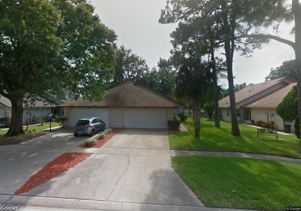
4512 Alder Dr Port Orange, FL 32127
South Port Orange NeighborhoodEstimated Value: $244,000 - $268,000
3
Beds
2
Baths
1,343
Sq Ft
$188/Sq Ft
Est. Value
About This Home
This home is located at 4512 Alder Dr, Port Orange, FL 32127 and is currently estimated at $251,864, approximately $187 per square foot. 4512 Alder Dr is a home with nearby schools including Sugar Mill Elementary School, Silver Sands Middle School, and Spruce Creek High School.
Ownership History
Date
Name
Owned For
Owner Type
Purchase Details
Closed on
Dec 11, 2001
Sold by
Dept Housing & Urban Dev Wa D C
Bought by
Gordon Catherine L
Current Estimated Value
Home Financials for this Owner
Home Financials are based on the most recent Mortgage that was taken out on this home.
Original Mortgage
$69,000
Outstanding Balance
$26,822
Interest Rate
6.5%
Estimated Equity
$225,042
Purchase Details
Closed on
Sep 12, 2001
Sold by
1St Horizon Home Loan Corp
Bought by
Housing & Urban Dev
Purchase Details
Closed on
Sep 6, 2001
Sold by
Clerk Circuit Court
Bought by
1St Horizon Home Loan Corp and F T Mtg Co
Purchase Details
Closed on
Jul 30, 1998
Sold by
Gomez Nelson and Gomez Maria H
Bought by
Thomas Michael W
Home Financials for this Owner
Home Financials are based on the most recent Mortgage that was taken out on this home.
Original Mortgage
$72,490
Interest Rate
6.96%
Mortgage Type
FHA
Purchase Details
Closed on
Feb 15, 1988
Bought by
Gordon Catherine L
Purchase Details
Closed on
Dec 15, 1987
Bought by
Gordon Catherine L
Create a Home Valuation Report for This Property
The Home Valuation Report is an in-depth analysis detailing your home's value as well as a comparison with similar homes in the area
Home Values in the Area
Average Home Value in this Area
Purchase History
| Date | Buyer | Sale Price | Title Company |
|---|---|---|---|
| Gordon Catherine L | $76,500 | -- | |
| Housing & Urban Dev | -- | -- | |
| 1St Horizon Home Loan Corp | -- | -- | |
| Thomas Michael W | $73,000 | -- | |
| Gordon Catherine L | $74,000 | -- | |
| Gordon Catherine L | $100 | -- |
Source: Public Records
Mortgage History
| Date | Status | Borrower | Loan Amount |
|---|---|---|---|
| Open | Gordon Catherine L | $69,000 | |
| Previous Owner | Thomas Michael W | $72,490 |
Source: Public Records
Tax History Compared to Growth
Tax History
| Year | Tax Paid | Tax Assessment Tax Assessment Total Assessment is a certain percentage of the fair market value that is determined by local assessors to be the total taxable value of land and additions on the property. | Land | Improvement |
|---|---|---|---|---|
| 2025 | $3,316 | $214,395 | $38,000 | $176,395 |
| 2024 | $3,316 | $214,840 | $38,000 | $176,840 |
| 2023 | $3,316 | $195,719 | $38,000 | $157,719 |
| 2022 | $3,002 | $173,081 | $25,000 | $148,081 |
| 2021 | $2,895 | $156,177 | $24,000 | $132,177 |
| 2020 | $2,624 | $143,584 | $14,800 | $128,784 |
| 2019 | $2,430 | $138,846 | $14,800 | $124,046 |
| 2018 | $2,216 | $117,526 | $8,000 | $109,526 |
| 2017 | $2,141 | $115,602 | $8,000 | $107,602 |
| 2016 | $1,945 | $95,512 | $0 | $0 |
| 2015 | $1,842 | $86,470 | $0 | $0 |
| 2014 | $1,697 | $77,409 | $0 | $0 |
Source: Public Records
Map
Nearby Homes
- 4508 Alder Dr
- 823 Wooddusk Dr
- 811 Brimfield Ct
- 932 Sabalwood Ct
- 772 Horseman Dr
- 962 Stonybrook Cir
- 1019 Fox Trace Ct
- 4577 Miles Dr
- 750 Horseman Dr
- 744 Horseman Dr
- 816 Stonybrook Cir
- 69 Tropical Ct
- 722 Raven Rock Ct
- 4589 Alder Dr
- 712 Kristina Ct
- 723 Raven Rock Ct
- 707 Kristina Ct
- 705 Kristina Ct
- 4590 Miles Dr
- 53 Windward Ct
- 4514 Alder Dr
- 4510 Alder Dr
- 4516 Alder Dr
- 4518 Alder Dr
- 4506 Alder Dr
- 4520 Alder Dr
- 4504 Alder Dr
- 4522 Alder Dr
- 862 Brimfield Ct
- 4502 Alder Dr
- 860 Brimfield Ct
- 4524 Alder Dr
- 4500 Alder Dr
- 863 Brimfield Ct
- 858 Brimfield Ct
- 4526 Alder Dr
- 861 Brimfield Ct
- 856 Brimfield Ct
- 859 Brimfield Ct
- 857 Brimfield Ct