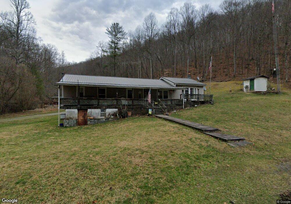
4512 Honey Branch Rd Saint Paul, VA 24283
Estimated Value: $141,278 - $222,000
4
Beds
2
Baths
1,872
Sq Ft
$93/Sq Ft
Est. Value
About This Home
This home is located at 4512 Honey Branch Rd, Saint Paul, VA 24283 and is currently estimated at $174,570, approximately $93 per square foot. 4512 Honey Branch Rd is a home located in Wise County.
Ownership History
Date
Name
Owned For
Owner Type
Purchase Details
Closed on
Oct 25, 2020
Sold by
Dingus Joseph Alan and Dingus James Russell
Bought by
Kilgore Frank
Current Estimated Value
Purchase Details
Closed on
Dec 30, 2017
Sold by
Dingus Russell Fred
Bought by
Dingus Joseph Alan and Dingus James Russell
Purchase Details
Closed on
Mar 24, 2006
Sold by
Dingus Denver and Dingus Faye
Bought by
Dingus Russell Fred and Dingus Barbara
Create a Home Valuation Report for This Property
The Home Valuation Report is an in-depth analysis detailing your home's value as well as a comparison with similar homes in the area
Home Values in the Area
Average Home Value in this Area
Purchase History
| Date | Buyer | Sale Price | Title Company |
|---|---|---|---|
| Kilgore Frank | $10,258 | None Available | |
| Dingus Joseph Alan | -- | None Available | |
| Dingus Russell Fred | -- | None Available | |
| Dingus Denver | -- | None Available |
Source: Public Records
Tax History Compared to Growth
Tax History
| Year | Tax Paid | Tax Assessment Tax Assessment Total Assessment is a certain percentage of the fair market value that is determined by local assessors to be the total taxable value of land and additions on the property. | Land | Improvement |
|---|---|---|---|---|
| 2025 | $558 | $80,800 | $9,300 | $71,500 |
| 2024 | $558 | $80,800 | $9,300 | $71,500 |
| 2023 | $558 | $80,800 | $9,300 | $71,500 |
| 2022 | $558 | $80,800 | $9,300 | $71,500 |
| 2021 | $518 | $75,100 | $9,300 | $65,800 |
| 2020 | $555 | $75,100 | $9,300 | $65,800 |
| 2019 | $555 | $80,400 | $14,600 | $65,800 |
| 2018 | $298 | $80,400 | $14,600 | $65,800 |
| 2017 | $282 | $80,400 | $14,600 | $65,800 |
| 2016 | $482 | $80,400 | $14,600 | $65,800 |
| 2015 | -- | $80,400 | $14,600 | $65,800 |
| 2010 | -- | $82,400 | $15,600 | $66,800 |
Source: Public Records
Map
Nearby Homes
- 4434 Honey Branch Rd
- 4232 Russell Creek Rd
- 0 County Road 838
- 3613 Honey Branch Rd
- 16100 Flags Rd
- 3219 Hardy Hollow Rd
- 3201 3rd Ave
- 16540 Tazewell St
- TBD Wise St
- 16827 Wise St
- 6746 Brushy Ridge Rd
- 293 Greystone Dr
- 0 Burke St
- 14439 Holbrook Chapel Rd
- 2049 Gravel Lick Rd
- 4406 Lawson Hollow Rd
- 123 Luttie Banner Dr
- 70 Dorado Bottom Rd
- 75 Church St
- 14408 Sandy Ridge Rd
- TBD Honey Branch Rd
- 4508 Honey Branch Rd
- 4437 Honey Branch Rd
- 4629 Honey Branch Rd
- 4331 Honey Branch Rd
- 4321 Honey Branch Rd
- 4702 Abrams Branch Rd
- 4490 Honey Branch Rd
- 4710 Honey Branch Rd
- 4805 Honey Branch Rd
- 4207 Honey Branch Rd
- 4233 Russell Creek Rd
- 4819 Honey Branch Rd
- 4822 Honey Branch Rd
- 4247 Russell Creek Rd
- 4175 Honey Branch Rd
- 4223 Russell Creek Rd
- 4167 Honey Branch Rd
- 4158 Honey Branch Rd
- 4161 Honey Branch Rd