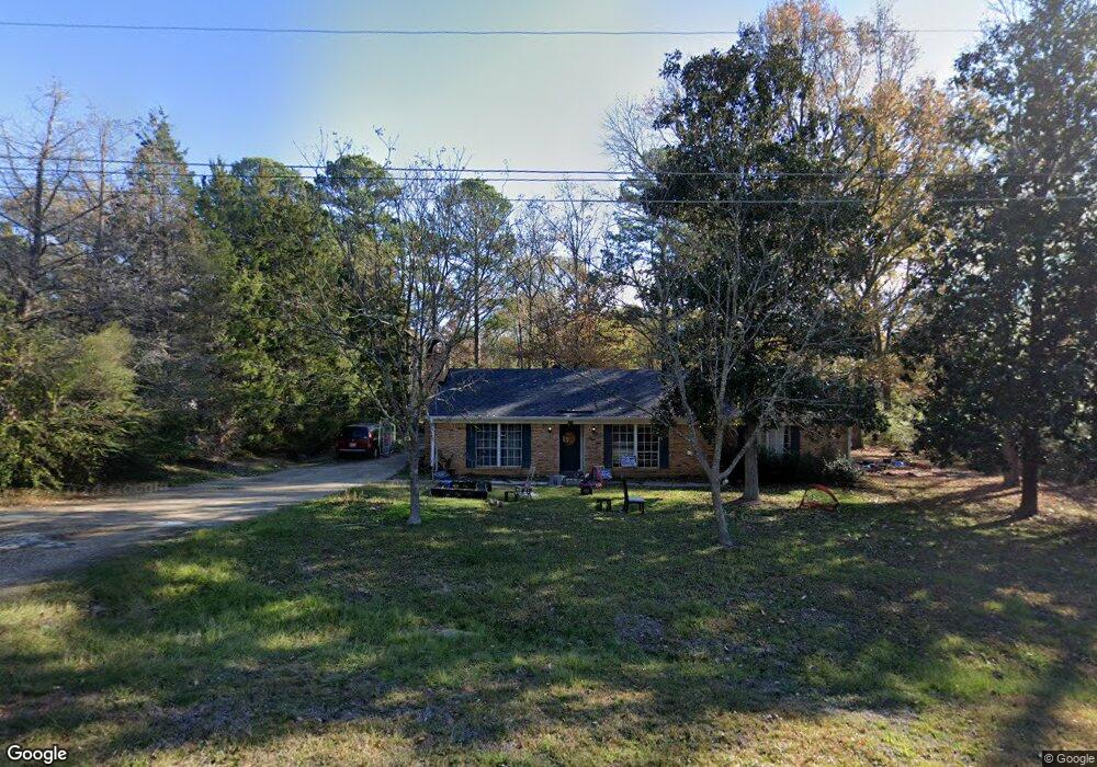
4512 Pine Knoll Dr Shreveport, LA 71107
Estimated Value: $152,947 - $189,000
3
Beds
2
Baths
1,506
Sq Ft
$114/Sq Ft
Est. Value
About This Home
This home is located at 4512 Pine Knoll Dr, Shreveport, LA 71107 and is currently estimated at $172,237, approximately $114 per square foot. 4512 Pine Knoll Dr is a home located in Caddo Parish with nearby schools including Blanchard Elementary School, Judson Fundamental Elementary School, and Fairfield Magnet School.
Ownership History
Date
Name
Owned For
Owner Type
Purchase Details
Closed on
Mar 28, 2014
Sold by
Anderson Julian
Bought by
Jefferson Washtaevius and Jefferson Marisa
Current Estimated Value
Home Financials for this Owner
Home Financials are based on the most recent Mortgage that was taken out on this home.
Original Mortgage
$101,020
Outstanding Balance
$76,736
Interest Rate
4.32%
Mortgage Type
Unknown
Estimated Equity
$95,501
Create a Home Valuation Report for This Property
The Home Valuation Report is an in-depth analysis detailing your home's value as well as a comparison with similar homes in the area
Home Values in the Area
Average Home Value in this Area
Purchase History
| Date | Buyer | Sale Price | Title Company |
|---|---|---|---|
| Jefferson Washtaevius | $99,000 | United Title Of Louisiana In |
Source: Public Records
Mortgage History
| Date | Status | Borrower | Loan Amount |
|---|---|---|---|
| Open | Jefferson Washtaevius | $101,020 |
Source: Public Records
Tax History Compared to Growth
Tax History
| Year | Tax Paid | Tax Assessment Tax Assessment Total Assessment is a certain percentage of the fair market value that is determined by local assessors to be the total taxable value of land and additions on the property. | Land | Improvement |
|---|---|---|---|---|
| 2024 | $1,537 | $10,213 | $1,256 | $8,957 |
| 2023 | $1,433 | $9,229 | $1,196 | $8,033 |
| 2022 | $1,433 | $9,229 | $1,196 | $8,033 |
| 2021 | $1,434 | $9,229 | $1,196 | $8,033 |
| 2020 | $1,434 | $9,229 | $1,196 | $8,033 |
| 2019 | $1,398 | $9,071 | $1,196 | $7,875 |
| 2018 | $304 | $9,071 | $1,196 | $7,875 |
| 2017 | $1,395 | $9,071 | $1,196 | $7,875 |
| 2015 | $395 | $9,645 | $1,196 | $8,449 |
| 2014 | $398 | $9,650 | $1,200 | $8,450 |
| 2013 | -- | $9,020 | $1,200 | $7,820 |
Source: Public Records
Map
Nearby Homes
- 4685 Kent Rd
- 4687 Kent Rd
- 1059 Winchester Dr
- 6095 Pine Hill Rd
- 1042 N Lane Dr
- 5244 N Market St
- 0 Northport Blvd Unit 20877053
- 5555 Old Mooringsport Rd
- 5037 N Market St
- 8308 Creekdale St
- 5220 Old Mooringsport Rd
- 5036 Asaff Ave
- TBD Northwood Rd S
- 6105 Shadow Wood Dr
- 0 Cambridge Cir
- 955 Roanoke Dr
- Mimosa III A Plan at Falcon Bay
- Hickory III B Plan at Falcon Bay
- Hickory III A Plan at Falcon Bay
- Cedar IV A Plan at Falcon Bay
- 4710 Kent Rd
- 4513 Pine Knoll Dr
- 4507 Pine Knoll Dr
- 4524 Pine Knoll Dr
- 4524 Pine Knoll Dr
- 4519 Pine Knoll Dr
- 4740 Kent Rd
- 4525 Pine Knoll Dr
- 4680 Kent Rd
- 4735 Kent Rd
- 4530 Pine Knoll Dr
- 4690 Kent Rd
- 4690 Kent Rd
- 4531 Pine Knoll Dr
- 4536 Pine Knoll Dr
- 4689 Kent Rd
- 4537 Pine Knoll Dr
- 4542 Pine Knoll Dr
- 4543 Pine Knoll Dr
- 4640 Kent Rd