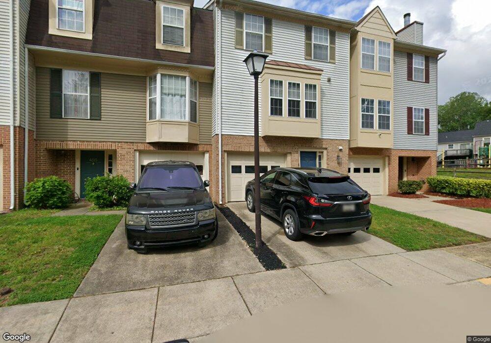
4513 Governor Pratt Ct Upper Marlboro, MD 20772
Estimated Value: $306,000 - $352,000
--
Bed
--
Bath
1,911
Sq Ft
$175/Sq Ft
Est. Value
About This Home
This home is located at 4513 Governor Pratt Ct, Upper Marlboro, MD 20772 and is currently estimated at $335,275, approximately $175 per square foot. 4513 Governor Pratt Ct is a home located in Prince George's County with nearby schools including Barack Obama Elementary School, James Madison Middle School, and Dr. Henry A. Wise Jr. High School.
Ownership History
Date
Name
Owned For
Owner Type
Purchase Details
Closed on
Jun 7, 1999
Sold by
Stallings Joan A
Bought by
Wilder Spencer and Wilder Stephanie A
Current Estimated Value
Purchase Details
Closed on
Apr 10, 1995
Sold by
Chandlee Mark S
Bought by
Stallings Joan A
Home Financials for this Owner
Home Financials are based on the most recent Mortgage that was taken out on this home.
Original Mortgage
$90,000
Interest Rate
8.66%
Purchase Details
Closed on
Nov 2, 1988
Sold by
Sterling Prop
Bought by
Chandlee Mark S and Chandlee Elizabeth A
Create a Home Valuation Report for This Property
The Home Valuation Report is an in-depth analysis detailing your home's value as well as a comparison with similar homes in the area
Home Values in the Area
Average Home Value in this Area
Purchase History
| Date | Buyer | Sale Price | Title Company |
|---|---|---|---|
| Wilder Spencer | $123,000 | -- | |
| Stallings Joan A | $120,000 | -- | |
| Chandlee Mark S | $106,100 | -- |
Source: Public Records
Mortgage History
| Date | Status | Borrower | Loan Amount |
|---|---|---|---|
| Previous Owner | Stallings Joan A | $90,000 |
Source: Public Records
Tax History Compared to Growth
Tax History
| Year | Tax Paid | Tax Assessment Tax Assessment Total Assessment is a certain percentage of the fair market value that is determined by local assessors to be the total taxable value of land and additions on the property. | Land | Improvement |
|---|---|---|---|---|
| 2025 | $3,655 | $254,600 | $76,300 | $178,300 |
| 2024 | $3,655 | $248,633 | $0 | $0 |
| 2023 | $2,698 | $242,667 | $0 | $0 |
| 2022 | $2,632 | $236,700 | $71,000 | $165,700 |
| 2021 | $6,725 | $222,800 | $0 | $0 |
| 2020 | $3,198 | $208,900 | $0 | $0 |
| 2019 | $2,792 | $195,000 | $58,500 | $136,500 |
| 2018 | $2,967 | $186,667 | $0 | $0 |
| 2017 | $2,873 | $178,333 | $0 | $0 |
| 2016 | -- | $170,000 | $0 | $0 |
| 2015 | $2,641 | $170,000 | $0 | $0 |
| 2014 | $2,641 | $170,000 | $0 | $0 |
Source: Public Records
Map
Nearby Homes
- 14325 Governor Lee Place
- 4638 Governor Kent Ct
- 4720 Colonel Ashton Place
- 14322 Colonel Clagett Ct
- 4750 John Rogers Blvd
- 4411 Largo Rd
- 4808 Colonel Brooke Ct
- 4807 Clirieden Ln
- 14523 Hampshire Hall Ct
- 4817 Clirieden Ln
- 14257 Hampshire Hall Ct
- 14314 Hampshire Hall Ct
- 4829 King John Way
- 14100 Farnsworth Ln Unit 2108
- 14404 Marlborough Dr
- 13800 Farnsworth Ln Unit 5403
- 13942 King Gregory Way
- 13900 King George Way
- 14100 Old Marlboro Pike
- 4503 Captain Duval Dr
- 4515 Governor Pratt Ct
- 4517 Governor Pratt Ct
- 4502 Governor Pratt Ct
- 4506 Governor Pratt Ct
- 4511 Governor Pratt Ct
- 4500 Governor Pratt Ct
- 4612 Governor Kent Ct
- 4706 Governor Ogle Ct
- 4610 Governor Kent Ct
- 4614 Governor Kent Ct
- 4608 Governor Kent Ct
- 4712 Governor Ogle Ct
- 4704 Governor Ogle Ct
- 4702 Governor Ogle Ct
- 14650 Governor Sprigg Place
- 14654 Governor Sprigg Place
- 4709 Governor Ogle Ct
- 14642 Governor Sprigg Place
- 4604 Governor Kent Ct
- 4700 Governor Ogle Ct