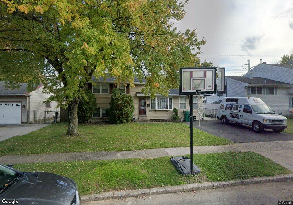
4514 Brookside Ave Bristol, PA 19007
Estimated Value: $355,000 - $389,000
4
Beds
1
Bath
1,500
Sq Ft
$251/Sq Ft
Est. Value
About This Home
This home is located at 4514 Brookside Ave, Bristol, PA 19007 and is currently estimated at $375,904, approximately $250 per square foot. 4514 Brookside Ave is a home located in Bucks County with nearby schools including Truman Senior High School, First Presbyterian Church School, and Isabet Academy.
Ownership History
Date
Name
Owned For
Owner Type
Purchase Details
Closed on
Oct 15, 2007
Sold by
Steele Mark S and Steele Ruth T
Bought by
Hall Jonathan T and Hall Nakia N
Current Estimated Value
Home Financials for this Owner
Home Financials are based on the most recent Mortgage that was taken out on this home.
Original Mortgage
$51,250
Interest Rate
6.15%
Mortgage Type
Purchase Money Mortgage
Purchase Details
Closed on
Jun 21, 1984
Bought by
Steele Mark S and Steele Ruth T
Create a Home Valuation Report for This Property
The Home Valuation Report is an in-depth analysis detailing your home's value as well as a comparison with similar homes in the area
Home Values in the Area
Average Home Value in this Area
Purchase History
| Date | Buyer | Sale Price | Title Company |
|---|---|---|---|
| Hall Jonathan T | $206,000 | Fidelity National Title Insu | |
| Steele Mark S | $58,000 | -- |
Source: Public Records
Mortgage History
| Date | Status | Borrower | Loan Amount |
|---|---|---|---|
| Closed | Hall Jonathan T | $51,250 | |
| Previous Owner | Hall Jonathan T | $154,500 |
Source: Public Records
Tax History Compared to Growth
Tax History
| Year | Tax Paid | Tax Assessment Tax Assessment Total Assessment is a certain percentage of the fair market value that is determined by local assessors to be the total taxable value of land and additions on the property. | Land | Improvement |
|---|---|---|---|---|
| 2025 | $5,866 | $21,600 | $4,320 | $17,280 |
| 2024 | $5,866 | $21,600 | $4,320 | $17,280 |
| 2023 | $5,823 | $21,600 | $4,320 | $17,280 |
| 2022 | $5,823 | $21,600 | $4,320 | $17,280 |
| 2021 | $5,823 | $21,600 | $4,320 | $17,280 |
| 2020 | $5,823 | $21,600 | $4,320 | $17,280 |
| 2019 | $5,801 | $21,600 | $4,320 | $17,280 |
| 2018 | $5,708 | $21,600 | $4,320 | $17,280 |
| 2017 | $5,621 | $21,600 | $4,320 | $17,280 |
| 2016 | $5,621 | $21,600 | $4,320 | $17,280 |
| 2015 | $4,085 | $21,600 | $4,320 | $17,280 |
| 2014 | $4,085 | $21,600 | $4,320 | $17,280 |
Source: Public Records
Map
Nearby Homes
- 3021 Bath Rd
- 150 Naomi Ct Unit 811
- 246 Colette Ct
- 145 Mill Dr
- 23 Misty Pine Rd
- 0 West Ave
- 185 Delhaas Cir
- 183 Delhaas Cir
- 187 Delhaas Cir
- 189 Delhaas Cir
- 194 Delhaas Cir
- 186 Delhaas Cir
- 193 Delhaas Cir
- 192 Delhaas Cir
- 190 Delhaas Cir
- 184 Delhaas Cir
- 191 Delhaas Cir
- 188 Delhaas Cir
- 57 Middle Rd
- 206 Delhaas Cir
- 4512 Brookside Ave
- 4516 Brookside Ave
- 4518 Brookside Ave
- 4508 Brookside Ave
- 4520 Brookside Ave
- 4515 Brookside Ave
- 4513 Brookside Ave
- 4517 Brookside Ave
- 2501 Woodlawn Dr
- 4511 Brookside Ave
- 4506 Brookside Ave
- 4600 Brookside Ave
- 4509 Brookside Ave
- 2503 Woodlawn Dr
- 4504 Brookside Ave
- 2500 Woodlawn Dr
- 4602 Brookside Ave
- 4507 Brookside Ave
- 2505 Woodlawn Dr
- 4505 Brookside Ave