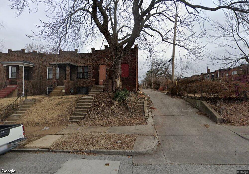
4515 Elmbank Ave Saint Louis, MO 63115
Greater Ville NeighborhoodEstimated Value: $37,000 - $69,000
--
Bed
1
Bath
1,728
Sq Ft
$27/Sq Ft
Est. Value
About This Home
This home is located at 4515 Elmbank Ave, Saint Louis, MO 63115 and is currently estimated at $46,771, approximately $27 per square foot. 4515 Elmbank Ave is a home located in St. Louis City with nearby schools including Hickey Elementary School, Sumner High School, and North Side Community Elementary School.
Ownership History
Date
Name
Owned For
Owner Type
Purchase Details
Closed on
Nov 24, 2021
Sold by
Land Reutilization Authority Of City Of
Bought by
Thomas Nick and Ford Thomas Manisha
Current Estimated Value
Purchase Details
Closed on
Mar 6, 2009
Sold by
Wilson Kerry and Wilson Valiere
Bought by
Land Reutilization Authority Of The City
Purchase Details
Closed on
Sep 19, 2001
Sold by
Land Reutilization Authority
Bought by
Wilson Kerry and Wilson Valiere
Create a Home Valuation Report for This Property
The Home Valuation Report is an in-depth analysis detailing your home's value as well as a comparison with similar homes in the area
Home Values in the Area
Average Home Value in this Area
Purchase History
| Date | Buyer | Sale Price | Title Company |
|---|---|---|---|
| Thomas Nick | $2,200 | None Available | |
| Land Reutilization Authority Of The City | -- | None Available | |
| Wilson Kerry | $1,000 | Title Associates Inc |
Source: Public Records
Mortgage History
| Date | Status | Borrower | Loan Amount |
|---|---|---|---|
| Closed | Thomas Nick | $0 |
Source: Public Records
Tax History Compared to Growth
Tax History
| Year | Tax Paid | Tax Assessment Tax Assessment Total Assessment is a certain percentage of the fair market value that is determined by local assessors to be the total taxable value of land and additions on the property. | Land | Improvement |
|---|---|---|---|---|
| 2025 | $194 | $2,040 | $270 | $1,770 |
| 2024 | $186 | $1,980 | $270 | $1,710 |
| 2023 | $186 | $1,980 | $270 | $1,710 |
| 2022 | $188 | $1,940 | $270 | $1,670 |
| 2021 | $0 | $2,400 | $270 | $2,130 |
| 2020 | $0 | $2,400 | $270 | $2,130 |
| 2019 | $0 | $2,400 | $270 | $2,130 |
| 2018 | $0 | $2,000 | $270 | $1,730 |
| 2017 | $0 | $2,000 | $270 | $1,730 |
| 2016 | $0 | $2,320 | $530 | $1,790 |
| 2015 | -- | $2,320 | $530 | $1,790 |
| 2014 | -- | $2,320 | $530 | $1,790 |
| 2013 | -- | $3,150 | $530 | $2,620 |
Source: Public Records
Map
Nearby Homes
- 3209 N Taylor Ave
- 3624 N Taylor Ave
- 3012 N Taylor Ave
- 3010 N Taylor Ave
- 4628 Elmbank Ave
- 4608 Greer Ave
- 4438 Labadie Ave
- 4669 Elmbank Ave
- 4559 Saint Louis Ave
- 2914 N Newstead Ave
- 2912 N Newstead Ave
- 4501 San Francisco Ave
- 4416 San Francisco Ave
- 4400 San Francisco Ave
- 3003 TAYOR N Taylor Ave
- 4627 Maffitt Ave
- 4713-4715 Natural Bridge Ave
- 4741 Greer Ave
- 4236 W Sacramento Ave
- 4429 Farlin Ave
- 3217 N Taylor Ave
- 3219 N Taylor Ave
- 3211 N Taylor Ave
- 3221 N Taylor Ave
- 3207 N Taylor Ave
- 3223 N Taylor Ave
- 4512 Ashland Ave
- 3203 N Taylor Ave
- 3225 N Taylor Ave
- 3201 N Taylor Ave
- 3227 N Taylor Ave
- 4517 Elmbank Ave
- 4516 Ashland Ave
- 4519 Elmbank Ave
- 3214 N Taylor Ave
- 3216 N Taylor Ave
- 3210 N Taylor Ave
- 4520 Ashland Ave
- 3218 N Taylor Ave
- 4521 Elmbank Ave