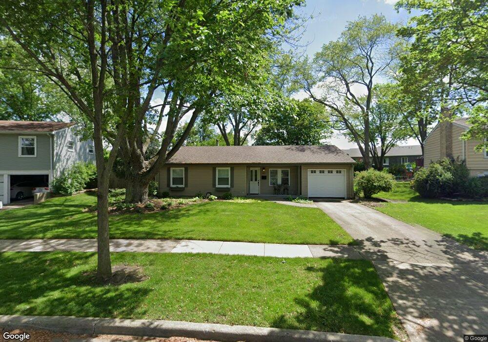
4515 Hoover St Rolling Meadows, IL 60008
Plum Grove Village NeighborhoodEstimated Value: $329,000 - $405,966
3
Beds
1
Bath
1,148
Sq Ft
$328/Sq Ft
Est. Value
About This Home
This home is located at 4515 Hoover St, Rolling Meadows, IL 60008 and is currently estimated at $375,992, approximately $327 per square foot. 4515 Hoover St is a home located in Cook County with nearby schools including Central Road Elementary School, Plum Grove Jr High School, and William Fremd High School.
Ownership History
Date
Name
Owned For
Owner Type
Purchase Details
Closed on
Mar 21, 1996
Sold by
Wilharm Keith A and Wilharm Kathy A
Bought by
Wilharm Keith A and Keith A Wilharm Trust
Current Estimated Value
Create a Home Valuation Report for This Property
The Home Valuation Report is an in-depth analysis detailing your home's value as well as a comparison with similar homes in the area
Home Values in the Area
Average Home Value in this Area
Purchase History
| Date | Buyer | Sale Price | Title Company |
|---|---|---|---|
| Wilharm Keith A | -- | -- |
Source: Public Records
Tax History
| Year | Tax Paid | Tax Assessment Tax Assessment Total Assessment is a certain percentage of the fair market value that is determined by local assessors to be the total taxable value of land and additions on the property. | Land | Improvement |
|---|---|---|---|---|
| 2025 | $8,109 | $32,001 | $9,886 | $22,115 |
| 2024 | $8,109 | $29,000 | $8,141 | $20,859 |
| 2023 | $7,776 | $29,000 | $8,141 | $20,859 |
| 2022 | $7,776 | $29,000 | $8,141 | $20,859 |
| 2021 | $7,451 | $25,126 | $4,070 | $21,056 |
| 2020 | $7,409 | $25,126 | $4,070 | $21,056 |
| 2019 | $7,396 | $27,887 | $4,070 | $23,817 |
| 2018 | $7,153 | $24,800 | $3,779 | $21,021 |
| 2017 | $7,026 | $24,800 | $3,779 | $21,021 |
| 2016 | $6,808 | $24,800 | $3,779 | $21,021 |
| 2015 | $6,177 | $21,554 | $3,489 | $18,065 |
| 2014 | $6,061 | $21,554 | $3,489 | $18,065 |
| 2013 | $5,893 | $21,554 | $3,489 | $18,065 |
Source: Public Records
Map
Nearby Homes
- 4406 Euclid Ave Unit 2C
- 2 Stuart on Oxford
- 4704 Euclid Ave Unit 1B
- 4704 Euclid Ave Unit 47042D
- 2 Croydon on Duxbury
- 1 Harrogate on Oxford
- 876 S Plum Grove Rd Unit 208
- 712-724 S Plum Grove Rd
- 724 S Plum Grove Rd
- 304 E Tall Trees Ln
- 2650 Brookwood Way Dr Unit 313
- 2650 Brookwood Way Dr Unit 108
- 2600 Brookwood Way Dr Unit 316
- 2600 Brookwood Way Dr Unit 305
- 278 W Illinois Ave
- 2401 Rohlwing Rd
- 123 Honeysuckle Ct
- 538 S Benton St
- 3000 California Ave
- 112 Ironwood Ct
- 4529 Hoover St
- 4501 Hoover St
- 4424 Euclid Ave Unit 2D
- 4424 Euclid Ave Unit 44242D
- 4424 Euclid Ave Unit 44242A
- 4424 Euclid Ave Unit 44241B
- 4424 Euclid Ave Unit 44241C
- 4424 Euclid Ave Unit 44241A
- 4424 Euclid Ave Unit 44242C
- 4424 Euclid Ave Unit 44241D
- 4424 Euclid Ave Unit 44242B
- 4424 Euclid Ave Unit 2C
- 4424 Euclid Ave Unit 1B
- 4424 Euclid Ave Unit 2A
- 4424 Euclid Ave Unit 1D
- 4424 Euclid Ave Unit 1A
- 4543 Hoover St
- 4487 Hoover St
- 4418 Euclid Ave Unit 44181A
- 4418 Euclid Ave Unit 44181D
Your Personal Tour Guide
Ask me questions while you tour the home.