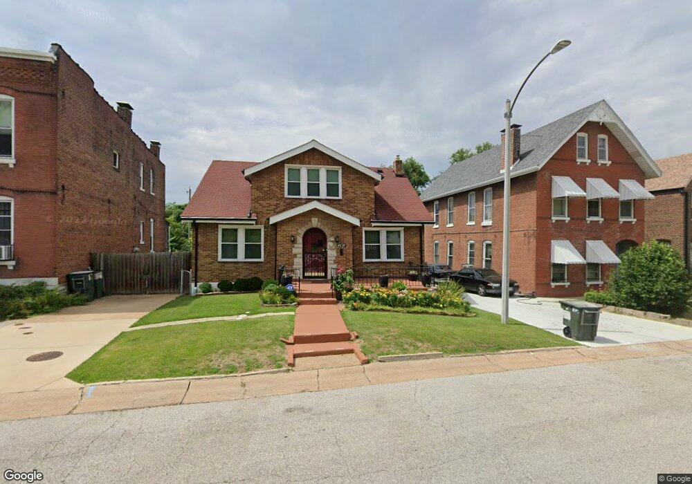
4515 N Newstead Ave Saint Louis, MO 63115
Penrose NeighborhoodEstimated Value: $65,421 - $97,000
3
Beds
1
Bath
1,862
Sq Ft
$42/Sq Ft
Est. Value
About This Home
This home is located at 4515 N Newstead Ave, Saint Louis, MO 63115 and is currently estimated at $77,855, approximately $41 per square foot. 4515 N Newstead Ave is a home located in St. Louis City with nearby schools including Hickey Elementary School, Yeatman-Liddell Middle School, and Vashon High School.
Ownership History
Date
Name
Owned For
Owner Type
Purchase Details
Closed on
Sep 25, 2012
Sold by
Gooden Albert Theodis and Allen Roy
Bought by
Gooden Albert Theodis and Allen Roy
Current Estimated Value
Purchase Details
Closed on
Aug 28, 2012
Sold by
Gooden Albert Theodis and Allen Roy
Bought by
Gooden Albert Theodis and Allen Roy
Purchase Details
Closed on
Jul 8, 2010
Sold by
Us Bank National Association
Bought by
Gooden Albert Theodis and Allen Roy
Create a Home Valuation Report for This Property
The Home Valuation Report is an in-depth analysis detailing your home's value as well as a comparison with similar homes in the area
Home Values in the Area
Average Home Value in this Area
Purchase History
| Date | Buyer | Sale Price | Title Company |
|---|---|---|---|
| Gooden Albert Theodis | -- | None Available | |
| Gooden Albert Theodis | -- | None Available | |
| Gooden Albert Theodis | -- | None Available |
Source: Public Records
Tax History Compared to Growth
Tax History
| Year | Tax Paid | Tax Assessment Tax Assessment Total Assessment is a certain percentage of the fair market value that is determined by local assessors to be the total taxable value of land and additions on the property. | Land | Improvement |
|---|---|---|---|---|
| 2025 | $505 | $5,920 | $740 | $5,180 |
| 2024 | $483 | $5,720 | $740 | $4,980 |
| 2023 | $483 | $5,720 | $740 | $4,980 |
| 2022 | $493 | $5,620 | $740 | $4,880 |
| 2021 | $492 | $5,620 | $740 | $4,880 |
| 2020 | $488 | $5,620 | $740 | $4,880 |
| 2019 | $487 | $5,620 | $740 | $4,880 |
| 2018 | $469 | $5,240 | $740 | $4,500 |
| 2017 | $462 | $5,240 | $740 | $4,500 |
| 2016 | $566 | $6,420 | $1,390 | $5,040 |
| 2015 | $515 | $6,430 | $1,390 | $5,040 |
| 2014 | $512 | $6,430 | $1,390 | $5,040 |
| 2013 | -- | $6,390 | $1,390 | $5,000 |
Source: Public Records
Map
Nearby Homes
- 4418 Dryden Ave
- 4627 Korte Ave
- 4608 Pope Ave
- 4610 Pope Ave
- 4449 Anderson Ave
- 4556 Carter Ave
- 4402 Clarence Ave
- 4246 N Taylor Ave
- 4648 Pope Ave
- 4537 Clarence Ave
- 4680 W Florissant Ave
- 4477 Bessie Ave
- 4419 Holly Ave
- 4450 Holly Ave
- 4535 Holly Ave
- 4454 Holly Ave
- 4253 Holly Ave
- 4430 Sexauer Ave
- 4237 Holly Ave
- 4499 Lee Ave Unit B
- 4521 N Newstead Ave
- 4501 N Newstead Ave
- 4528 Dryden Ave
- 4525 N Newstead Ave
- 4524 Dryden Ave
- 4532 Dryden Ave
- 4485 N Taylor Ave
- 4520 Dryden Ave
- 4536 Dryden Ave
- 4520 Kingston Ct
- 4516 Dryden Ave
- 4481 N Taylor Ave
- 4540 Dryden Ave
- 4514 Dryden Ave
- 4508 N Newstead Ave
- 4477 N Taylor Ave
- 4512 Dryden Ave
- 4544 Dryden Ave
- 4475 N Taylor Ave
- 4524 Kingston Ct