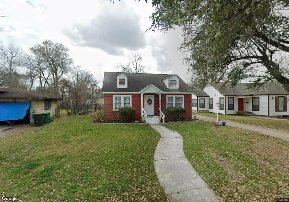
4516 Dixie Dr Houston, TX 77021
OST-South Union NeighborhoodEstimated Value: $174,909 - $235,000
4
Beds
2
Baths
1,522
Sq Ft
$141/Sq Ft
Est. Value
About This Home
This home is located at 4516 Dixie Dr, Houston, TX 77021 and is currently estimated at $213,977, approximately $140 per square foot. 4516 Dixie Dr is a home located in Harris County with nearby schools including Peck Elementary School, Cullen Middle School, and Yates High School.
Ownership History
Date
Name
Owned For
Owner Type
Purchase Details
Closed on
Nov 18, 2009
Sold by
Jones Linda Richard and Richard Edward
Bought by
Taylor Wanda L
Current Estimated Value
Purchase Details
Closed on
Jan 31, 2008
Sold by
Taylor Wanda L
Bought by
Jones Linda Richard and Richard Edward
Purchase Details
Closed on
Aug 15, 2007
Sold by
Taylor Wanda L
Bought by
Jones Linda Richard and Richard Edward
Create a Home Valuation Report for This Property
The Home Valuation Report is an in-depth analysis detailing your home's value as well as a comparison with similar homes in the area
Home Values in the Area
Average Home Value in this Area
Purchase History
| Date | Buyer | Sale Price | Title Company |
|---|---|---|---|
| Taylor Wanda L | -- | None Available | |
| Jones Linda Richard | -- | None Available | |
| Jones Linda Richard | -- | None Available |
Source: Public Records
Tax History
| Year | Tax Paid | Tax Assessment Tax Assessment Total Assessment is a certain percentage of the fair market value that is determined by local assessors to be the total taxable value of land and additions on the property. | Land | Improvement |
|---|---|---|---|---|
| 2025 | $2,004 | $171,647 | $108,851 | $62,796 |
| 2024 | $2,004 | $171,647 | $108,851 | $62,796 |
| 2023 | $2,004 | $167,753 | $99,247 | $68,506 |
| 2022 | $1,991 | $158,918 | $89,642 | $69,276 |
| 2021 | $1,916 | $99,051 | $54,426 | $44,625 |
| 2020 | $1,810 | $77,413 | $35,217 | $42,196 |
| 2019 | $1,719 | $75,276 | $35,217 | $40,059 |
| 2018 | $0 | $61,765 | $28,814 | $32,951 |
| 2017 | $1,562 | $61,765 | $28,814 | $32,951 |
| 2016 | $1,495 | $61,765 | $28,814 | $32,951 |
| 2015 | -- | $61,765 | $28,814 | $32,951 |
| 2014 | -- | $48,856 | $16,008 | $32,848 |
Source: Public Records
Map
Nearby Homes
- 4522 Dixie Dr
- 4516 Normandy Way
- 4509 Kingsbury St
- 4504 Kingsbury St
- 4603 Keystone St
- 5914 Cullen Blvd
- 4604 Keystone St
- 4503 Dewberry St
- 4522 Dewberry St
- 4613 Dewberry St
- 4509 Perry St
- 4608 Dewberry St
- 5229 Griggs Rd
- 4505 Perry St
- 0 New York St
- 4516 Perry St
- 5811 Eastwood St
- 6014 Grace Ln Unit A/B
- 6320 Paris St
- 6325 Cullen Blvd
- 4514 Dixie Dr
- 4518 Dixie Dr
- 4515 Kingsbury St
- 4512 Dixie Dr
- 4520 Dixie Dr
- 4517 Kingsbury St
- 4513 Kingsbury St
- 4519 Kingsbury St
- 4511 Kingsbury St
- 4515 Dixie Dr
- 4510 Dixie Dr
- 4513 Dixie Dr
- 4517 Dixie Dr
- 4511 Dixie Dr
- 4519 Dixie Dr
- 4524 Dixie Dr
- 4508 Dixie Dr
- 4523 Kingsbury St
- 4521 Dixie Dr
- 4507 Kingsbury St
Your Personal Tour Guide
Ask me questions while you tour the home.