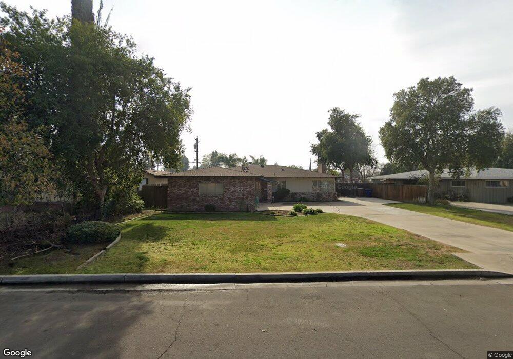
4517 Bloomquist Dr Bakersfield, CA 93309
Southwest Bakersfield NeighborhoodEstimated Value: $329,000 - $334,332
3
Beds
2
Baths
1,686
Sq Ft
$197/Sq Ft
Est. Value
About This Home
This home is located at 4517 Bloomquist Dr, Bakersfield, CA 93309 and is currently estimated at $331,666, approximately $196 per square foot. 4517 Bloomquist Dr is a home located in Kern County with nearby schools including Munsey Elementary School, Curran Middle School, and West High School.
Ownership History
Date
Name
Owned For
Owner Type
Purchase Details
Closed on
Jun 6, 2022
Sold by
Stephens Lawrence E and Stephens Kristine A
Bought by
Lawrence E Stephens And Kristine A Stephens R
Current Estimated Value
Purchase Details
Closed on
Jun 9, 1999
Sold by
Karpe Robert W
Bought by
Stephens Lawrence E and Stephens Kristine A
Home Financials for this Owner
Home Financials are based on the most recent Mortgage that was taken out on this home.
Original Mortgage
$75,000
Interest Rate
7.64%
Mortgage Type
Seller Take Back
Purchase Details
Closed on
Dec 3, 1998
Sold by
Karpe Robert W
Bought by
Karpe Robert W and Robert W Karpe Family Trust
Create a Home Valuation Report for This Property
The Home Valuation Report is an in-depth analysis detailing your home's value as well as a comparison with similar homes in the area
Home Values in the Area
Average Home Value in this Area
Purchase History
| Date | Buyer | Sale Price | Title Company |
|---|---|---|---|
| Lawrence E Stephens And Kristine A Stephens R | -- | None Listed On Document | |
| Stephens Lawrence E | $82,500 | Fidelity National Title | |
| Karpe Robert W | -- | -- |
Source: Public Records
Mortgage History
| Date | Status | Borrower | Loan Amount |
|---|---|---|---|
| Previous Owner | Stephens Lawrence E | $75,000 |
Source: Public Records
Tax History
| Year | Tax Paid | Tax Assessment Tax Assessment Total Assessment is a certain percentage of the fair market value that is determined by local assessors to be the total taxable value of land and additions on the property. | Land | Improvement |
|---|---|---|---|---|
| 2025 | $2,170 | $145,520 | $53,780 | $91,740 |
| 2024 | $2,109 | $142,668 | $52,726 | $89,942 |
| 2023 | $2,109 | $139,872 | $51,693 | $88,179 |
| 2022 | $2,028 | $137,131 | $50,680 | $86,451 |
| 2021 | $1,936 | $134,444 | $49,687 | $84,757 |
| 2020 | $1,891 | $133,067 | $49,178 | $83,889 |
| 2019 | $1,852 | $133,067 | $49,178 | $83,889 |
| 2018 | $1,794 | $127,902 | $47,269 | $80,633 |
| 2017 | $1,780 | $125,396 | $46,343 | $79,053 |
| 2016 | $1,631 | $122,939 | $45,435 | $77,504 |
| 2015 | $1,628 | $121,094 | $44,753 | $76,341 |
| 2014 | $1,579 | $118,724 | $43,877 | $74,847 |
Source: Public Records
Map
Nearby Homes
- 1001 McDonald Way Unit 40
- 4629 Fishering Dr
- 225 Blomquist Dr
- 225 Bloomquist Dr
- 4424 Belle Terrace
- 4412 Joanne Ave
- 912 Valhalla Dr
- 4801 Belle Terrace Unit C
- 1017 Nimrod Ct
- 513 Prosser Ave
- 4600 Randy Ave
- 4420 4424 Belle Terrace
- 4605 Parkwood Ct
- 305 Jones St
- 700 New Stine Rd Unit 10
- 108 Curran St
- 5401 Burning Tree Ct
- 4116 Erin Ct
- 1437 Libra Ct
- 705 Bermuda St
- 4511 Bloomquist Dr
- 4523 Bloomquist Dr
- 4505 Bloomquist Dr
- 4601 Blomquist Dr
- 4601 Bloomquist Dr
- 4514 Bloomquist Dr
- 4514 Blomquist Dr
- 4518 Bloomquist Dr
- 4510 Bloomquist Dr
- 4510 Blomquist Dr
- 4506 Bloomquist Dr
- 4600 Bloomquist Dr
- 4506 Blomquist Dr
- 4607 Bloomquist Dr
- 4604 Blomquist Dr
- 4500 Blomquist Dr
- 4604 Bloomquist Dr
- 4500 Bloomquist Dr
- 4419 Bloomquist Dr
- 901 Nimrod Ct
Your Personal Tour Guide
Ask me questions while you tour the home.