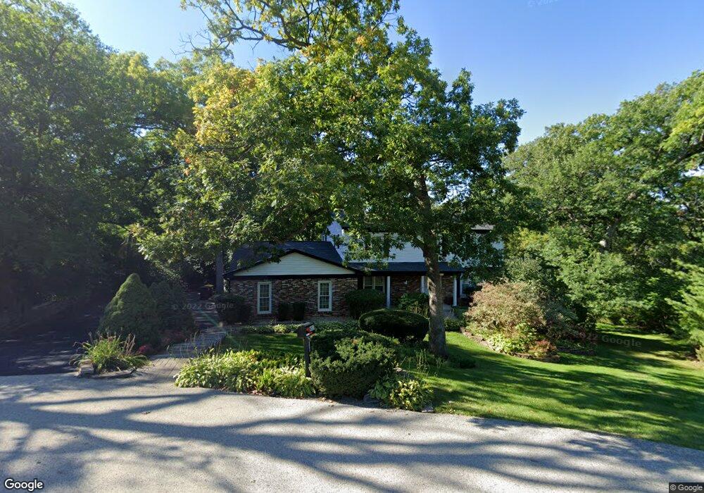
4517 Carthage Ct Crystal Lake, IL 60012
Estimated Value: $484,000 - $542,000
3
Beds
6
Baths
2,560
Sq Ft
$197/Sq Ft
Est. Value
About This Home
This home is located at 4517 Carthage Ct, Crystal Lake, IL 60012 and is currently estimated at $505,528, approximately $197 per square foot. 4517 Carthage Ct is a home located in McHenry County with nearby schools including Prairie Grove Elementary School, Prairie Grove Junior High School, and Prairie Ridge High School.
Ownership History
Date
Name
Owned For
Owner Type
Purchase Details
Closed on
Jun 26, 2001
Sold by
Hoar Michael A and Hoar Kathleen Mullin
Bought by
Stawiarski James and Stawiarski Martha
Current Estimated Value
Home Financials for this Owner
Home Financials are based on the most recent Mortgage that was taken out on this home.
Original Mortgage
$203,000
Outstanding Balance
$78,458
Interest Rate
7.18%
Estimated Equity
$427,070
Create a Home Valuation Report for This Property
The Home Valuation Report is an in-depth analysis detailing your home's value as well as a comparison with similar homes in the area
Home Values in the Area
Average Home Value in this Area
Purchase History
| Date | Buyer | Sale Price | Title Company |
|---|---|---|---|
| Stawiarski James | $261,000 | Chicago Title Insurance Co |
Source: Public Records
Mortgage History
| Date | Status | Borrower | Loan Amount |
|---|---|---|---|
| Open | Stawiarski James | $203,000 | |
| Closed | Stawiarski James | $31,900 |
Source: Public Records
Tax History Compared to Growth
Tax History
| Year | Tax Paid | Tax Assessment Tax Assessment Total Assessment is a certain percentage of the fair market value that is determined by local assessors to be the total taxable value of land and additions on the property. | Land | Improvement |
|---|---|---|---|---|
| 2024 | $8,830 | $126,617 | $21,927 | $104,690 |
| 2023 | $8,633 | $113,548 | $19,664 | $93,884 |
| 2022 | $8,321 | $97,332 | $20,978 | $76,354 |
| 2021 | $7,829 | $91,254 | $19,668 | $71,586 |
| 2020 | $7,715 | $88,518 | $19,078 | $69,440 |
| 2019 | $7,517 | $84,158 | $18,138 | $66,020 |
| 2018 | $8,511 | $93,602 | $22,363 | $71,239 |
| 2017 | $8,330 | $89,675 | $21,425 | $68,250 |
| 2016 | $8,229 | $85,560 | $20,442 | $65,118 |
| 2013 | -- | $81,427 | $19,454 | $61,973 |
Source: Public Records
Map
Nearby Homes
- 636 Cassia Ct
- 634 Cassia Ct
- 632 Cassia Ct
- Charlotte Plan at Woodlore Estates - Woodlore Townes - Phase 2
- Marianne Plan at Woodlore Estates - Woodlore Townes - Phase 2
- Darcy Plan at Woodlore Estates - Woodlore Townes - Phase 2
- 4706 Wyoming Way
- 654 Cassia Ct
- 648 Cassia Ct
- 660 Cassia Ct
- 1009 Persimmon Ct
- 1027 Mayhaw Dr
- 1149 Brighton Cir
- 1119 Glengary Cir
- 1087 Sugar Maple Dr
- 546 Cimmaron Cir
- 1091 Sugar Maple Dr
- 1170 Overhill Ct
- 1101 Black Cherry Dr
- 532 Nunda Trail
- 4515 Carthage Ct
- 4520 Carthage Ct
- 4516 Carthage Ct
- 4513 Ripon Rd
- 4510 Carthage Ct
- 4511 Carthage Ct
- 4609 Shady Oaks Ln
- 4607 Ripon Rd
- 4509 Ripon Rd
- 4507 Carthage Ct
- 4519 Ripon Rd
- 4502 Carthage Ct
- 4605 Oak Crest Rd
- 4614 Shady Oaks Ln
- 4502 Ripon Rd
- 4503 Carthage Ct
- 4516 Drake Dr
- 4410 Stanford St
- 4613 Oak Crest Rd
- 4710 Ripon Rd