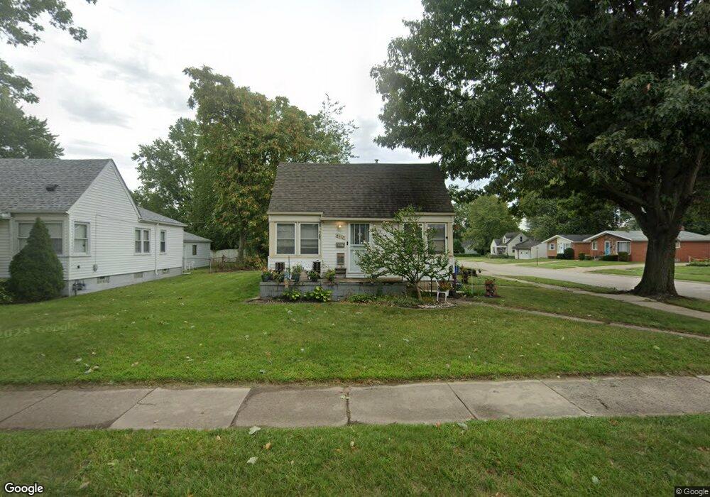
4517 Westpoint St Dearborn Heights, MI 48125
Estimated Value: $169,000 - $184,000
3
Beds
1
Bath
900
Sq Ft
$195/Sq Ft
Est. Value
About This Home
This home is located at 4517 Westpoint St, Dearborn Heights, MI 48125 and is currently estimated at $175,766, approximately $195 per square foot. 4517 Westpoint St is a home located in Wayne County with nearby schools including Polk Elementary School, Bedford School, and Pardee School.
Ownership History
Date
Name
Owned For
Owner Type
Purchase Details
Closed on
Feb 23, 2010
Sold by
Suntrust Mortgage Inc
Bought by
Federal National Mortgage Association
Current Estimated Value
Purchase Details
Closed on
Jan 27, 2010
Sold by
Woods Angela
Bought by
Suntrust Mortgage Inc
Purchase Details
Closed on
Feb 23, 2007
Sold by
Borg Danny A and Borg Lynn M
Bought by
Woods Angela S
Purchase Details
Closed on
Feb 24, 2006
Sold by
Standard Federal Bank
Bought by
Borg Danny A
Home Financials for this Owner
Home Financials are based on the most recent Mortgage that was taken out on this home.
Original Mortgage
$44,000
Interest Rate
6.38%
Mortgage Type
Purchase Money Mortgage
Create a Home Valuation Report for This Property
The Home Valuation Report is an in-depth analysis detailing your home's value as well as a comparison with similar homes in the area
Home Values in the Area
Average Home Value in this Area
Purchase History
| Date | Buyer | Sale Price | Title Company |
|---|---|---|---|
| Federal National Mortgage Association | -- | None Available | |
| Suntrust Mortgage Inc | $110,809 | None Available | |
| Woods Angela S | $101,060 | Fidelity National Title | |
| Borg Danny A | $55,000 | Attorneys Title Agency Llc |
Source: Public Records
Mortgage History
| Date | Status | Borrower | Loan Amount |
|---|---|---|---|
| Previous Owner | Borg Danny A | $44,000 |
Source: Public Records
Tax History Compared to Growth
Tax History
| Year | Tax Paid | Tax Assessment Tax Assessment Total Assessment is a certain percentage of the fair market value that is determined by local assessors to be the total taxable value of land and additions on the property. | Land | Improvement |
|---|---|---|---|---|
| 2025 | $1,665 | $84,600 | $0 | $0 |
| 2024 | $1,665 | $75,100 | $0 | $0 |
| 2023 | $1,576 | $64,500 | $0 | $0 |
| 2022 | $2,356 | $56,400 | $0 | $0 |
| 2021 | $2,340 | $51,200 | $0 | $0 |
| 2019 | $2,523 | $41,800 | $0 | $0 |
| 2018 | $1,145 | $35,800 | $0 | $0 |
| 2017 | $1,038 | $33,000 | $0 | $0 |
| 2016 | $1,635 | $31,300 | $0 | $0 |
| 2015 | $2,900 | $29,000 | $0 | $0 |
| 2013 | $2,990 | $31,000 | $0 | $0 |
| 2010 | -- | $35,000 | $0 | $0 |
Source: Public Records
Map
Nearby Homes
- 4489 Westpoint St
- 4474 Syracuse St
- 4506 Syracuse St
- 4193 Cornell St
- 4665 Syracuse St
- 4901 Cornell St
- 24117 Eton Ave
- 4449 Academy St
- 24339 Eton Ave
- 3841 Westpoint St
- 3925 Madison St
- 24360 Pennie St
- 24426 Lehigh St
- 24409 Stanford St
- 24035 Currier St
- 4459 Parker St
- 24635 Stanford St
- 5689 Cornell St
- 24337 Ross St
- 24443 Powers Ave
- 4505 Westpoint St
- 4497 Westpoint St
- 4518 Cornell St
- 4506 Cornell St
- 4481 Westpoint St
- 4498 Cornell St
- 23827 Annapolis St
- 23819 Annapolis St
- 4490 Cornell St
- 4473 Westpoint St
- 23901 Annapolis St
- 4498 Westpoint St
- 4482 Cornell St
- 4490 Westpoint St
- 23913 Annapolis St
- 4465 Westpoint St
- 23801 Annapolis St
- 4474 Cornell St
- 4641 Westpoint St
- 4482 Westpoint St