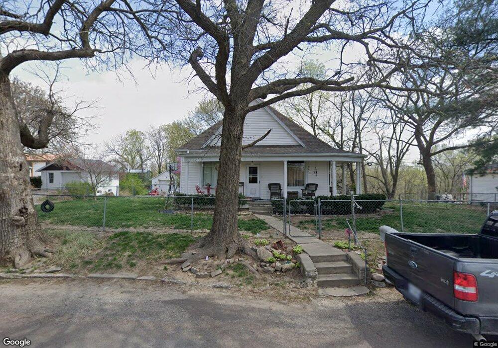
4519 Maxwell Rd Saint Joseph, MO 64505
Northside NeighborhoodEstimated Value: $140,000 - $184,000
Studio
--
Bath
1,078
Sq Ft
$149/Sq Ft
Est. Value
About This Home
This home is located at 4519 Maxwell Rd, Saint Joseph, MO 64505 and is currently estimated at $160,317, approximately $148 per square foot. 4519 Maxwell Rd is a home located in Buchanan County with nearby schools including Pershing Elementary School, Robidoux Middle School, and Lafayette High School.
Ownership History
Date
Name
Owned For
Owner Type
Purchase Details
Closed on
Oct 4, 2006
Sold by
Co Hsbc Bank Na
Bought by
Nold Stasia N
Current Estimated Value
Home Financials for this Owner
Home Financials are based on the most recent Mortgage that was taken out on this home.
Original Mortgage
$78,500
Outstanding Balance
$46,124
Interest Rate
6.37%
Mortgage Type
New Conventional
Estimated Equity
$114,193
Purchase Details
Closed on
Aug 2, 2005
Sold by
Roach Judith L and Judith L Roach Trust
Bought by
Farley Louis A
Home Financials for this Owner
Home Financials are based on the most recent Mortgage that was taken out on this home.
Original Mortgage
$99,275
Interest Rate
7.65%
Mortgage Type
Assumption
Create a Home Valuation Report for This Property
The Home Valuation Report is an in-depth analysis detailing your home's value as well as a comparison with similar homes in the area
Home Values in the Area
Average Home Value in this Area
Purchase History
We collect this data history from publicly available records. To have your information removed, we recommend requesting removal directly through your county’s website.
| Date | Buyer | Sale Price | Title Company |
|---|---|---|---|
| Nold Stasia N | -- | Hall Abstract & Title Co Inc | |
| Farley Louis A | $104,500 | Advantage Title Llc |
Source: Public Records
Mortgage History
We collect this data history from publicly available records. To have your information removed, we recommend requesting removal directly through your county’s website.
| Date | Status | Borrower | Loan Amount |
|---|---|---|---|
| Open | Nold Stasia N | $78,500 | |
| Previous Owner | Farley Louis A | $99,275 |
Source: Public Records
Tax History
| Year | Tax Paid | Tax Assessment Tax Assessment Total Assessment is a certain percentage of the fair market value that is determined by local assessors to be the total taxable value of land and additions on the property. | Land | Improvement |
|---|---|---|---|---|
| 2025 | $912 | $13,350 | $3,800 | $9,550 |
| 2024 | $868 | $12,690 | $3,800 | $8,890 |
| 2023 | $868 | $12,690 | $3,800 | $8,890 |
| 2022 | $802 | $12,690 | $3,800 | $8,890 |
| 2021 | $806 | $12,690 | $3,800 | $8,890 |
| 2020 | $802 | $12,690 | $3,800 | $8,890 |
| 2019 | $787 | $12,690 | $3,800 | $8,890 |
| 2018 | $709 | $12,690 | $3,800 | $8,890 |
| 2017 | $702 | $12,690 | $0 | $0 |
| 2015 | $1 | $7,300 | $0 | $0 |
| 2014 | $445 | $7,300 | $0 | $0 |
Source: Public Records
Map
Nearby Homes
- 4716 NE Amazonia Rd
- 1911 Oscar St
- 5518 Karrasch St
- 1024 Roosevelt Ave
- 2219 Dewey St
- 3504 N 5th Street Terrace
- 6004 NE Amazonia Rd
- 4112 Miller Rd
- Lot 20 Millstone Blvd
- 3500 Waterworks Rd
- 3131 Saint Joseph Ave
- 2622 Green Valley Rd
- 3118 N 11th St
- 4502 Orchard Rd
- 3112 N 11th St
- 4406 Orchard Rd
- 3101 Saint Joseph Ave
- 3112 Hampton Rd
- 3004 & 3006 N 10th St
- 3415 N 2nd St
- 4515 Maxwell Rd
- 4523 Maxwell Rd
- 4513 Maxwell Rd
- 4524 Maxwell Rd
- 4520 Maxwell Rd
- 4514 Maxwell Rd
- 4509 Maxwell Rd
- 4602 Maxwell Rd
- 4601 Maxwell Rd
- 4604 Maxwell Rd
- 4507 Maxwell Rd
- 4510 Maxwell Rd
- 4516 Maxwell Rd
- 4508 Maxwell Rd
- 4505 Maxwell Rd
- 4506 Maxwell Rd
- 4612 Maxwell Rd
- 4518 Maxwell Rd
- 4518 Maxwell Rd
- 4504 Maxwell Rd
Your Personal Tour Guide
Ask me questions while you tour the home.