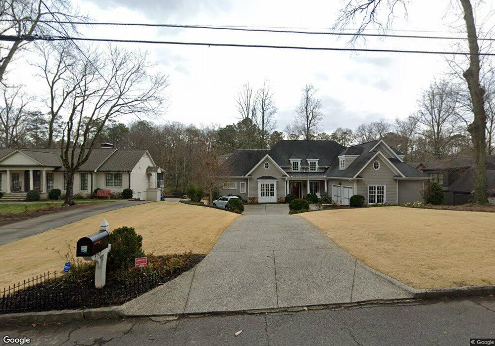
452 Broadland Rd NW Unit 3 Atlanta, GA 30342
Chastain Park NeighborhoodEstimated Value: $1,762,000 - $3,642,000
3
Beds
3
Baths
5,056
Sq Ft
$562/Sq Ft
Est. Value
About This Home
This home is located at 452 Broadland Rd NW Unit 3, Atlanta, GA 30342 and is currently estimated at $2,839,628, approximately $561 per square foot. 452 Broadland Rd NW Unit 3 is a home located in Fulton County with nearby schools including Jackson Elementary School, Sutton Middle School, and North Atlanta High School.
Ownership History
Date
Name
Owned For
Owner Type
Purchase Details
Closed on
Jun 22, 2012
Sold by
Minear Richard G
Bought by
Minear Julie A and Rim Sharon
Current Estimated Value
Home Financials for this Owner
Home Financials are based on the most recent Mortgage that was taken out on this home.
Original Mortgage
$1,100,000
Outstanding Balance
$760,907
Interest Rate
3.79%
Mortgage Type
New Conventional
Estimated Equity
$2,078,721
Purchase Details
Closed on
Jul 26, 2011
Sold by
Reeves Kathleen Ferguson
Bought by
Minear Richard G and Minear Julie A
Home Financials for this Owner
Home Financials are based on the most recent Mortgage that was taken out on this home.
Original Mortgage
$376,000
Interest Rate
4.53%
Mortgage Type
New Conventional
Create a Home Valuation Report for This Property
The Home Valuation Report is an in-depth analysis detailing your home's value as well as a comparison with similar homes in the area
Home Values in the Area
Average Home Value in this Area
Purchase History
| Date | Buyer | Sale Price | Title Company |
|---|---|---|---|
| Minear Julie A | $1,536,500 | -- | |
| Minear Richard G | -- | -- | |
| Minear Richard G | $470,000 | -- |
Source: Public Records
Mortgage History
| Date | Status | Borrower | Loan Amount |
|---|---|---|---|
| Open | Minear Julie A | $1,100,000 | |
| Previous Owner | Minear Richard G | $376,000 |
Source: Public Records
Tax History Compared to Growth
Tax History
| Year | Tax Paid | Tax Assessment Tax Assessment Total Assessment is a certain percentage of the fair market value that is determined by local assessors to be the total taxable value of land and additions on the property. | Land | Improvement |
|---|---|---|---|---|
| 2025 | $22,157 | $796,560 | $154,200 | $642,360 |
| 2023 | $34,794 | $796,560 | $154,200 | $642,360 |
| 2022 | $19,497 | $624,360 | $171,440 | $452,920 |
| 2021 | $18,777 | $606,200 | $166,440 | $439,760 |
| 2020 | $22,258 | $594,000 | $127,640 | $466,360 |
| 2019 | $497 | $500,000 | $50,440 | $449,560 |
| 2018 | $19,521 | $500,000 | $50,440 | $449,560 |
| 2017 | $21,253 | $500,000 | $50,440 | $449,560 |
| 2016 | $20,859 | $612,800 | $50,440 | $562,360 |
| 2015 | $21,419 | $612,800 | $50,440 | $562,360 |
| 2014 | $21,444 | $612,800 | $50,440 | $562,360 |
Source: Public Records
Map
Nearby Homes
- 499 Broadland Rd NW
- 4045 Northside Dr NW
- 3955 Northside Dr NW
- 465 Hillside Dr NW
- 386 King Rd NW
- 258 Pineland Rd NW
- 4220 Exeter Close NW
- 235 Hillside Dr NW
- 3800 Northside Dr NW
- 631 Fairfield Rd NW
- 737 W Conway Dr NW
- 280 Blackland Rd NW
- 133 Blackland Rd NW
- 3594 Tuxedo Ct NW
- 620 Allen Ct NW
- 1040 W Conway Dr NW
- 3625 Tuxedo Rd NW
- 3660 Haddon Hall Rd NW
- 4555 Jettridge Dr NW
- 4377 Paran Place NW
- 452 Broadland Rd NW
- 462 Broadland Rd NW
- 442 Broadland Rd NW
- 432 Broadland Rd NW Unit 3
- 470 Broadland Rd NW
- 422 Broadland Rd NW Unit 3
- 480 Broadland Rd NW
- 457 Broadland Rd NW
- 447 Broadland Rd NW
- 439 Broadland Rd NW Unit 3
- 467 Broadland Rd NW
- 412 Broadland Rd NW
- 490 Broadland Rd NW
- 429 Broadland Rd NW
- 489 Broadland Rd NW
- 477 Broadland Rd NW Unit 3
- 402 Broadland Rd NW
- 0 Broadland Rd NW Unit 7381714
- 0 Broadland Rd NW Unit 7266635
- 0 Broadland Rd NW Unit 7218694