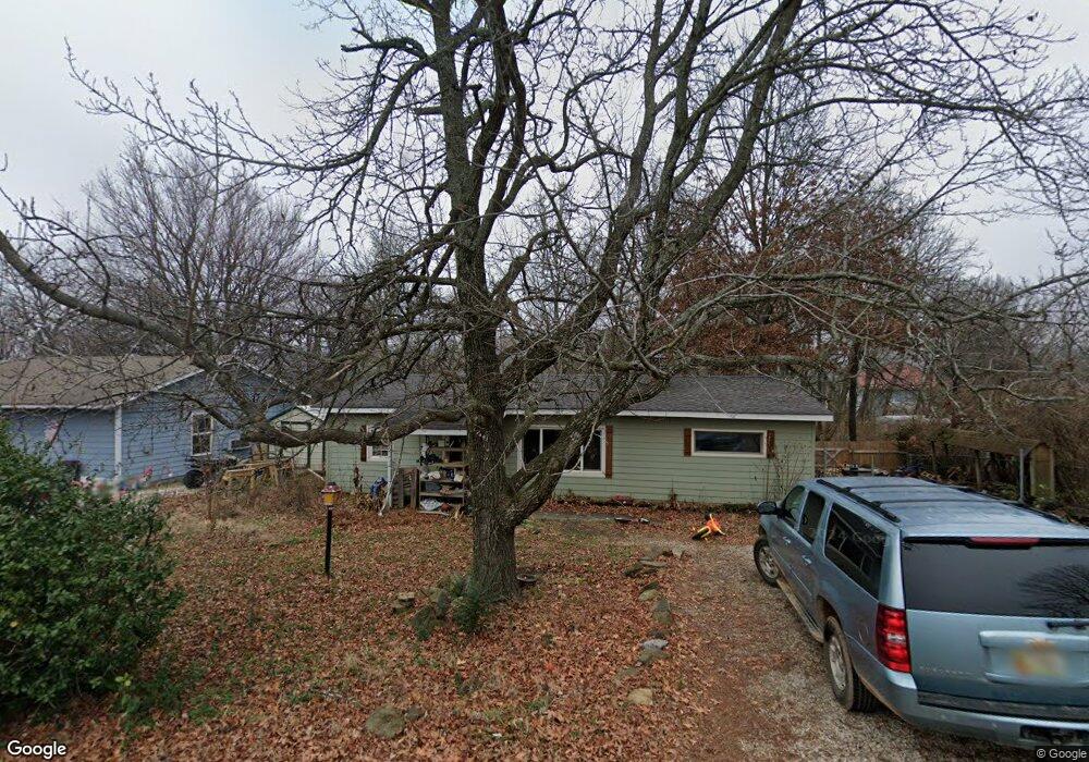
452 Center Ave West Fork, AR 72774
Estimated Value: $180,000 - $220,000
3
Beds
1
Bath
1,104
Sq Ft
$179/Sq Ft
Est. Value
About This Home
This home is located at 452 Center Ave, West Fork, AR 72774 and is currently estimated at $197,805, approximately $179 per square foot. 452 Center Ave is a home located in Washington County with nearby schools including West Fork Elementary School, West Fork Middle School, and West Fork High School.
Ownership History
Date
Name
Owned For
Owner Type
Purchase Details
Closed on
Aug 13, 2019
Sold by
Hurtado Jason
Bought by
Hurtado Shivaun
Current Estimated Value
Purchase Details
Closed on
Aug 27, 2004
Sold by
Arvest Bank
Bought by
Hurtado Jason E and Hurtado Shivaun M
Home Financials for this Owner
Home Financials are based on the most recent Mortgage that was taken out on this home.
Original Mortgage
$43,800
Interest Rate
5.97%
Mortgage Type
Seller Take Back
Purchase Details
Closed on
Jun 28, 1989
Bought by
Mcilquham John and Mcilquham Gladys
Purchase Details
Closed on
Feb 15, 1989
Bought by
Ward Johnny L and Mary Ann
Purchase Details
Closed on
Mar 10, 1988
Bought by
Bates Jim D and Bates Geneva N
Purchase Details
Closed on
Dec 15, 1982
Bought by
Vanmeter Geneva N
Create a Home Valuation Report for This Property
The Home Valuation Report is an in-depth analysis detailing your home's value as well as a comparison with similar homes in the area
Home Values in the Area
Average Home Value in this Area
Purchase History
| Date | Buyer | Sale Price | Title Company |
|---|---|---|---|
| Hurtado Shivaun | -- | None Available | |
| Hurtado Jason E | $38,000 | Waco Title Company | |
| Mcilquham John | -- | -- | |
| Ward Johnny L | $27,000 | -- | |
| Bates Jim D | -- | -- | |
| Vanmeter Geneva N | $23,000 | -- |
Source: Public Records
Mortgage History
| Date | Status | Borrower | Loan Amount |
|---|---|---|---|
| Previous Owner | Hurtado Jason E | $43,800 |
Source: Public Records
Tax History Compared to Growth
Tax History
| Year | Tax Paid | Tax Assessment Tax Assessment Total Assessment is a certain percentage of the fair market value that is determined by local assessors to be the total taxable value of land and additions on the property. | Land | Improvement |
|---|---|---|---|---|
| 2025 | $1,055 | $23,470 | $5,000 | $18,470 |
| 2024 | $973 | $23,470 | $5,000 | $18,470 |
| 2023 | $899 | $23,470 | $5,000 | $18,470 |
| 2022 | $799 | $16,060 | $4,000 | $12,060 |
| 2021 | $737 | $16,060 | $4,000 | $12,060 |
| 2020 | $676 | $16,060 | $4,000 | $12,060 |
| 2019 | $614 | $11,570 | $3,000 | $8,570 |
| 2018 | $614 | $11,570 | $3,000 | $8,570 |
| 2017 | $597 | $11,570 | $3,000 | $8,570 |
| 2016 | $597 | $11,570 | $3,000 | $8,570 |
| 2015 | $597 | $11,570 | $3,000 | $8,570 |
| 2014 | $558 | $10,820 | $3,600 | $7,220 |
Source: Public Records
Map
Nearby Homes
- 340 W Smith St
- Springs 1445 Plan at Rolling Plains
- Eureka 1536 Plan at Rolling Plains
- Oak 1463 Plan at Rolling Plains
- Magnolia 1556 Plan at Rolling Plains
- Ashton 1496 Plan at Rolling Plains
- Ouachita 1669 Plan at Rolling Plains
- Osage 1567 Plan at Rolling Plains
- Maple 1659 Plan at Rolling Plains
- 497 Clark Ave
- 503 Clark Ave
- 222 Rivendale Dr
- 378 Hidden Creek Place
- 393 W Smith St
- 365 W Smith St
- 359 W Smith St
- 339 W Smith St
- 327 W Smith St
- 385 W Smith St
- 260 Culp Trail
- 444 Center Ave
- 280 N Smith
- 280 W Smith St
- 271 Hayes St
- 280 Smith St
- 463 Mcknight Ave
- 461 Center Ave
- 445 Mcknight Ave
- 451 Center Ave
- 469 Mcknight Ave
- 480 Center Ave
- 435 Mcknight Ave
- 296 Hayes St
- 481 Center Ave
- 485 Mcknight Ave
- 470 Mcknight Ave
- 452 Mcknight Ave
- 466 Clark Ave
- 492 Center Ave
- 423 Mcknight Ave