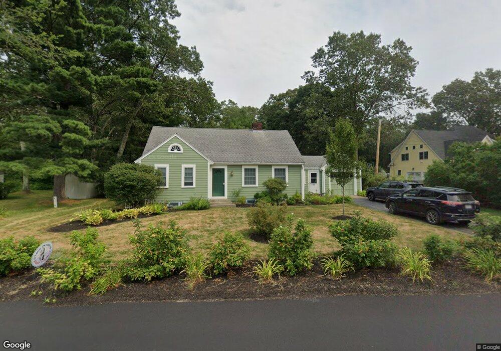
452 Dutton Rd Sudbury, MA 01776
Estimated Value: $686,000 - $777,000
3
Beds
1
Bath
1,632
Sq Ft
$454/Sq Ft
Est. Value
About This Home
This home is located at 452 Dutton Rd, Sudbury, MA 01776 and is currently estimated at $740,677, approximately $453 per square foot. 452 Dutton Rd is a home located in Middlesex County with nearby schools including Peter Noyes Elementary School, Ephraim Curtis Middle School, and Lincoln-Sudbury Regional High School.
Ownership History
Date
Name
Owned For
Owner Type
Purchase Details
Closed on
Aug 16, 1993
Sold by
Cavanaugh William J and Cavanaugh Susan P
Bought by
Green Lucy A
Current Estimated Value
Home Financials for this Owner
Home Financials are based on the most recent Mortgage that was taken out on this home.
Original Mortgage
$100,000
Interest Rate
7.16%
Mortgage Type
Purchase Money Mortgage
Create a Home Valuation Report for This Property
The Home Valuation Report is an in-depth analysis detailing your home's value as well as a comparison with similar homes in the area
Home Values in the Area
Average Home Value in this Area
Purchase History
| Date | Buyer | Sale Price | Title Company |
|---|---|---|---|
| Green Lucy A | $159,000 | -- |
Source: Public Records
Mortgage History
| Date | Status | Borrower | Loan Amount |
|---|---|---|---|
| Closed | Green Lucy A | $100,000 | |
| Previous Owner | Green Lucy A | $15,600 |
Source: Public Records
Tax History
| Year | Tax Paid | Tax Assessment Tax Assessment Total Assessment is a certain percentage of the fair market value that is determined by local assessors to be the total taxable value of land and additions on the property. | Land | Improvement |
|---|---|---|---|---|
| 2025 | $9,211 | $629,200 | $385,200 | $244,000 |
| 2024 | $8,892 | $608,600 | $373,900 | $234,700 |
| 2023 | $8,961 | $568,200 | $339,800 | $228,400 |
| 2022 | $8,724 | $483,300 | $311,900 | $171,400 |
| 2021 | $8,509 | $451,900 | $311,900 | $140,000 |
| 2020 | $8,338 | $451,900 | $311,900 | $140,000 |
| 2019 | $8,094 | $451,900 | $311,900 | $140,000 |
| 2018 | $8,106 | $452,100 | $315,500 | $136,600 |
| 2017 | $7,669 | $432,300 | $304,700 | $127,600 |
| 2016 | $7,382 | $414,700 | $293,100 | $121,600 |
| 2015 | $7,029 | $399,400 | $279,300 | $120,100 |
| 2014 | $6,970 | $386,600 | $269,500 | $117,100 |
Source: Public Records
Map
Nearby Homes
- 25 Poplar St
- 30 Kendall Rd
- 53 Pine St
- 557 Dutton Rd Unit 2
- 62 Churchill St
- 30 Harness Ln
- 11 Great Lake Dr
- 30 Rolling Ln
- 11 October Rd
- 45 Webster Cir
- 15 Huckleberry Ln
- 0 Robbins Rd
- 8 Twillingate Rd
- 22 Barracks Rd Unit 22
- 15 Barracks Rd Unit 15
- 0 Boston Post Rd
- 11 Farmstead Ln Unit 11
- 355 Maynard Rd
- 55 Widow Rites Ln
- 45 Widow Rites Ln
Your Personal Tour Guide
Ask me questions while you tour the home.