Estimated Value: $146,000 - $183,000
Studio
1
Bath
1,750
Sq Ft
$96/Sq Ft
Est. Value
About This Home
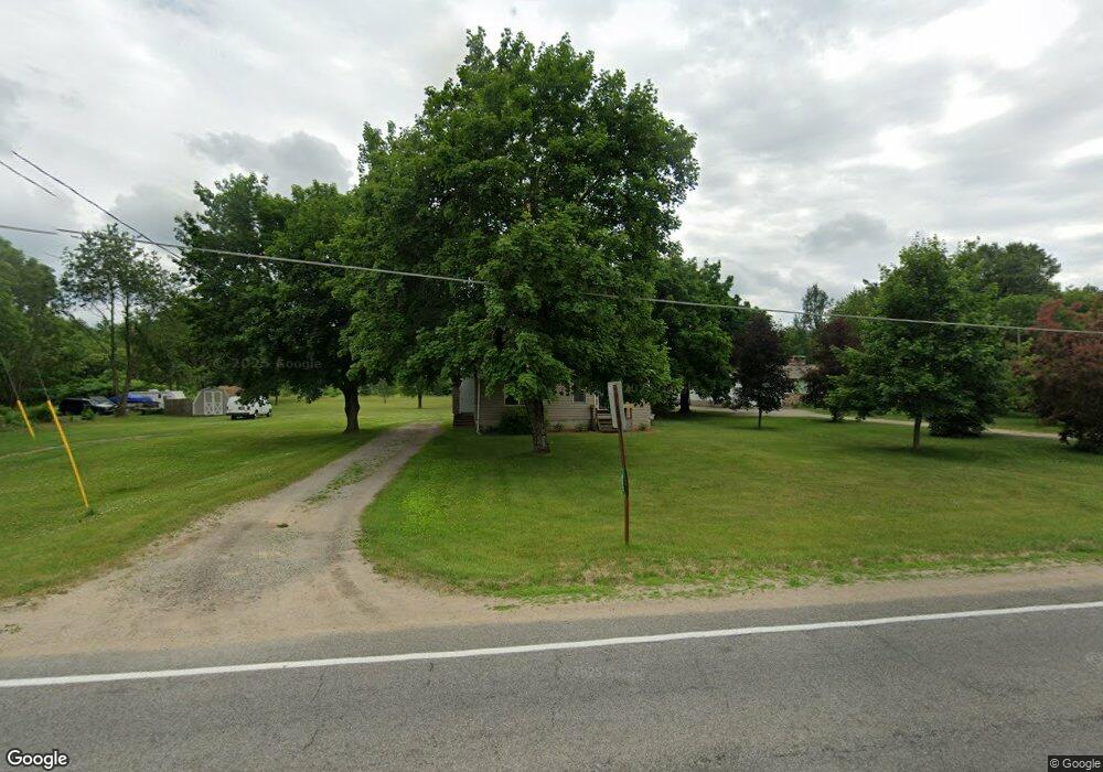
This home is located at 452 E 120th St, Grant, MI 49327 and is currently estimated at $168,728, approximately $96 per square foot. 452 E 120th St is a home located in Newaygo County with nearby schools including Grant Primary Center, Grant Elementary School, and Grant Middle School.
Ownership History
Date
Name
Owned For
Owner Type
Purchase Details
Closed on
Jan 28, 2014
Sold by
Davis Lawrence D
Bought by
Davis Trust No 1
Current Estimated Value
Purchase Details
Closed on
Dec 15, 2010
Sold by
Fannie Mae
Bought by
Davis Lawrence and Davis Cecilia
Purchase Details
Closed on
Jun 21, 2010
Sold by
Bac Home Loans Servicing Lp
Bought by
Federal National Mortgage Association
Purchase Details
Closed on
Mar 16, 2010
Sold by
Brenner Raymond
Bought by
Bac Home Loans Servicing
Purchase Details
Closed on
Mar 28, 1997
Sold by
Longoria Reynaldo J
Bought by
Bouwkamp Christopher
Create a Home Valuation Report for This Property
The Home Valuation Report is an in-depth analysis detailing your home's value as well as a comparison with similar homes in the area
Purchase History
| Date | Buyer | Sale Price | Title Company |
|---|---|---|---|
| Davis Trust No 1 | -- | -- | |
| Davis Lawrence | $27,000 | -- | |
| Federal National Mortgage Association | -- | -- | |
| Bac Home Loans Servicing | $49,157 | -- | |
| Bouwkamp Christopher | $34,500 | -- |
Source: Public Records
Tax History
| Year | Tax Paid | Tax Assessment Tax Assessment Total Assessment is a certain percentage of the fair market value that is determined by local assessors to be the total taxable value of land and additions on the property. | Land | Improvement |
|---|---|---|---|---|
| 2025 | $288 | $51,700 | $0 | $0 |
| 2024 | $3 | $48,000 | $0 | $0 |
| 2023 | $269 | $40,800 | $0 | $0 |
| 2022 | $613 | $36,700 | $0 | $0 |
| 2021 | $637 | $33,300 | $0 | $0 |
| 2020 | $630 | $29,600 | $0 | $0 |
| 2019 | $609 | $26,900 | $0 | $0 |
| 2018 | $661 | $21,600 | $0 | $0 |
| 2017 | $659 | $20,300 | $0 | $0 |
| 2016 | $619 | $20,100 | $0 | $0 |
| 2015 | -- | $22,200 | $0 | $0 |
| 2014 | -- | $20,700 | $0 | $0 |
Source: Public Records
Map
Nearby Homes
- Lot 19 S Elder Ave
- 151 & 153 Clark St
- 140 E Commerce St
- 11298 S Gordon Ave
- 283 S Jones St
- 12449 S Catalpa Ave
- 500 E 136th St
- 953 E 136th St
- 10021 S Mason Dr
- 10041 S Mason Dr
- 608 E The Ln
- 177 W 96th St
- 9500 S Annie Ln
- 9310 Benjamin Dr
- 9370 S Hannah Ln
- 2119 W 116th St
- 9425 S Benjamin Dr
- 2308 W 112th St
- 0 W 112th St Unit 26006032
- 1773 N Newaygo Rd
- 420 E 120th St
- 386 E 120th St
- 482 E 120th St
- 490 E 120th St
- 514 E 120th St
- 11975 Sycamore Ave
- 536 E 120th St
- 302 E 120th St
- 333 E 120th St
- 523 E 120th St
- 285 E 120th St
- 576 E 120th St
- 565 E 120th St
- 235 E 120th St
- 601 E 120th St
- 233 E 120th St
- 622 E 120th St
- 205 E 120th St
- 11671 Sycamore Ave
- 189 E 120th St
Your Personal Tour Guide
Ask me questions while you tour the home.