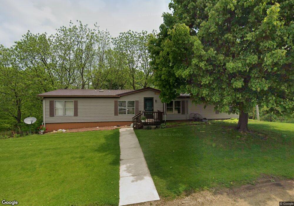
452 E Dale St Browntown, WI 53522
Estimated Value: $166,134 - $302,000
--
Bed
--
Bath
--
Sq Ft
0.75
Acres
About This Home
This home is located at 452 E Dale St, Browntown, WI 53522 and is currently estimated at $228,284. 452 E Dale St is a home located in Green County.
Create a Home Valuation Report for This Property
The Home Valuation Report is an in-depth analysis detailing your home's value as well as a comparison with similar homes in the area
Home Values in the Area
Average Home Value in this Area
Tax History Compared to Growth
Tax History
| Year | Tax Paid | Tax Assessment Tax Assessment Total Assessment is a certain percentage of the fair market value that is determined by local assessors to be the total taxable value of land and additions on the property. | Land | Improvement |
|---|---|---|---|---|
| 2024 | $1,613 | $123,500 | $13,900 | $109,600 |
| 2023 | $1,867 | $123,500 | $13,900 | $109,600 |
| 2022 | $2,347 | $116,200 | $12,400 | $103,800 |
| 2021 | $2,245 | $116,200 | $12,400 | $103,800 |
| 2020 | $2,230 | $116,200 | $12,400 | $103,800 |
| 2019 | $1,903 | $116,200 | $12,400 | $103,800 |
| 2018 | $2,232 | $108,100 | $12,400 | $95,700 |
| 2017 | $2,332 | $108,100 | $12,400 | $95,700 |
| 2016 | $2,296 | $108,100 | $12,400 | $95,700 |
| 2014 | $1,917 | $108,100 | $12,400 | $95,700 |
Source: Public Records
Map
Nearby Homes
- 360 S Church St
- 000 County Highway M
- 113 S Liberty St
- W8192 Pilz Rd
- W8194 Pilz Rd
- N2090 Allen Rd
- N2202 Cadiz Springs Rd
- TBD Miller Rd
- Lot 3 Rd
- W7880 Wisconsin 11
- 139.57 AC County Road M
- 000 County Road M
- 7841 W Hwy County M
- TBD E County M
- N2451 Ullom Rd Unit 20
- 301 S Galena St
- W6579 Karric Ln
- 619 Bridge St
- W6430 Patterson Rd
- 204 Carver St