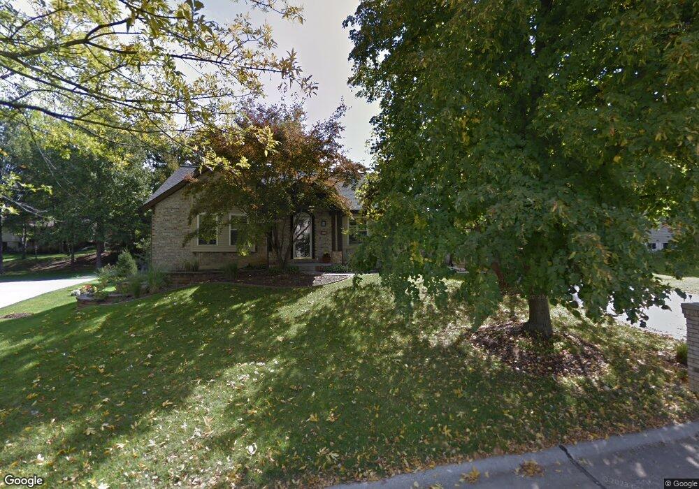
452 Mason Ridge Dr Saint Charles, MO 63304
Estimated Value: $395,805 - $457,000
3
Beds
2
Baths
1,824
Sq Ft
$238/Sq Ft
Est. Value
About This Home
This home is located at 452 Mason Ridge Dr, Saint Charles, MO 63304 and is currently estimated at $433,451, approximately $237 per square foot. 452 Mason Ridge Dr is a home located in St. Charles County with nearby schools including Warren Elementary School, Saeger Middle School, and Francis Howell Central High School.
Ownership History
Date
Name
Owned For
Owner Type
Purchase Details
Closed on
Aug 20, 2003
Sold by
Eberhardt Keven A and Eberhardt Maria M
Bought by
Dutton Tim C and Dutton Rebecca L
Current Estimated Value
Home Financials for this Owner
Home Financials are based on the most recent Mortgage that was taken out on this home.
Original Mortgage
$155,000
Outstanding Balance
$67,709
Interest Rate
5.51%
Mortgage Type
Purchase Money Mortgage
Estimated Equity
$365,742
Purchase Details
Closed on
Apr 15, 1999
Sold by
Barbara A Schillhahn Timothy F and Barbara Schillhahn
Bought by
Eberhardt Kevin A
Home Financials for this Owner
Home Financials are based on the most recent Mortgage that was taken out on this home.
Original Mortgage
$114,400
Interest Rate
7.16%
Create a Home Valuation Report for This Property
The Home Valuation Report is an in-depth analysis detailing your home's value as well as a comparison with similar homes in the area
Home Values in the Area
Average Home Value in this Area
Purchase History
| Date | Buyer | Sale Price | Title Company |
|---|---|---|---|
| Dutton Tim C | $225,000 | -- | |
| Eberhardt Kevin A | -- | -- |
Source: Public Records
Mortgage History
| Date | Status | Borrower | Loan Amount |
|---|---|---|---|
| Open | Dutton Tim C | $155,000 | |
| Previous Owner | Eberhardt Kevin A | $114,400 |
Source: Public Records
Tax History Compared to Growth
Tax History
| Year | Tax Paid | Tax Assessment Tax Assessment Total Assessment is a certain percentage of the fair market value that is determined by local assessors to be the total taxable value of land and additions on the property. | Land | Improvement |
|---|---|---|---|---|
| 2025 | $3,707 | $66,312 | -- | -- |
| 2024 | $3,707 | $62,051 | -- | -- |
| 2023 | $3,705 | $62,051 | $0 | $0 |
| 2022 | $3,333 | $51,828 | $0 | $0 |
| 2021 | $3,336 | $51,828 | $0 | $0 |
| 2020 | $2,921 | $43,880 | $0 | $0 |
| 2019 | $2,908 | $43,880 | $0 | $0 |
| 2018 | $3,081 | $44,467 | $0 | $0 |
| 2017 | $3,055 | $44,467 | $0 | $0 |
| 2016 | $2,742 | $38,400 | $0 | $0 |
| 2015 | $2,708 | $38,400 | $0 | $0 |
| 2014 | $2,552 | $35,105 | $0 | $0 |
Source: Public Records
Map
Nearby Homes
- 6024 Mo-N Unit Lot 2
- 6025 Mo-N Unit Lot 1
- 201 Valley Lakes Ct
- 308 Cypress Point Ct
- 1399 Valli Ln
- 1512 Brittany Cove
- Rosemont Plan at Prairie Bluff - Heritage Collection
- Sierra Plan at Prairie Bluff - Heritage Collection
- Sierra – Universal Design Plan at Prairie Bluff - Heritage Collection
- Pierce Plan at Prairie Bluff - Heritage Collection
- Lancaster Plan at Prairie Bluff - Heritage Collection
- Chesapeake Plan at Prairie Bluff - Heritage Collection
- Windsor Plan at Prairie Bluff - Heritage Collection
- Bridgeport Plan at Prairie Bluff - Heritage Collection
- Davenport Plan at Prairie Bluff - Heritage Collection
- Portsmouth Plan at Prairie Bluff - Heritage Collection
- Braxton Plan at Prairie Bluff - Heritage Collection
- 301 Switchgrass Landing Ln
- 317 Switchgrass Landing Ln
- 37 Cloverdale Dr
- 448 Mason Ridge Dr
- 456 Mason Ridge Dr
- 315 Bristlecone Ct N
- 317 Bristlecone Ct N
- 311 Bristlecone Ct N
- 457 Mason Ridge Dr
- 460 Mason Ridge Dr
- 279 Copperwood Trail
- 301 Summer Ridge Dr
- 461 Mason Ridge Dr
- 5125 Silver Lake Dr
- 307 Bristlecone Ct N
- 465 Mason Ridge Dr
- 5129 Silver Lake Dr
- 305 Summer Ridge Dr
- 464 Mason Ridge Dr
- 314 Bristlecone Ct N
- 318 Bristlecone Ct N
- 310 Bristlecone Ct N
- 275 Copperwood Trail