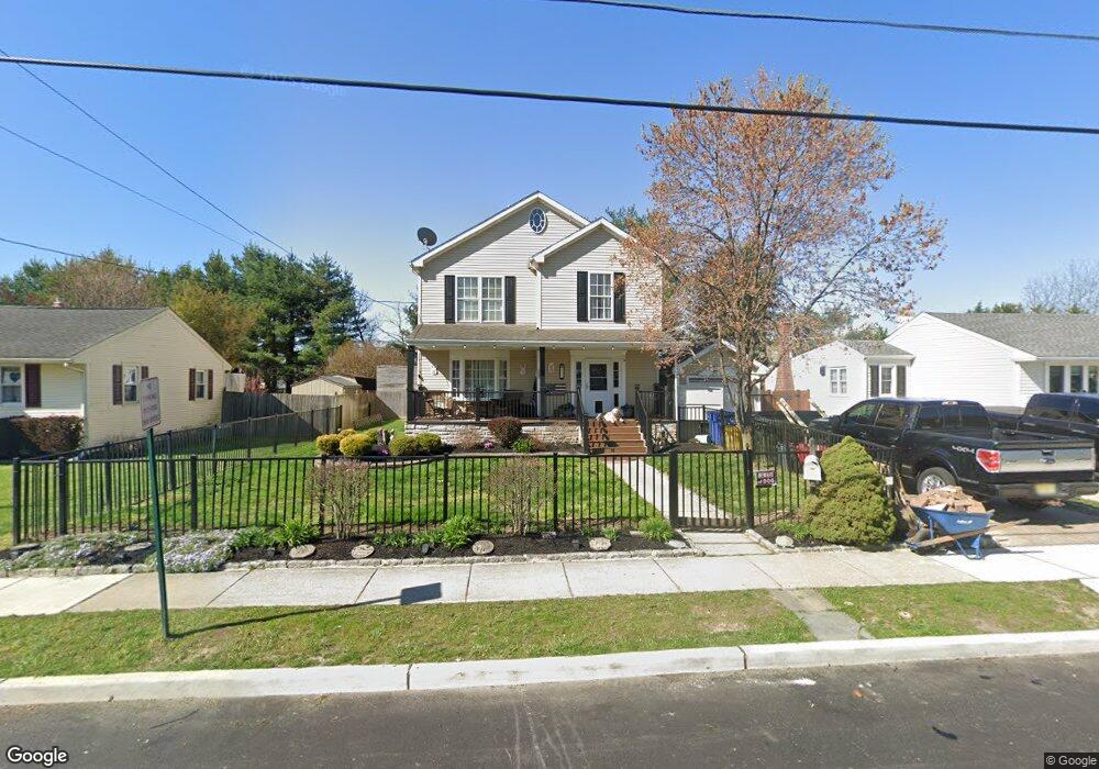
452 N Coles Ave Maple Shade, NJ 08052
Estimated Value: $406,000 - $510,939
4
Beds
3
Baths
2,100
Sq Ft
$217/Sq Ft
Est. Value
About This Home
This home is located at 452 N Coles Ave, Maple Shade, NJ 08052 and is currently estimated at $456,235, approximately $217 per square foot. 452 N Coles Ave is a home located in Burlington County with nearby schools including Ralph J Steinhauer Elementary School, Maude M. Wilkins Elementary School, and Howard R Yocum School.
Ownership History
Date
Name
Owned For
Owner Type
Purchase Details
Closed on
Jun 2, 2003
Sold by
Estate Of Samuel R Alloway and Alloway Charles G
Bought by
Mckale Jeffrey D and Mckale Virginia L
Current Estimated Value
Home Financials for this Owner
Home Financials are based on the most recent Mortgage that was taken out on this home.
Original Mortgage
$142,500
Outstanding Balance
$62,105
Interest Rate
5.71%
Mortgage Type
Purchase Money Mortgage
Estimated Equity
$394,130
Create a Home Valuation Report for This Property
The Home Valuation Report is an in-depth analysis detailing your home's value as well as a comparison with similar homes in the area
Home Values in the Area
Average Home Value in this Area
Purchase History
| Date | Buyer | Sale Price | Title Company |
|---|---|---|---|
| Mckale Jeffrey D | $150,000 | -- |
Source: Public Records
Mortgage History
| Date | Status | Borrower | Loan Amount |
|---|---|---|---|
| Open | Mckale Jeffrey D | $142,500 |
Source: Public Records
Tax History Compared to Growth
Tax History
| Year | Tax Paid | Tax Assessment Tax Assessment Total Assessment is a certain percentage of the fair market value that is determined by local assessors to be the total taxable value of land and additions on the property. | Land | Improvement |
|---|---|---|---|---|
| 2025 | $9,820 | $258,700 | $44,000 | $214,700 |
| 2024 | $9,536 | $258,700 | $44,000 | $214,700 |
| 2023 | $9,536 | $258,700 | $44,000 | $214,700 |
| 2022 | $9,388 | $258,700 | $44,000 | $214,700 |
| 2021 | $9,298 | $258,700 | $44,000 | $214,700 |
| 2020 | $9,324 | $258,700 | $44,000 | $214,700 |
| 2019 | $8,982 | $258,700 | $44,000 | $214,700 |
| 2018 | $8,827 | $258,700 | $44,000 | $214,700 |
| 2017 | $8,723 | $258,700 | $44,000 | $214,700 |
| 2016 | $8,594 | $258,700 | $44,000 | $214,700 |
| 2015 | $8,408 | $258,700 | $44,000 | $214,700 |
| 2014 | $8,152 | $258,700 | $44,000 | $214,700 |
Source: Public Records
Map
Nearby Homes
- 432 N Coles Ave
- 12 Collins Ln
- 4 W Germantown Ave
- 301 N Coles Ave
- 41 Orchard Ave
- 480 W Front St
- 29 W Broadway
- 48 N Terrace Ave
- 218 E Germantown Ave
- 505 Greenwood Ave
- 8534 Orchard Ave
- 524 W Main St
- 3422 Palace Ct
- 8515 Bryn Mawr Ave
- 8337 Herbert Ave
- 8704 Park Ave
- 3423 New Jersey Ct
- 22 Theodore Ave
- 19 Farnsworth Ave
- 8331 Stockton Ave
- 448 N Coles Ave
- 456 N Coles Ave
- 444 N Coles Ave
- 460 N Coles Ave
- 216 W Germantown Ave
- 440 N Coles Ave
- 464 N Coles Ave
- 216 E Germantown Ave
- 451 N Coles Ave
- 308 B Collins Lane B
- 308 Collins Ln
- 447 N Coles Ave
- 436 N Coles Ave
- 468 N Coles Ave
- 212 W Germantown Ave
- 443 N Coles Ave
- 219 W Germantown Ave
- 208 W Germantown Ave
- 215 W Germantown Ave
- 472 N Coles Ave