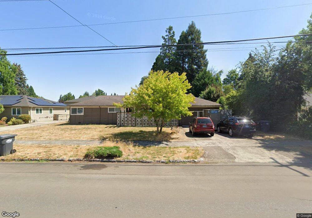
452 NE 5th Ave Hillsboro, OR 97124
Central Hillsboro NeighborhoodEstimated Value: $580,000 - $657,000
3
Beds
2
Baths
2,154
Sq Ft
$286/Sq Ft
Est. Value
About This Home
This home is located at 452 NE 5th Ave, Hillsboro, OR 97124 and is currently estimated at $615,706, approximately $285 per square foot. 452 NE 5th Ave is a home located in Washington County with nearby schools including Lincoln Street Elementary School, Evergreen Jr High School, and Glencoe High School.
Ownership History
Date
Name
Owned For
Owner Type
Purchase Details
Closed on
Mar 10, 2022
Sold by
Graham Michael M
Bought by
Graham Michael M and Graham Linda S
Current Estimated Value
Home Financials for this Owner
Home Financials are based on the most recent Mortgage that was taken out on this home.
Original Mortgage
$353,000
Outstanding Balance
$329,555
Interest Rate
3.85%
Mortgage Type
New Conventional
Estimated Equity
$286,151
Purchase Details
Closed on
Apr 25, 2017
Sold by
Graham Mike M and Graham Linda S
Bought by
Graham Michael M and Graham Linda S
Home Financials for this Owner
Home Financials are based on the most recent Mortgage that was taken out on this home.
Original Mortgage
$312,000
Interest Rate
4.3%
Mortgage Type
New Conventional
Create a Home Valuation Report for This Property
The Home Valuation Report is an in-depth analysis detailing your home's value as well as a comparison with similar homes in the area
Home Values in the Area
Average Home Value in this Area
Purchase History
| Date | Buyer | Sale Price | Title Company |
|---|---|---|---|
| Graham Michael M | -- | First American Title | |
| Graham Michael M | -- | Wfg Title |
Source: Public Records
Mortgage History
| Date | Status | Borrower | Loan Amount |
|---|---|---|---|
| Open | Graham Michael M | $353,000 | |
| Previous Owner | Graham Michael M | $312,000 |
Source: Public Records
Tax History Compared to Growth
Tax History
| Year | Tax Paid | Tax Assessment Tax Assessment Total Assessment is a certain percentage of the fair market value that is determined by local assessors to be the total taxable value of land and additions on the property. | Land | Improvement |
|---|---|---|---|---|
| 2025 | $4,830 | $295,460 | -- | -- |
| 2024 | $4,692 | $286,860 | -- | -- |
| 2023 | $4,692 | $278,510 | $0 | $0 |
| 2022 | $4,565 | $278,510 | $0 | $0 |
| 2021 | $4,473 | $262,530 | $0 | $0 |
| 2020 | $4,377 | $254,890 | $0 | $0 |
| 2019 | $4,251 | $247,470 | $0 | $0 |
| 2018 | $4,069 | $240,270 | $0 | $0 |
| 2017 | $3,922 | $233,280 | $0 | $0 |
| 2016 | $3,814 | $226,490 | $0 | $0 |
| 2015 | $3,661 | $219,900 | $0 | $0 |
| 2014 | $3,640 | $213,500 | $0 | $0 |
Source: Public Records
Map
Nearby Homes
- 624 NE Edison St
- 420 NE Jackson St
- 354 NE Jackson St
- 511 NE Lincoln St
- 245 NE 4th Ave
- 665 NE 3rd Ave
- 341 NE 3rd Ave
- 874 NE 6th Dr
- 553 NE Buena Vista St
- 154 NW Garibaldi St
- 1 NE 3rd Ave
- 856 NW Val Ct
- 1242 NE Parkside Dr
- 960 E Main St
- 1184 NE Turner Dr
- 1269 NE Grant St
- 1425 NE Glen Ellen Dr
- 1303 NE Cornell Rd
- 301 W Main St
- 456 NW Dennis Ave
- 474 NE 5th Ave
- 432 NE 5th Ave
- 516 NE 5th Ave
- 451 NE 6th Ave
- 437 NE 6th Ave
- 471 NE 6th Ave
- 412 NE 5th Ave
- 525 NE Edison St
- 545 NE Edison St
- 429 NE 5th Ave
- 439 NE 5th Ave
- 473 NE 5th Ave
- 513 NE 6th Ave
- 532 NE 5th Ave
- 507 NE 5th Ave
- 471 NE Edison St
- 415 NE 6th Ave
- 519 NE 5th Ave
- 463 NE Edison St
- 543 NE 6th Ave