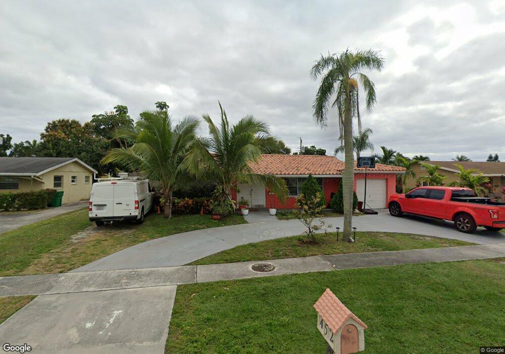
452 Palo Alto Dr Palm Springs, FL 33461
Palm Springs Village NeighborhoodEstimated Value: $493,169 - $524,000
3
Beds
2
Baths
1,521
Sq Ft
$337/Sq Ft
Est. Value
About This Home
This home is located at 452 Palo Alto Dr, Palm Springs, FL 33461 and is currently estimated at $513,292, approximately $337 per square foot. 452 Palo Alto Dr is a home located in Palm Beach County with nearby schools including Clifford O Taylor/Kirklane Elementary School, John I. Leonard High School, and Palm Springs Middle School.
Ownership History
Date
Name
Owned For
Owner Type
Purchase Details
Closed on
Mar 21, 2023
Sold by
Corea Marlen
Bought by
Corea Marlen
Current Estimated Value
Purchase Details
Closed on
Feb 9, 2007
Sold by
Klein Stuart M and Klein Sheryl G
Bought by
Corea Marlen
Home Financials for this Owner
Home Financials are based on the most recent Mortgage that was taken out on this home.
Original Mortgage
$63,800
Interest Rate
6.14%
Mortgage Type
Stand Alone Second
Create a Home Valuation Report for This Property
The Home Valuation Report is an in-depth analysis detailing your home's value as well as a comparison with similar homes in the area
Home Values in the Area
Average Home Value in this Area
Purchase History
| Date | Buyer | Sale Price | Title Company |
|---|---|---|---|
| Corea Marlen | -- | None Listed On Document | |
| Corea Marlen | $319,000 | Attorney |
Source: Public Records
Mortgage History
| Date | Status | Borrower | Loan Amount |
|---|---|---|---|
| Previous Owner | Corea Marlen | $63,800 | |
| Previous Owner | Corea Marlen | $255,200 |
Source: Public Records
Tax History Compared to Growth
Tax History
| Year | Tax Paid | Tax Assessment Tax Assessment Total Assessment is a certain percentage of the fair market value that is determined by local assessors to be the total taxable value of land and additions on the property. | Land | Improvement |
|---|---|---|---|---|
| 2024 | $2,166 | $126,820 | -- | -- |
| 2023 | $2,105 | $123,126 | $0 | $0 |
| 2022 | $2,038 | $119,540 | $0 | $0 |
| 2021 | $1,958 | $116,058 | $0 | $0 |
| 2020 | $1,935 | $114,456 | $0 | $0 |
| 2019 | $1,903 | $111,883 | $0 | $0 |
| 2018 | $1,802 | $109,797 | $0 | $0 |
| 2017 | $1,783 | $107,539 | $0 | $0 |
| 2016 | $1,786 | $105,327 | $0 | $0 |
| 2015 | $1,779 | $104,595 | $0 | $0 |
| 2014 | $1,778 | $103,765 | $0 | $0 |
Source: Public Records
Map
Nearby Homes
- 794 Springdale Cir
- 821 Springdale Cir
- 844 Springdale Cir Unit 84D
- 429 Kirk Rd
- 2100 Springdale 314 Blvd Unit 314
- 2100 Springdale Blvd Unit 306
- 337 Cypress Ln
- 700 Village Green Ct Unit H320
- 700 Village Green Ct Unit H221
- 700 Village Green Ct Unit H319
- 700 Village Green Ct Unit H303
- 700 Village Green Ct Unit H314
- 3100 Springdale Blvd Unit 214
- 200 Village Green Cir E Unit K218
- 200 Village Green Cir E Unit K310
- 200 Village Green Cir E Unit K102
- 200 Village Green Cir E Unit K202
- 44 Springdale Cir
- 555 Purdy Ln Unit A203
- 425 San Mateo Dr
- 448 Palo Alto Dr
- 456 Palo Alto Dr
- 453 Los Altos Rd
- 457 Los Altos Rd
- 449 Los Altos Rd
- 444 Palo Alto Dr
- 460 Palo Alto Dr
- 449 Palo Alto Dr
- 453 Palo Alto Dr
- 461 Los Altos Rd
- 445 Los Altos Rd
- 445 Palo Alto Dr
- 457 Palo Alto Dr
- 440 Palo Alto Dr
- 464 Palo Alto Dr
- 441 Los Altos Rd
- 465 Los Altos Rd
- 441 Palo Alto Dr
- 461 Palo Alto Dr
- 452 Los Altos Rd