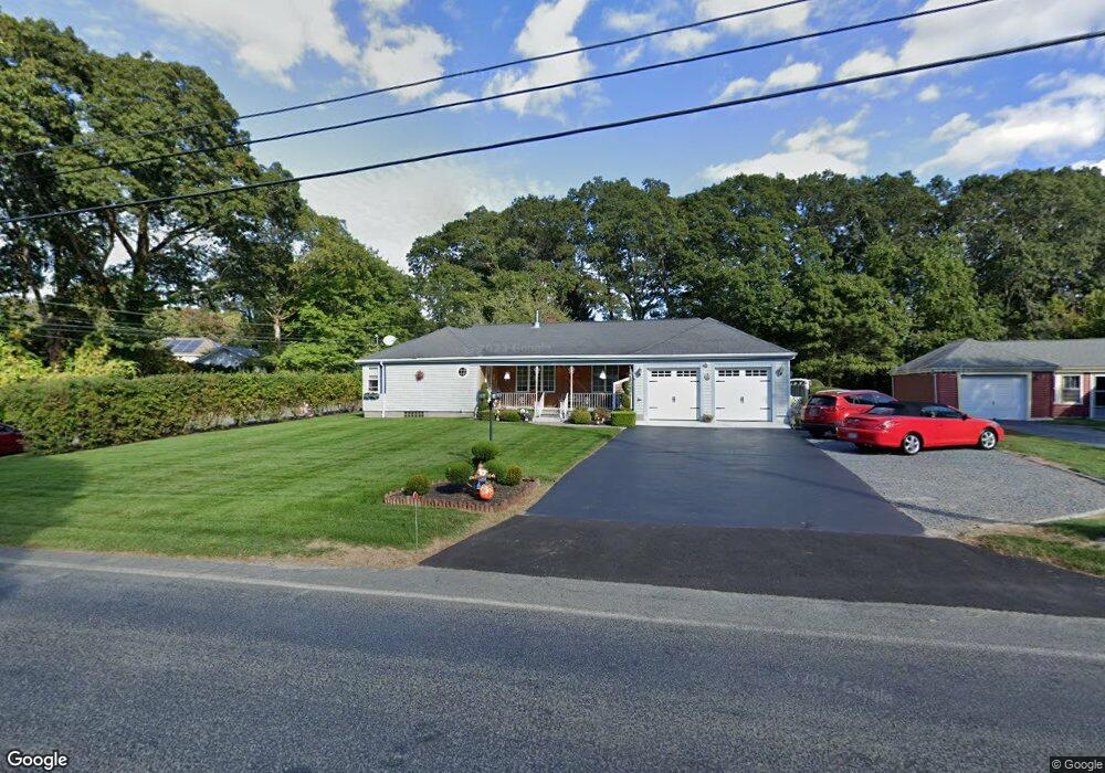
452 Sanford Rd Westport, MA 02790
North Westport NeighborhoodEstimated Value: $499,255 - $689,000
3
Beds
--
Bath
1,688
Sq Ft
$334/Sq Ft
Est. Value
About This Home
This home is located at 452 Sanford Rd, Westport, MA 02790 and is currently estimated at $563,814, approximately $334 per square foot. 452 Sanford Rd is a home located in Bristol County with nearby schools including Alice A. Macomber Primary School, Westport Elementary School, and Westport Middle-High School.
Ownership History
Date
Name
Owned For
Owner Type
Purchase Details
Closed on
Apr 13, 1992
Sold by
Desrosiers Juliette
Bought by
Cambra Michael E and Cambra Cheryl A
Current Estimated Value
Home Financials for this Owner
Home Financials are based on the most recent Mortgage that was taken out on this home.
Original Mortgage
$100,000
Interest Rate
8.73%
Mortgage Type
Purchase Money Mortgage
Create a Home Valuation Report for This Property
The Home Valuation Report is an in-depth analysis detailing your home's value as well as a comparison with similar homes in the area
Home Values in the Area
Average Home Value in this Area
Purchase History
| Date | Buyer | Sale Price | Title Company |
|---|---|---|---|
| Cambra Michael E | $125,000 | -- |
Source: Public Records
Mortgage History
| Date | Status | Borrower | Loan Amount |
|---|---|---|---|
| Closed | Cambra Michael E | $100,000 | |
| Previous Owner | Cambra Michael E | $250,000 |
Source: Public Records
Tax History Compared to Growth
Tax History
| Year | Tax Paid | Tax Assessment Tax Assessment Total Assessment is a certain percentage of the fair market value that is determined by local assessors to be the total taxable value of land and additions on the property. | Land | Improvement |
|---|---|---|---|---|
| 2025 | $3,354 | $450,200 | $166,800 | $283,400 |
| 2024 | $3,306 | $427,700 | $148,100 | $279,600 |
| 2023 | $3,207 | $393,000 | $134,900 | $258,100 |
| 2022 | $2,818 | $354,800 | $134,900 | $219,900 |
| 2021 | $2,818 | $326,900 | $111,500 | $215,400 |
| 2020 | $2,719 | $322,500 | $107,100 | $215,400 |
| 2019 | $2,778 | $335,900 | $107,100 | $228,800 |
| 2018 | $2,449 | $299,700 | $108,300 | $191,400 |
| 2017 | $2,330 | $292,400 | $104,800 | $187,600 |
| 2016 | $2,151 | $271,900 | $101,400 | $170,500 |
| 2015 | $1,998 | $251,900 | $103,700 | $148,200 |
Source: Public Records
Map
Nearby Homes