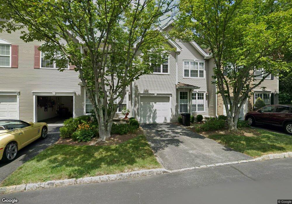
452 Sierra Ct Mahwah, NJ 07430
Estimated Value: $781,707 - $817,000
--
Bed
--
Bath
1,888
Sq Ft
$426/Sq Ft
Est. Value
About This Home
This home is located at 452 Sierra Ct, Mahwah, NJ 07430 and is currently estimated at $805,177, approximately $426 per square foot. 452 Sierra Ct is a home located in Bergen County with nearby schools including Mahwah High School.
Ownership History
Date
Name
Owned For
Owner Type
Purchase Details
Closed on
Sep 1, 2000
Sold by
Nelson Debra J
Bought by
Huang Victor Wei Chung and Liu Belinda Shu Rong
Current Estimated Value
Home Financials for this Owner
Home Financials are based on the most recent Mortgage that was taken out on this home.
Original Mortgage
$296,000
Interest Rate
7.83%
Purchase Details
Closed on
Sep 10, 1999
Sold by
Brenner Peter and Brenner Kathleen
Bought by
Nelson Debra Jean
Home Financials for this Owner
Home Financials are based on the most recent Mortgage that was taken out on this home.
Original Mortgage
$303,250
Interest Rate
6.12%
Purchase Details
Closed on
Apr 19, 1996
Sold by
K Hovnanian At Mahwah Viii Inc
Bought by
Brenner Peter and Brenner Kathleen
Home Financials for this Owner
Home Financials are based on the most recent Mortgage that was taken out on this home.
Original Mortgage
$207,000
Interest Rate
7.81%
Create a Home Valuation Report for This Property
The Home Valuation Report is an in-depth analysis detailing your home's value as well as a comparison with similar homes in the area
Home Values in the Area
Average Home Value in this Area
Purchase History
| Date | Buyer | Sale Price | Title Company |
|---|---|---|---|
| Huang Victor Wei Chung | $370,000 | -- | |
| Nelson Debra Jean | $319,000 | -- | |
| Brenner Peter | $243,548 | -- |
Source: Public Records
Mortgage History
| Date | Status | Borrower | Loan Amount |
|---|---|---|---|
| Previous Owner | Huang Victor Wei Chung | $296,000 | |
| Previous Owner | Nelson Debra Jean | $303,250 | |
| Previous Owner | Brenner Peter | $207,000 |
Source: Public Records
Tax History Compared to Growth
Tax History
| Year | Tax Paid | Tax Assessment Tax Assessment Total Assessment is a certain percentage of the fair market value that is determined by local assessors to be the total taxable value of land and additions on the property. | Land | Improvement |
|---|---|---|---|---|
| 2025 | $9,404 | $455,600 | $190,000 | $265,600 |
| 2024 | $9,281 | $455,600 | $190,000 | $265,600 |
| 2023 | $8,984 | $455,600 | $190,000 | $265,600 |
| 2022 | $8,984 | $455,600 | $190,000 | $265,600 |
| 2021 | $8,889 | $455,600 | $190,000 | $265,600 |
| 2020 | $8,675 | $455,600 | $190,000 | $265,600 |
| 2019 | $8,388 | $455,600 | $190,000 | $265,600 |
| 2018 | $8,269 | $455,600 | $190,000 | $265,600 |
| 2017 | $8,137 | $455,600 | $190,000 | $265,600 |
| 2016 | $7,959 | $455,600 | $190,000 | $265,600 |
| 2015 | $7,850 | $455,600 | $190,000 | $265,600 |
| 2014 | $7,718 | $455,600 | $190,000 | $265,600 |
Source: Public Records
Map
Nearby Homes
- 435 Green Mountain Rd Unit 33
- 609 Glasmere Rd
- 622 Blue Ridge Ln
- 289 Vista View Dr
- 92 Hopkins Ct
- 64 Sunset Ct
- 227 Mountainview Dr
- 112 Moffatt Rd
- 111 Moffatt Rd
- 162 Grandview Ln Unit 162
- 199 Island Rd
- 1088 Ash Dr
- 128 Grove St
- 1271 Heath Ct
- 38 N Railroad Ave
- 17 Mountain Ave
- 34 N Railroad Ave
- 861 Juniper Way
- 950 Juniper Way Unit B1
- 14 N Railroad Ave
- 451 Sierra Ct
- 453 Sierra Ct
- 450 Sierra Ct
- 449 Sierra Ct
- 445 Santiago Ct
- 446 Santiago Ct
- 444 Santiago Ct
- 447 Santiago Ct Unit 447
- 443 Santiago Ct
- 448 Santiago Ct Unit 448
- 454 Lost River Ct
- 455 Lost River Ct
- 442 Santiago Ct
- 436 Green Mountain Rd
- 456 Lost River Ct
- 441 Santiago Ct
- 460 Green Mountain Rd
- 457 Lost River Ct
- 440 Santiago Ct
- 439 Santiago Ct