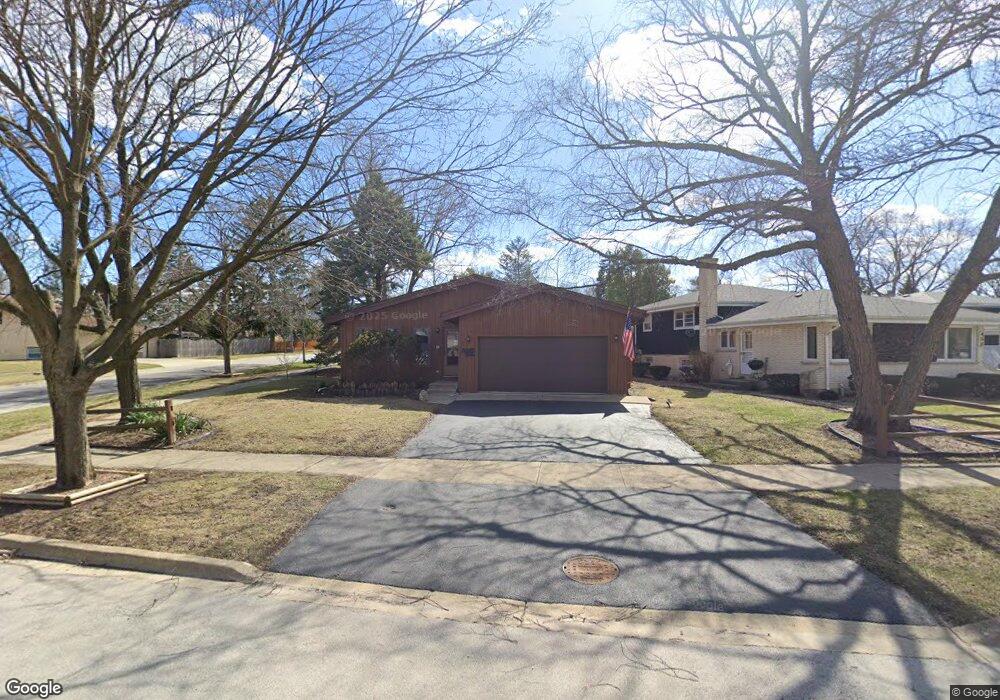
452 W Commonwealth Ln Elmhurst, IL 60126
Estimated Value: $400,771 - $499,000
Studio
--
Bath
1,326
Sq Ft
$346/Sq Ft
Est. Value
About This Home
This home is located at 452 W Commonwealth Ln, Elmhurst, IL 60126 and is currently estimated at $458,693, approximately $345 per square foot. 452 W Commonwealth Ln is a home located in DuPage County with nearby schools including Salt Creek Elementary School, Stella May Swartz Elementary School, and John E Albright Middle School.
Ownership History
Date
Name
Owned For
Owner Type
Purchase Details
Closed on
Nov 1, 1993
Sold by
Lessner Wayne F
Bought by
Cederborg Christine E
Current Estimated Value
Home Financials for this Owner
Home Financials are based on the most recent Mortgage that was taken out on this home.
Original Mortgage
$140,000
Interest Rate
5.87%
Create a Home Valuation Report for This Property
The Home Valuation Report is an in-depth analysis detailing your home's value as well as a comparison with similar homes in the area
Home Values in the Area
Average Home Value in this Area
Purchase History
| Date | Buyer | Sale Price | Title Company |
|---|---|---|---|
| Cederborg Christine E | $178,500 | -- |
Source: Public Records
Mortgage History
| Date | Status | Borrower | Loan Amount |
|---|---|---|---|
| Closed | Cederborg Christine E | $140,000 |
Source: Public Records
Tax History
| Year | Tax Paid | Tax Assessment Tax Assessment Total Assessment is a certain percentage of the fair market value that is determined by local assessors to be the total taxable value of land and additions on the property. | Land | Improvement |
|---|---|---|---|---|
| 2024 | $4,007 | $137,965 | $37,416 | $100,549 |
| 2023 | $3,736 | $127,580 | $34,600 | $92,980 |
| 2022 | $3,923 | $122,640 | $33,260 | $89,380 |
| 2021 | $4,099 | $119,590 | $32,430 | $87,160 |
| 2020 | $4,150 | $116,970 | $31,720 | $85,250 |
| 2019 | $4,206 | $111,210 | $30,160 | $81,050 |
| 2018 | $4,320 | $110,330 | $28,550 | $81,780 |
| 2017 | $4,476 | $105,140 | $27,210 | $77,930 |
| 2016 | $4,491 | $99,040 | $25,630 | $73,410 |
| 2015 | $4,772 | $92,270 | $23,880 | $68,390 |
| 2014 | $5,005 | $90,040 | $21,800 | $68,240 |
| 2013 | $4,959 | $91,310 | $22,110 | $69,200 |
Source: Public Records
Map
Nearby Homes
- 465 W Verret St
- 964 S Hillside Ave
- 8 Saint Regis Ct
- 3 Charlotte Cir
- 3 Dewalt Ct
- 625 E Van Buren St
- 2 S Atrium Way Unit 606
- 1S045 Spring Rd Unit H2
- 1S045 Spring Rd Unit 1D
- 1S055 Spring Rd Unit 1C
- 995 S Swain Ave
- 20 Oak Tree Ct
- 868 S Spring Rd
- 1 Maple Tree Ct
- 936 S Mitchell Ave
- 1335 S Villa Ave
- 4 Oak Brook Club Dr Unit G205
- 1200 S Prospect Ave Unit 108
- 130 Crab Apple Ln
- 769 S Fairview Ave
- 458 W Commonwealth Ln
- 462 W Commonwealth Ln
- 1059 S Sunset Ave
- 466 W Commonwealth Ln
- 1042 S Sunset Ave
- 470 W Commonwealth Ln
- 1077 S Sunset Ave
- 436 W Commonwealth Ln
- 475 W Avery St
- 443 W Commonwealth Ln
- 432 W Commonwealth Ln
- 455 W Avery St
- 474 W Commonwealth Ln
- 459 W Commonwealth Ln
- 481 W Avery St
- 477 W Avery St
- 439 W Commonwealth Ln
- 1038 S Sunset Ave
- 428 W Commonwealth Ln
- 435 W Commonwealth Ln
Your Personal Tour Guide
Ask me questions while you tour the home.