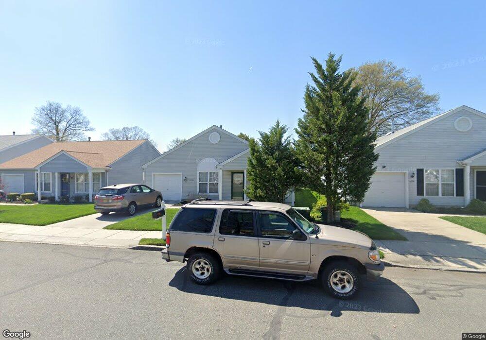
4520 Arrison Ct Pennsauken, NJ 08109
Estimated Value: $340,000 - $405,000
--
Bed
--
Bath
1,420
Sq Ft
$257/Sq Ft
Est. Value
About This Home
This home is located at 4520 Arrison Ct, Pennsauken, NJ 08109 and is currently estimated at $365,281, approximately $257 per square foot. 4520 Arrison Ct is a home with nearby schools including Thomas Paine Elementary School, John A Carusi Middle School, and Cherry Hill High-West High School.
Ownership History
Date
Name
Owned For
Owner Type
Purchase Details
Closed on
Sep 2, 2020
Sold by
Maple Commons Homeowners Association Inc
Bought by
County Of Camden
Current Estimated Value
Purchase Details
Closed on
Aug 30, 2006
Sold by
Zane Helen
Bought by
Nardi Frank J and Nardi Barbara M
Home Financials for this Owner
Home Financials are based on the most recent Mortgage that was taken out on this home.
Original Mortgage
$70,715
Interest Rate
6.49%
Purchase Details
Closed on
Dec 19, 2001
Sold by
Maple Commons Urban Renewal Ll
Bought by
Zane Edward and Zane Helen
Home Financials for this Owner
Home Financials are based on the most recent Mortgage that was taken out on this home.
Original Mortgage
$138,000
Interest Rate
7.14%
Create a Home Valuation Report for This Property
The Home Valuation Report is an in-depth analysis detailing your home's value as well as a comparison with similar homes in the area
Home Values in the Area
Average Home Value in this Area
Purchase History
| Date | Buyer | Sale Price | Title Company |
|---|---|---|---|
| County Of Camden | -- | None Listed On Document | |
| Nardi Frank J | $274,900 | -- | |
| Zane Edward | $152,940 | -- |
Source: Public Records
Mortgage History
| Date | Status | Borrower | Loan Amount |
|---|---|---|---|
| Previous Owner | Nardi Frank J | $70,715 | |
| Previous Owner | Zane Edward | $138,000 |
Source: Public Records
Tax History Compared to Growth
Tax History
| Year | Tax Paid | Tax Assessment Tax Assessment Total Assessment is a certain percentage of the fair market value that is determined by local assessors to be the total taxable value of land and additions on the property. | Land | Improvement |
|---|---|---|---|---|
| 2025 | $8,116 | $316,500 | $50,400 | $266,100 |
| 2024 | $7,960 | $186,500 | $45,300 | $141,200 |
| 2023 | $7,960 | $186,500 | $45,300 | $141,200 |
| 2022 | $1,748 | $45,300 | $45,300 | $0 |
| 2021 | $1,795 | $45,300 | $45,300 | $0 |
| 2020 | $1,608 | $45,300 | $45,300 | $0 |
| 2019 | $1,627 | $45,300 | $45,300 | $0 |
| 2018 | $1,635 | $45,300 | $45,300 | $0 |
| 2017 | $1,639 | $45,300 | $45,300 | $0 |
| 2016 | $0 | $201,600 | $60,400 | $141,200 |
| 2015 | -- | $201,600 | $60,400 | $141,200 |
| 2014 | -- | $142,900 | $29,600 | $113,300 |
Source: Public Records
Map
Nearby Homes
- 4527 Arrison Ct
- 7320 Maple Ave Unit 231
- 7330 Maple Ave Unit 123
- 7340 Maple Ave
- 7336 Rudderow Ave
- 213 Wilbur Ave
- 4312 Union Ave
- 124 Ivins Ave
- 202 State St
- 7628 Rudderow Ave
- 710 Church Rd
- 214 Barlow Ave
- 7665 Rudderow Ave
- 10 Church Rd
- 6555 Maple Ave
- 217 Glenwood Ave
- 210 E Maple Ave Unit A4
- 7775 Marion Ave
- 327 Monroe Ave
- 3412 Union Ave Unit C4
- 4524 Arrison Ct
- 4516 Arrison Ct
- 4602 Arrison Ct
- 4512 Arrison Ct
- 4532 Cooper Ave
- 4526 Cooper Ave
- 4523 Arrison Ct
- 4508 Arrison Ct
- 4519 Arrison Ct
- 7074 Cooper Ave
- 4515 Arrison Ct
- 4610 Arrison Ct
- 4504 Arrison Ct
- 4520 Cooper Ave
- 4601 Arrison Ct
- 4605 Arrison Ct
- 4614 Arrison Ct
- 4528 Shapley Ct
- 4532 Shapley Ct
- 4524 Shapley Ct