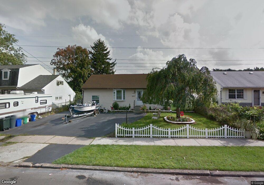
4520 Brookside Ave Bristol, PA 19007
Estimated Value: $337,000 - $346,000
3
Beds
2
Baths
1,246
Sq Ft
$274/Sq Ft
Est. Value
About This Home
This home is located at 4520 Brookside Ave, Bristol, PA 19007 and is currently estimated at $341,025, approximately $273 per square foot. 4520 Brookside Ave is a home located in Bucks County with nearby schools including Truman Senior High School, First Presbyterian Church School, and Isabet Academy.
Ownership History
Date
Name
Owned For
Owner Type
Purchase Details
Closed on
May 24, 2019
Sold by
Marley Properties Llc
Bought by
Vinciguerro Kasie and Vinciguerro Nikki
Current Estimated Value
Home Financials for this Owner
Home Financials are based on the most recent Mortgage that was taken out on this home.
Original Mortgage
$211,105
Outstanding Balance
$183,877
Interest Rate
3.75%
Mortgage Type
FHA
Estimated Equity
$157,148
Purchase Details
Closed on
Jan 25, 2019
Sold by
Wardaski Mitchel J and Wardaski Carol A
Bought by
Marley Properties Llc
Purchase Details
Closed on
Aug 1, 1988
Sold by
Wardaski Mitchell J
Bought by
Wardaski Mitchell J and Carol Ann
Create a Home Valuation Report for This Property
The Home Valuation Report is an in-depth analysis detailing your home's value as well as a comparison with similar homes in the area
Home Values in the Area
Average Home Value in this Area
Purchase History
| Date | Buyer | Sale Price | Title Company |
|---|---|---|---|
| Vinciguerro Kasie | $215,000 | Westminster Abstract Company | |
| Marley Properties Llc | $120,000 | None Available | |
| Wardaski Mitchell J | -- | -- |
Source: Public Records
Mortgage History
| Date | Status | Borrower | Loan Amount |
|---|---|---|---|
| Open | Vinciguerro Kasie | $211,105 |
Source: Public Records
Tax History Compared to Growth
Tax History
| Year | Tax Paid | Tax Assessment Tax Assessment Total Assessment is a certain percentage of the fair market value that is determined by local assessors to be the total taxable value of land and additions on the property. | Land | Improvement |
|---|---|---|---|---|
| 2025 | $4,454 | $16,400 | $4,320 | $12,080 |
| 2024 | $4,454 | $16,400 | $4,320 | $12,080 |
| 2023 | $4,421 | $16,400 | $4,320 | $12,080 |
| 2022 | $4,421 | $16,400 | $4,320 | $12,080 |
| 2021 | $4,421 | $16,400 | $4,320 | $12,080 |
| 2020 | $4,421 | $16,400 | $4,320 | $12,080 |
| 2019 | $4,405 | $16,400 | $4,320 | $12,080 |
| 2018 | $4,334 | $16,400 | $4,320 | $12,080 |
| 2017 | $4,268 | $16,400 | $4,320 | $12,080 |
| 2016 | $4,268 | $16,400 | $4,320 | $12,080 |
| 2015 | $3,036 | $16,400 | $4,320 | $12,080 |
| 2014 | $3,036 | $16,400 | $4,320 | $12,080 |
Source: Public Records
Map
Nearby Homes
- 3021 Bath Rd
- 150 Naomi Ct Unit 811
- 246 Colette Ct
- 145 Mill Dr
- 23 Misty Pine Rd
- 185 Delhaas Cir
- 183 Delhaas Cir
- 187 Delhaas Cir
- 189 Delhaas Cir
- 194 Delhaas Cir
- 186 Delhaas Cir
- 192 Delhaas Cir
- 193 Delhaas Cir
- 190 Delhaas Cir
- 184 Delhaas Cir
- 188 Delhaas Cir
- 191 Delhaas Cir
- 0 West Ave
- 206 Delhaas Cir
- 4510 Fayette Dr
- 4600 Brookside Ave
- 4518 Brookside Ave
- 4516 Brookside Ave
- 4602 Brookside Ave
- 2500 Woodlawn Dr
- 2501 Woodlawn Dr
- 4514 Brookside Ave
- 4604 Brookside Ave
- 4603 Brookside Ave
- 4517 Brookside Ave
- 4512 Brookside Ave
- 2503 Woodlawn Dr
- 2501 Green Ave
- 4515 Brookside Ave
- 2502 Woodlawn Dr
- 2503 Green Ave
- 4513 Brookside Ave
- 4603 David Dr
- 2505 Woodlawn Dr
- 4606 Brookside Ave