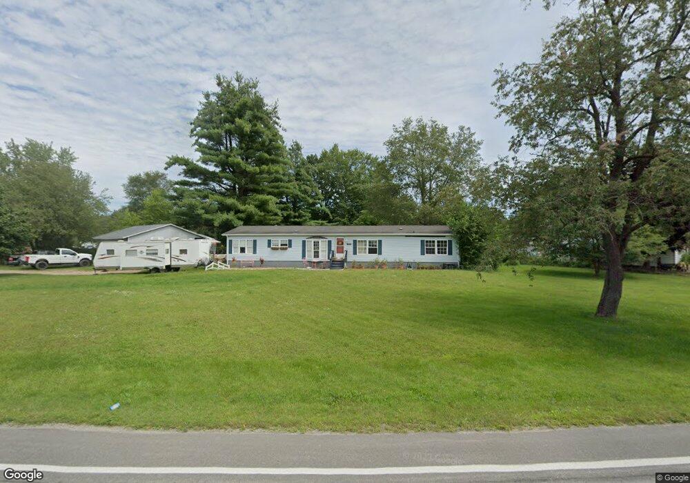
4520 Brott Rd Ruby, MI 48049
Ruby NeighborhoodEstimated Value: $217,000 - $303,000
About This Home
This home is located at 4520 Brott Rd, Ruby, MI 48049 and is currently estimated at $249,000, approximately $123 per square foot. 4520 Brott Rd is a home located in St. Clair County with nearby schools including Yale Senior High School.
Ownership History
We collect this data history from publicly available records. To have your information removed, we recommend requesting removal directly through your county’s website.
Purchase Details
Purchase Details
Purchase Details
Purchase Details
Purchase Details
Home Values in the Area
Average Home Value in this Area
Purchase History
We collect this data history from publicly available records. To have your information removed, we recommend requesting removal directly through your county’s website.
| Date | Buyer | Sale Price | Title Company |
|---|---|---|---|
| -- | Attorney | ||
| -- | Attorney | ||
| -- | -- | ||
| -- | -- | ||
| -- | None Available | ||
| $129,563 | None Available |
Tax History
We collect this data history from publicly available records. To have your information removed, we recommend requesting removal directly through your county’s website.
| Year | Tax Paid | Tax Assessment Tax Assessment Total Assessment is a certain percentage of the fair market value that is determined by local assessors to be the total taxable value of land and additions on the property. | Land | Improvement |
|---|---|---|---|---|
| 2025 | $702 | $110,300 | $0 | $0 |
| 2024 | $681 | $111,700 | $0 | $0 |
| 2023 | $648 | $102,000 | $0 | $0 |
| 2022 | $1,560 | $90,600 | $0 | $0 |
| 2020 | $1,351 | $81,100 | $23,300 | $57,800 |
| 2019 | $1,335 | $67,100 | $0 | $0 |
| 2018 | $1,316 | $68,900 | $0 | $0 |
| 2017 | $1,301 | $64,600 | $0 | $0 |
| 2016 | $549 | $64,600 | $0 | $0 |
| 2015 | -- | $52,300 | $0 | $52,300 |
| 2014 | -- | $51,300 | $0 | $51,300 |
| 2013 | -- | $61,500 | $0 | $0 |
Map
- 6865 Abbottsford Rd
- 4299 Rabidue Rd
- 3750 Mclain Rd
- 3910 Cribbins Rd
- Lot 2 Beard Rd
- Lot 1 Beard Rd
- Lot 3 Beard Rd
- Lot 4 Beard Rd
- 3650 Rabidue Rd
- VL Lapeer Rd
- VL Cribbins Rd
- 3309 Rabidue Rd
- 0004 Vincent Rd
- 0002 Vincent Rd
- 0003 Vincent Rd
- 0001 Vincent Rd
- 0 Rynn Rd Unit 50202174
- 7860 Rynn Rd
- 0000 Conrad Dr
- 00 Bean Vl Lot E Rd
- 4526 Brott Rd
- 4526 Brott Rd
- 6855 Mels Dr
- 6845 Mels Dr
- 4548 Brott Rd
- 6840 Imlay City Rd
- 6860 Imlay City Rd
- 6854 Mels Dr
- 6825 Mels Dr
- 4554 Brott Rd
- 6844 Mels Dr
- 6820 Imlay City Rd
- 6805 Mels Dr
- 4562 Brott Rd
- 6800 Imlay City Rd
- 6871 Imlay City Rd
- 6801 Mels Dr
- 4035 Brott Rd
- 6863 Imlay City Rd
- 6885 Imlay City Rd
Ask me questions while you tour the home.