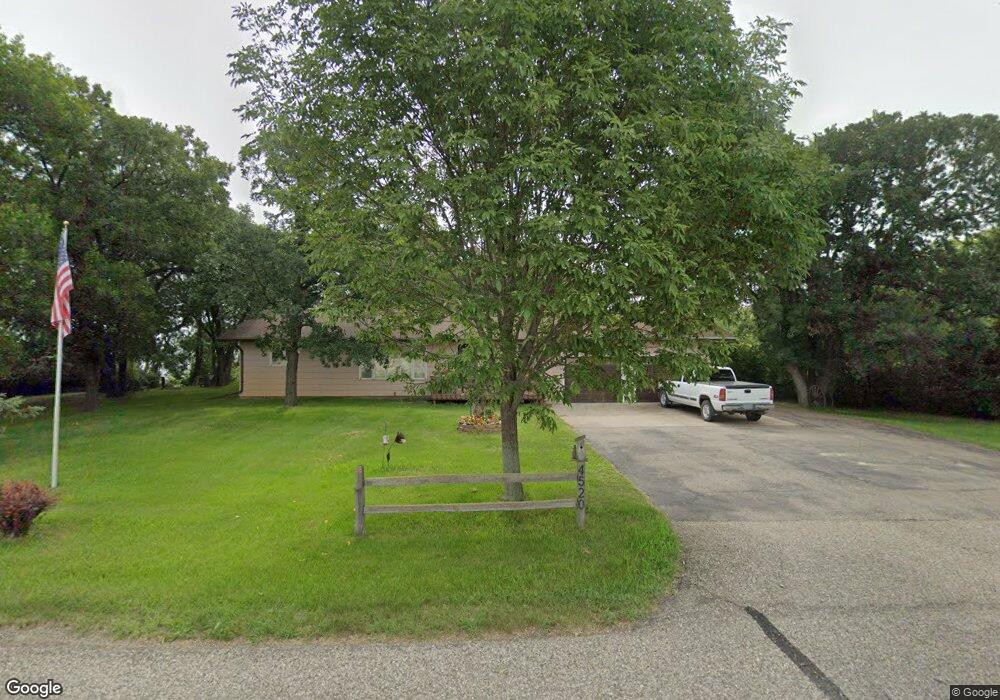
4520 Highway 20 Devils Lake, ND 58301
Estimated Value: $339,000 - $681,000
2
Beds
1
Bath
1,288
Sq Ft
$357/Sq Ft
Est. Value
About This Home
This home is located at 4520 Highway 20, Devils Lake, ND 58301 and is currently estimated at $459,637, approximately $356 per square foot. 4520 Highway 20 is a home with nearby schools including Minnie H. Kindergarten Center, Central Middle School, and Devils Lake High School.
Ownership History
Date
Name
Owned For
Owner Type
Purchase Details
Closed on
May 20, 2022
Sold by
Vasichek John L and Vasichek Darlene E
Bought by
John L Vasichek Trust
Current Estimated Value
Purchase Details
Closed on
May 5, 2009
Sold by
Nordrum Bryan L and Nordrum Kristi R
Bought by
Vasichek John L and Vasichek Darlene E
Home Financials for this Owner
Home Financials are based on the most recent Mortgage that was taken out on this home.
Original Mortgage
$109,600
Interest Rate
4.9%
Mortgage Type
New Conventional
Create a Home Valuation Report for This Property
The Home Valuation Report is an in-depth analysis detailing your home's value as well as a comparison with similar homes in the area
Purchase History
| Date | Buyer | Sale Price | Title Company |
|---|---|---|---|
| John L Vasichek Trust | -- | None Listed On Document | |
| Vasichek John L | -- | None Available | |
| Vasichek John L | $137,000 | None Available |
Source: Public Records
Mortgage History
| Date | Status | Borrower | Loan Amount |
|---|---|---|---|
| Previous Owner | Vasichek John L | $109,600 |
Source: Public Records
Tax History
| Year | Tax Paid | Tax Assessment Tax Assessment Total Assessment is a certain percentage of the fair market value that is determined by local assessors to be the total taxable value of land and additions on the property. | Land | Improvement |
|---|---|---|---|---|
| 2025 | $2,886 | $121,950 | $40,000 | $81,950 |
| 2024 | $2,886 | $114,850 | $40,000 | $74,850 |
| 2023 | $2,369 | $111,400 | $29,000 | $82,400 |
| 2022 | $2,157 | $104,650 | $22,250 | $82,400 |
| 2021 | $1,919 | $95,250 | $22,250 | $73,000 |
| 2020 | $1,754 | $90,750 | $22,250 | $68,500 |
| 2019 | $1,733 | $89,000 | $22,250 | $66,750 |
| 2018 | $1,584 | $0 | $0 | $0 |
| 2017 | $1,365 | $0 | $0 | $0 |
| 2016 | $1,235 | $67,750 | $0 | $0 |
| 2015 | $1,396 | $0 | $0 | $0 |
| 2014 | $1,451 | $0 | $0 | $0 |
| 2013 | -- | $0 | $0 | $0 |
Source: Public Records
Map
Nearby Homes
- 2435 12th Ave SW
- 2613 29th Ave SW
- LOT 11 Pinehurst Ct
- LOT 12 Pinehurst Ct
- LOT 10 Pinehurst Ct
- LOT 13 Augusta Ave
- LOT 8 Augusta Ave
- 802 Washington Ave
- LOT 9 Pinehurst Ct
- LOT 3 Augusta Ave
- LOT 2 Augusta Ave
- LOT 4 Augusta Ave
- LOT 7 Augusta Ave
- LOT 5 Augusta Ave
- LOT 6 Augusta Ave
- 518 Fair Ave
- XX Country Club Estates
- 113 Country Club Rd
- 215 Nadess Ave
- TBD Eagle Bend Estates
- 4518 Highway 20
- 4517 Highway 20
- 4517 Highway 20
- 4510 Highway 20
- 4508 Highway 20
- 4506 Highway 20
- 122 Acorn Ridge
- 142 Acorn Ridge
- 106 Acorn Ridge
- 4535 Highway 20
- 119 Rock Island Dr
- 4507 Highway 20
- 133 Acorn Ridge
- 109 Acorn Ridge
- 157 Acorn Ridge
- 157 Acorn Ridge
- 225 Acorn Ridge
- 118 Rock Island Dr
- 112 Rock Island Dr
- 404 Roberts St
Your Personal Tour Guide
Ask me questions while you tour the home.