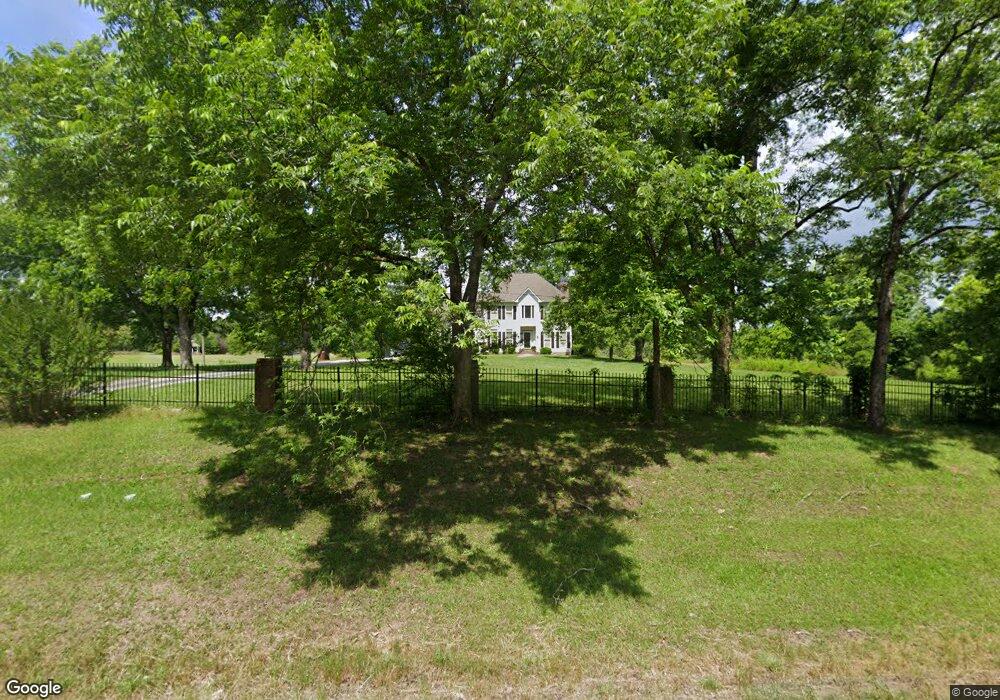
4520 Highway 77 N Union Point, GA 30669
Estimated Value: $295,000 - $434,000
--
Bed
2
Baths
2,320
Sq Ft
$156/Sq Ft
Est. Value
About This Home
This home is located at 4520 Highway 77 N, Union Point, GA 30669 and is currently estimated at $361,879, approximately $155 per square foot. 4520 Highway 77 N is a home located in Greene County with nearby schools including Greene County High School.
Ownership History
Date
Name
Owned For
Owner Type
Purchase Details
Closed on
May 5, 2020
Sold by
Randolph Robert L
Bought by
Jackson Jalyssa
Current Estimated Value
Home Financials for this Owner
Home Financials are based on the most recent Mortgage that was taken out on this home.
Original Mortgage
$99,715
Outstanding Balance
$88,291
Interest Rate
3.6%
Mortgage Type
FHA
Estimated Equity
$273,588
Purchase Details
Closed on
Jun 27, 2014
Sold by
Jackson Shantelle D
Bought by
Randolph Robert L and Randolph Cornelia L
Purchase Details
Closed on
Feb 3, 2012
Sold by
Jackson Mario
Bought by
Jackson Shantelle
Purchase Details
Closed on
Apr 20, 1999
Sold by
Ranolph Robert L and Ranolph Cornelia
Bought by
Jackson Shantelle D and Jackson Mario V
Purchase Details
Closed on
Oct 2, 1996
Bought by
Ranolph Robert L and Ranolph Cornelia
Create a Home Valuation Report for This Property
The Home Valuation Report is an in-depth analysis detailing your home's value as well as a comparison with similar homes in the area
Home Values in the Area
Average Home Value in this Area
Purchase History
| Date | Buyer | Sale Price | Title Company |
|---|---|---|---|
| Jackson Jalyssa | $240,000 | -- | |
| Randolph Robert L | -- | -- | |
| Jackson Shantelle | -- | -- | |
| Jackson Shantelle D | -- | -- | |
| Ranolph Robert L | -- | -- |
Source: Public Records
Mortgage History
| Date | Status | Borrower | Loan Amount |
|---|---|---|---|
| Open | Jackson Jalyssa | $99,715 |
Source: Public Records
Tax History Compared to Growth
Tax History
| Year | Tax Paid | Tax Assessment Tax Assessment Total Assessment is a certain percentage of the fair market value that is determined by local assessors to be the total taxable value of land and additions on the property. | Land | Improvement |
|---|---|---|---|---|
| 2025 | $2,048 | $127,320 | $15,960 | $111,360 |
| 2024 | $2,180 | $121,480 | $15,960 | $105,520 |
| 2023 | $2,017 | $111,840 | $12,080 | $99,760 |
| 2022 | $1,936 | $97,960 | $9,280 | $88,680 |
| 2021 | $1,879 | $88,520 | $9,280 | $79,240 |
| 2020 | $1,515 | $63,360 | $8,240 | $55,120 |
| 2019 | $1,549 | $63,360 | $8,240 | $55,120 |
| 2018 | $1,529 | $63,360 | $8,240 | $55,120 |
| 2017 | $1,415 | $62,132 | $8,252 | $53,880 |
| 2016 | $1,428 | $62,812 | $8,252 | $54,560 |
| 2015 | $1,405 | $62,812 | $8,252 | $54,560 |
| 2014 | $1,305 | $57,648 | $8,252 | $49,396 |
Source: Public Records
Map
Nearby Homes
- 3434 Union Point Rd
- 0 Dogwood Rd
- 1211 Peachtree Ave W
- 0 Woodville Rd Unit 7667944
- 0 Woodville Rd Unit 10628010
- 1091 Peachtree Ave E
- 1110 Woodland Way
- 1110 Woodland Ln
- 5971 Penfield Rd
- 5011 Penfield Rd
- 1101 Boswell Rd
- 204 Maple St
- 1251 Adams Rd
- 0 Washington Hwy Unit 7276060
- 3021 Penfield Rd
- 215 Hunter St
- 1860 Washington Hwy
- 324 N Rhodes St
- 0 S Rhodes St Unit 10618488
- 0 Woodland Ct Unit 10543600
- 4470 Hwy 77n
- 4470 Highway 77 N
- 1332 Community Dr
- 4460 Highway 77 N
- 0 Community Dr Unit 50601
- 0 Community Dr Unit 10351833
- 0 Community Dr Unit 66757
- 4430 Highway 77 N
- 3434 Union Point Rd Unit 3434 Union Point Roa
- 1372 Community Dr
- 1171 Community Dr
- 1131 Community Dr
- 1328 Community Dr
- 1322 Community Dr
- 1060 Community Dr
- 1121 Community Dr
- 1306 Community Dr
- 1061 Community Dr
- 4350 Highway 77 N
- 4350 Highway 77 N