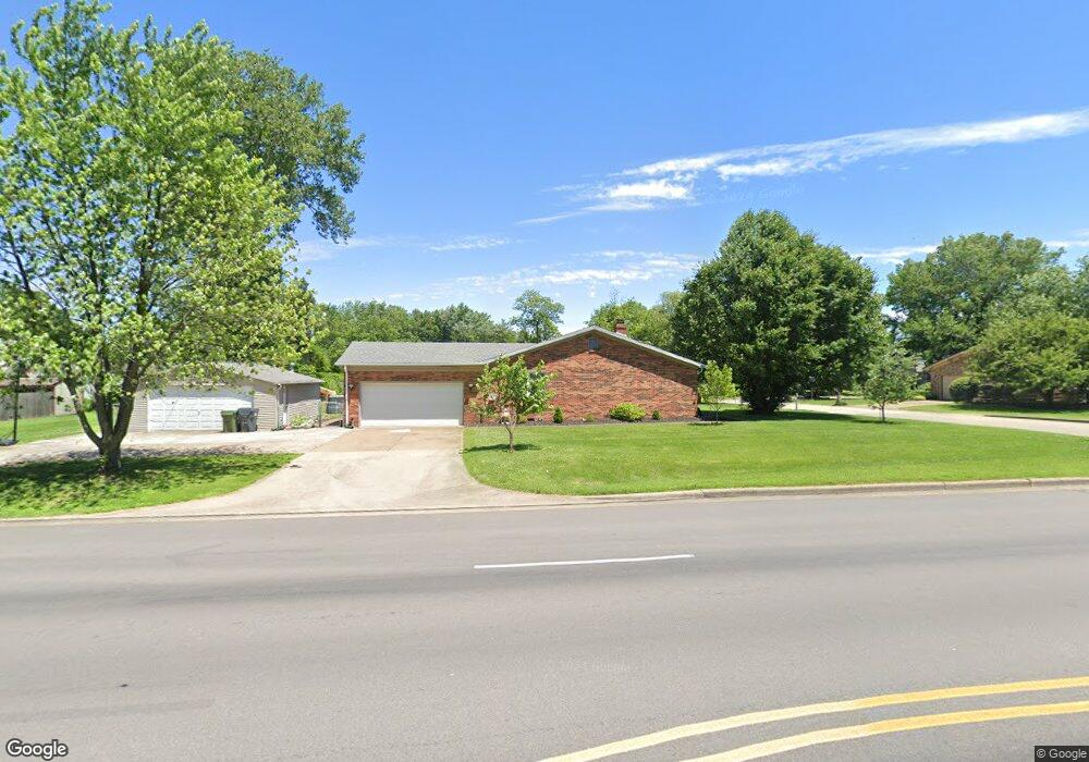
4522 Stonegate Dr Newburgh, IN 47630
Estimated Value: $266,014 - $309,000
4
Beds
2
Baths
2,094
Sq Ft
$141/Sq Ft
Est. Value
About This Home
This home is located at 4522 Stonegate Dr, Newburgh, IN 47630 and is currently estimated at $294,754, approximately $140 per square foot. 4522 Stonegate Dr is a home located in Warrick County with nearby schools including Newburgh Elementary School, Castle North Middle School, and Castle High School.
Ownership History
Date
Name
Owned For
Owner Type
Purchase Details
Closed on
Feb 24, 2011
Sold by
Secretary Of Housing & Urban Development
Bought by
Grimwood Daniel R
Current Estimated Value
Home Financials for this Owner
Home Financials are based on the most recent Mortgage that was taken out on this home.
Original Mortgage
$105,957
Outstanding Balance
$71,677
Interest Rate
4.85%
Mortgage Type
New Conventional
Estimated Equity
$223,077
Purchase Details
Closed on
Sep 1, 2009
Sold by
Flagstar Bank Fsb
Bought by
Secretary Of Housing & Urban Development
Purchase Details
Closed on
Apr 9, 2009
Sold by
Shoup Erick A and Shoup Staci S
Bought by
Flagstar Bank Fsb
Create a Home Valuation Report for This Property
The Home Valuation Report is an in-depth analysis detailing your home's value as well as a comparison with similar homes in the area
Home Values in the Area
Average Home Value in this Area
Purchase History
| Date | Buyer | Sale Price | Title Company |
|---|---|---|---|
| Grimwood Daniel R | -- | None Available | |
| Secretary Of Housing & Urban Development | -- | None Available | |
| Flagstar Bank Fsb | $150,359 | None Available |
Source: Public Records
Mortgage History
| Date | Status | Borrower | Loan Amount |
|---|---|---|---|
| Open | Grimwood Daniel R | $105,957 |
Source: Public Records
Tax History
| Year | Tax Paid | Tax Assessment Tax Assessment Total Assessment is a certain percentage of the fair market value that is determined by local assessors to be the total taxable value of land and additions on the property. | Land | Improvement |
|---|---|---|---|---|
| 2025 | $1,008 | $232,900 | $45,700 | $187,200 |
| 2024 | $1,008 | $217,400 | $31,300 | $186,100 |
| 2023 | $968 | $212,500 | $31,300 | $181,200 |
| 2022 | $960 | $203,100 | $31,300 | $171,800 |
| 2021 | $735 | $174,600 | $36,700 | $137,900 |
| 2020 | $679 | $161,700 | $33,900 | $127,800 |
| 2019 | $760 | $164,400 | $33,200 | $131,200 |
| 2018 | $627 | $157,700 | $33,200 | $124,500 |
| 2017 | $801 | $156,000 | $33,200 | $122,800 |
| 2016 | $645 | $141,200 | $33,200 | $108,000 |
| 2014 | $1,001 | $146,300 | $35,300 | $111,000 |
| 2013 | $1,025 | $149,800 | $35,400 | $114,400 |
Source: Public Records
Map
Nearby Homes
- 8300 Oak Dr
- 8344 N Birch Dr
- 4266 Foxmoor Dr
- 8211 Yorkridge Dr
- 8188 Sycamore Dr
- 4433 Stonegarden Ln
- 8855 Hickory Ln
- 8911 Blackstone Dr
- 8160 Wyntree Villas Dr
- 0 Willow Pond Rd
- 7970 Alexandra Ln
- 4500 Clint Cir
- 7811 Ridgemont Dr
- 7877 Camp Brosend Rd
- 5233 State Route 261
- 3895 High Pointe Dr
- 3879 High Pointe Dr
- 7733 Ridgemont Dr
- 5144 Kenwood Dr
- 7588 Broadview Dr
- 4500 Bell Rd
- 8477 Outer Lincoln Ave
- 4566 Stonegate Dr
- 4577 Stonegate Dr
- 4555 Bell Rd
- 8511 Outer Lincoln Ave
- 8455 Outer Lincoln Ave
- 8440 Poplar Dr
- 4577 Bell Rd
- 4599 Stonegate Dr
- 8533 Outer Lincoln Ave
- 4588 Stonegate Dr
- 8433 Outer Lincoln Ave
- 8555 Lincoln Ave
- 4611 Stonegate Dr
- 8422 Poplar Dr
- 4600 Stonegate Dr
- 8444 Outer Lincoln Ave
- 8411 Outer Lincoln Ave
- 8499 Sycamore Dr
Your Personal Tour Guide
Ask me questions while you tour the home.