Estimated Value: $230,000 - $285,000
3
Beds
3
Baths
2,371
Sq Ft
$105/Sq Ft
Est. Value
About This Home
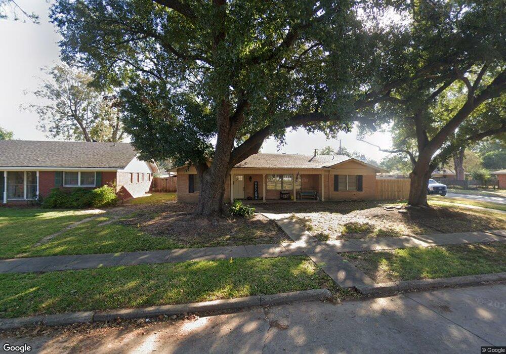
This home is located at 4523 Tibbs St, Shreveport, LA 71105 and is currently estimated at $249,842, approximately $105 per square foot. 4523 Tibbs St is a home located in Caddo Parish with nearby schools including Broadmoor STEM Academy, Fairfield Magnet School, and Eden Gardens Fundamental Elementary School.
Ownership History
Date
Name
Owned For
Owner Type
Purchase Details
Closed on
Mar 11, 2016
Sold by
White Andrews Ronna Rae
Bought by
Jessup Robert Tracy
Current Estimated Value
Purchase Details
Closed on
Sep 21, 2011
Sold by
Buller Daniel Robert and Buller Maxine Mary Naquin
Bought by
Andrews Ronna Rae White
Home Financials for this Owner
Home Financials are based on the most recent Mortgage that was taken out on this home.
Original Mortgage
$218,808
Interest Rate
4.28%
Mortgage Type
FHA
Create a Home Valuation Report for This Property
The Home Valuation Report is an in-depth analysis detailing your home's value as well as a comparison with similar homes in the area
Home Values in the Area
Average Home Value in this Area
Purchase History
| Date | Buyer | Sale Price | Title Company |
|---|---|---|---|
| Jessup Robert Tracy | $235,000 | Security Title | |
| Andrews Ronna Rae White | $224,500 | None Available |
Source: Public Records
Mortgage History
| Date | Status | Borrower | Loan Amount |
|---|---|---|---|
| Previous Owner | Andrews Ronna Rae White | $218,808 |
Source: Public Records
Tax History Compared to Growth
Tax History
| Year | Tax Paid | Tax Assessment Tax Assessment Total Assessment is a certain percentage of the fair market value that is determined by local assessors to be the total taxable value of land and additions on the property. | Land | Improvement |
|---|---|---|---|---|
| 2024 | $2,962 | $19,003 | $4,286 | $14,717 |
| 2023 | $2,778 | $17,431 | $4,082 | $13,349 |
| 2022 | $2,778 | $17,431 | $4,082 | $13,349 |
| 2021 | $2,736 | $17,431 | $4,082 | $13,349 |
| 2020 | $2,736 | $17,431 | $4,082 | $13,349 |
| 2019 | $2,751 | $17,009 | $4,082 | $12,927 |
| 2018 | $2,190 | $17,009 | $4,082 | $12,927 |
| 2017 | $2,794 | $17,009 | $4,082 | $12,927 |
| 2015 | $1,178 | $16,590 | $4,080 | $12,510 |
| 2014 | $1,187 | $16,590 | $4,080 | $12,510 |
| 2013 | -- | $16,590 | $4,080 | $12,510 |
Source: Public Records
Map
Nearby Homes
- 4622 Tibbs St
- 351 Arthur Ave
- 4419 Norway Dr
- 209 Dogwood Rd
- 462 Gloria Ave
- 237 Pierremont Rd
- 5812 Fern Ave
- 4509 Finley Dr
- 261 Pierremont Rd
- 4421 Fern Ave
- 265 Pierremont Rd
- 470 Pennsylvania Ave
- 263 Symphony Ln
- 353 Atlantic Ave
- 460 Leo Ave
- 459 Atlantic Ave
- 470 Leo Ave
- 300 Pierremont Rd Unit 40
- 297 Pennsylvania Ave
- 4719 Gilbert Dr