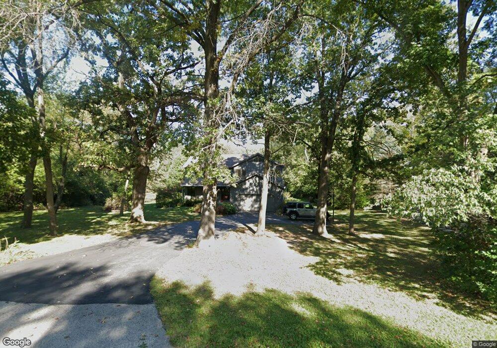
4524 Ripon Rd Crystal Lake, IL 60012
Estimated Value: $503,188 - $601,000
3
Beds
5
Baths
2,988
Sq Ft
$185/Sq Ft
Est. Value
About This Home
This home is located at 4524 Ripon Rd, Crystal Lake, IL 60012 and is currently estimated at $554,047, approximately $185 per square foot. 4524 Ripon Rd is a home located in McHenry County with nearby schools including Husmann Elementary School, Hannah Beardsley Middle School, and Prairie Ridge High School.
Ownership History
Date
Name
Owned For
Owner Type
Purchase Details
Closed on
Jan 15, 1999
Sold by
Snarski John M and Schubert Christina L
Bought by
Sidi Colin and Sidi Channing
Current Estimated Value
Home Financials for this Owner
Home Financials are based on the most recent Mortgage that was taken out on this home.
Original Mortgage
$252,000
Outstanding Balance
$58,399
Interest Rate
6.75%
Estimated Equity
$495,648
Create a Home Valuation Report for This Property
The Home Valuation Report is an in-depth analysis detailing your home's value as well as a comparison with similar homes in the area
Home Values in the Area
Average Home Value in this Area
Purchase History
| Date | Buyer | Sale Price | Title Company |
|---|---|---|---|
| Sidi Colin | $280,000 | Chicago Title Insurance Co |
Source: Public Records
Mortgage History
| Date | Status | Borrower | Loan Amount |
|---|---|---|---|
| Open | Sidi Colin | $252,000 |
Source: Public Records
Tax History Compared to Growth
Tax History
| Year | Tax Paid | Tax Assessment Tax Assessment Total Assessment is a certain percentage of the fair market value that is determined by local assessors to be the total taxable value of land and additions on the property. | Land | Improvement |
|---|---|---|---|---|
| 2024 | $9,797 | $137,022 | $28,018 | $109,004 |
| 2023 | $9,502 | $122,879 | $25,126 | $97,753 |
| 2022 | $9,518 | $117,845 | $26,804 | $91,041 |
| 2021 | $9,031 | $110,486 | $25,130 | $85,356 |
| 2020 | $8,895 | $107,175 | $24,377 | $82,798 |
| 2019 | $8,578 | $101,896 | $23,176 | $78,720 |
| 2018 | $9,901 | $114,758 | $29,815 | $84,943 |
| 2017 | $10,000 | $109,943 | $28,564 | $81,379 |
| 2016 | $9,957 | $104,897 | $27,253 | $77,644 |
| 2013 | -- | $99,831 | $25,937 | $73,894 |
Source: Public Records
Map
Nearby Homes
- 4706 Wyoming Way
- 1009 Persimmon Ct
- 1087 Sugar Maple Dr
- 1140 River Birch Blvd
- 1091 Sugar Maple Dr
- 1119 Glengary Cir
- 636 Cassia Ct
- 634 Cassia Ct
- 632 Cassia Ct
- Charlotte Plan at Woodlore Estates - Woodlore Townes - Phase 2
- Marianne Plan at Woodlore Estates - Woodlore Townes - Phase 2
- Darcy Plan at Woodlore Estates - Woodlore Townes - Phase 2
- 1027 Mayhaw Dr
- 1149 Brighton Cir
- 654 Cassia Ct
- 648 Cassia Ct
- 660 Cassia Ct
- 1170 Overhill Ct
- 546 Cimmaron Cir
- 1214 Buckeye Cir
- 4602 Ripon Rd
- 4520 Ripon Rd
- 4514 Ripon Rd
- 4519 Ripon Rd
- 4410 Stanford St
- 4607 Ripon Rd
- 4601 Wyoming Way
- 4605 Wyoming Way
- 4502 Ripon Rd
- 4516 Carthage Ct
- 4508 Ripon Rd
- 4513 Ripon Rd
- 4520 Carthage Ct
- 4509 Ripon Rd
- 4702 Ripon Rd
- 1091 Williamsbury Dr
- 1087 Williamsbury Dr
- 4703 Wyoming Way
- 1083 Williamsbury Dr
- 1025 Persimmon Ct