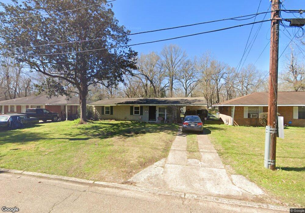
4525 Mcclelland Ct Baton Rouge, LA 70805
Mid City North NeighborhoodEstimated Value: $62,000 - $80,000
3
Beds
1
Bath
1,022
Sq Ft
$68/Sq Ft
Est. Value
About This Home
This home is located at 4525 Mcclelland Ct, Baton Rouge, LA 70805 and is currently estimated at $69,086, approximately $67 per square foot. 4525 Mcclelland Ct is a home located in East Baton Rouge Parish with nearby schools including Claiborne Elementary School, Brookstown Middle Magnet Academy, and Istrouma High School.
Ownership History
Date
Name
Owned For
Owner Type
Purchase Details
Closed on
Mar 31, 1998
Sold by
Sellers Brent Alan
Bought by
Springer Monica Davis
Current Estimated Value
Home Financials for this Owner
Home Financials are based on the most recent Mortgage that was taken out on this home.
Original Mortgage
$31,600
Outstanding Balance
$5,967
Interest Rate
7.04%
Estimated Equity
$63,119
Create a Home Valuation Report for This Property
The Home Valuation Report is an in-depth analysis detailing your home's value as well as a comparison with similar homes in the area
Home Values in the Area
Average Home Value in this Area
Purchase History
| Date | Buyer | Sale Price | Title Company |
|---|---|---|---|
| Springer Monica Davis | $42,900 | -- |
Source: Public Records
Mortgage History
| Date | Status | Borrower | Loan Amount |
|---|---|---|---|
| Open | Springer Monica Davis | $31,600 |
Source: Public Records
Tax History Compared to Growth
Tax History
| Year | Tax Paid | Tax Assessment Tax Assessment Total Assessment is a certain percentage of the fair market value that is determined by local assessors to be the total taxable value of land and additions on the property. | Land | Improvement |
|---|---|---|---|---|
| 2024 | $74 | $6,228 | $314 | $5,914 |
| 2023 | $74 | $5,560 | $280 | $5,280 |
| 2022 | $664 | $5,560 | $280 | $5,280 |
| 2021 | $649 | $5,560 | $280 | $5,280 |
| 2020 | $644 | $5,560 | $280 | $5,280 |
| 2019 | $612 | $5,050 | $250 | $4,800 |
| 2018 | $604 | $5,050 | $250 | $4,800 |
| 2017 | $604 | $5,050 | $250 | $4,800 |
| 2016 | $43 | $3,370 | $250 | $3,120 |
| 2015 | $64 | $4,900 | $250 | $4,650 |
| 2014 | $570 | $4,900 | $250 | $4,650 |
| 2013 | -- | $4,900 | $250 | $4,650 |
Source: Public Records
Map
Nearby Homes
- 6550/6534 Prescott Rd
- 4791 Prescott Rd
- 4778 Broadway St
- 4126 Prescott Ct
- 5949 Heidel Ave
- 5373 Sycamore St
- 4887 Enterprise St
- 5765 Beech St
- TBD E Brookstown Dr
- 5035 Mcclelland Dr
- 3905 Elm Dr
- 5950 Saint Gerard Ave
- 5136 Mcclelland Dr
- 4762 Clayton Dr
- 5169 Annette St
- 4641 Clayton Dr
- 4635 Sherwood St
- 5218 Enterprise St
- 5156 Linden St
- 5332 Enterprise St
- 4465 Mcclelland Ct
- 4535 Mcclelland Ct
- 4445 Mcclelland Ct
- 4545 Mcclelland Ct
- 4545 Mcclelland Ct Unit 1
- 5245 Shelley Ct
- 5466 Shelley Ct
- 4524 Mcclelland Ct
- 4536 Mcclelland Ct
- 4444 Mcclelland Ct
- 5550 Shelley Ct
- 4434 Mcclelland Ct
- 4435 Mcclelland Ct
- 4555 Mcclelland Ct
- 5612 Shelley Ct
- 5515 Shelley Ct
- 5615 Clayton Ct
- 5615 Clayton Ct
- 5425 Clayton Dr
- 4425 Mcclelland Ct