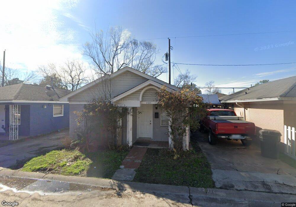
4527 Lelay Cir Houston, TX 77022
Independence Heights NeighborhoodEstimated Value: $136,931 - $174,000
2
Beds
1
Bath
872
Sq Ft
$176/Sq Ft
Est. Value
About This Home
This home is located at 4527 Lelay Cir, Houston, TX 77022 and is currently estimated at $153,733, approximately $176 per square foot. 4527 Lelay Cir is a home located in Harris County with nearby schools including Kennedy Elementary School, Williams Middle, and Booker T Washington Sr High.
Ownership History
Date
Name
Owned For
Owner Type
Purchase Details
Closed on
Jul 28, 2017
Sold by
Collett Bobby and Collett Bobby
Bought by
Collett Bobby
Current Estimated Value
Purchase Details
Closed on
Sep 9, 2010
Sold by
Deutsche Bank National Trust Company
Bought by
Nguy Minh and Huang Jian
Purchase Details
Closed on
Mar 2, 2010
Sold by
Cantrell Elizabeth and Cantrell Michael
Bought by
Deutsche Bank National Trust Company
Purchase Details
Closed on
Mar 22, 2006
Sold by
Fmb Real Estate Investments Llc
Bought by
Cantrell Elizabeth
Purchase Details
Closed on
May 1, 2005
Sold by
Forrest Spindle Trust
Bought by
Fmb Real Estate Investments Llc
Home Financials for this Owner
Home Financials are based on the most recent Mortgage that was taken out on this home.
Original Mortgage
$43,000
Interest Rate
5.75%
Mortgage Type
Purchase Money Mortgage
Purchase Details
Closed on
Mar 31, 2005
Sold by
Fannie Mae
Bought by
Spindle Forrest Gray and Spindle Bronwen Freda
Home Financials for this Owner
Home Financials are based on the most recent Mortgage that was taken out on this home.
Original Mortgage
$43,000
Interest Rate
5.75%
Mortgage Type
Purchase Money Mortgage
Purchase Details
Closed on
Oct 5, 2004
Sold by
Vallejo Francisco D
Bought by
Federal National Mortgage Association
Purchase Details
Closed on
Oct 22, 1997
Sold by
Blankenship Trust
Bought by
Vallejo Francisco D
Home Financials for this Owner
Home Financials are based on the most recent Mortgage that was taken out on this home.
Original Mortgage
$39,900
Interest Rate
7.52%
Purchase Details
Closed on
Aug 26, 1997
Sold by
Drennan Ulrick
Bought by
Blankenship Trust
Home Financials for this Owner
Home Financials are based on the most recent Mortgage that was taken out on this home.
Original Mortgage
$39,900
Interest Rate
7.52%
Create a Home Valuation Report for This Property
The Home Valuation Report is an in-depth analysis detailing your home's value as well as a comparison with similar homes in the area
Home Values in the Area
Average Home Value in this Area
Purchase History
| Date | Buyer | Sale Price | Title Company |
|---|---|---|---|
| Collett Bobby | -- | None Available | |
| Collett Bobby | -- | None Available | |
| Collett Bobby | -- | None Available | |
| Nguy Minh | -- | Lsi Title Agency Inc | |
| Deutsche Bank National Trust Company | $55,250 | None Available | |
| Cantrell Elizabeth | -- | Fidelity National Title Co | |
| Fmb Real Estate Investments Llc | -- | -- | |
| Spindle Forrest Gray | -- | Texas American Title Company | |
| Federal National Mortgage Association | $40,896 | -- | |
| Vallejo Francisco D | -- | Alamo Title Company #77 | |
| Blankenship Trust | -- | -- |
Source: Public Records
Mortgage History
| Date | Status | Borrower | Loan Amount |
|---|---|---|---|
| Previous Owner | Spindle Forrest Gray | $43,000 | |
| Previous Owner | Vallejo Francisco D | $39,900 |
Source: Public Records
Tax History Compared to Growth
Tax History
| Year | Tax Paid | Tax Assessment Tax Assessment Total Assessment is a certain percentage of the fair market value that is determined by local assessors to be the total taxable value of land and additions on the property. | Land | Improvement |
|---|---|---|---|---|
| 2025 | $1,988 | $96,798 | $33,707 | $63,091 |
| 2024 | $1,988 | $95,000 | $33,707 | $61,293 |
| 2023 | $1,988 | $96,600 | $33,707 | $62,893 |
| 2022 | $2,127 | $96,600 | $33,707 | $62,893 |
| 2021 | $1,408 | $60,400 | $13,879 | $46,521 |
| 2020 | $1,486 | $61,385 | $13,879 | $47,506 |
| 2019 | $1,300 | $51,385 | $13,879 | $37,506 |
| 2018 | $1,141 | $45,107 | $13,879 | $31,228 |
| 2017 | $1,141 | $45,107 | $13,879 | $31,228 |
| 2016 | $721 | $28,530 | $4,957 | $23,573 |
| 2015 | $733 | $28,530 | $4,957 | $23,573 |
| 2014 | $733 | $28,530 | $4,957 | $23,573 |
Source: Public Records
Map
Nearby Homes
- 144 Knightsbridge Park Ln
- 147 Knightsbridge Park Ln
- 107 W Whitney St Unit E
- 107 W Whitney St Unit C
- 4423 Yale St
- 225 Noras Ln Unit E
- 8901 N Main St
- 4510 Old Yale St Unit A
- 115 E Thornton Rd
- 4435 Whitney Oak Ln
- 310 Walthall Dr
- 312 Walthall Dr
- 315 E Whitney St
- 0 Victoria Unit 54691087
- 4605 Yale St Unit C
- 4605 Yale St Unit A
- 4605 Yale St Unit J
- 320 Thornton Rd
- 0 E 45th St
- 303 Victoria Dr
- 4531 Lelay Cir
- 4523 Lelay Cir
- 4526 Pecan Park Cir
- 4530 Pecan Park Cir
- 4522 Pecan Park Cir
- 4519 Lelay Cir
- 4535 Lelay Cir
- 4534 Pecan Park Cir
- 4518 Pecan Park Cir
- 4526 Lelay Cir
- 4522 Lelay Cir
- 4530 Lelay Cir
- 4515 Lelay Cir
- 4539 Lelay Cir
- 4518 Lelay Cir
- 4538 Pecan Park Cir
- 4514 Pecan Park Cir
- 4534 Lelay Cir
- 4514 Lelay Cir
- 4511 Lelay Cir