
45275 Highway 242 Myrtle Point, OR 97458
Estimated payment $2,186/month
Highlights
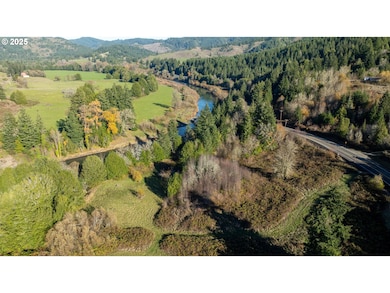
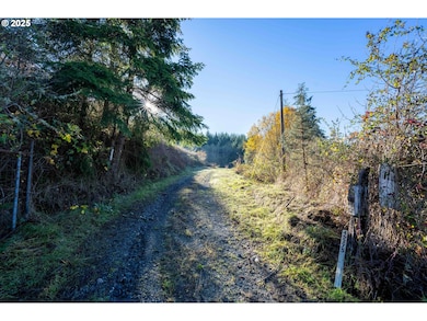
- River Front
- 37.55 Acre Lot
- Farm
- RV Access or Parking
- Mountain View
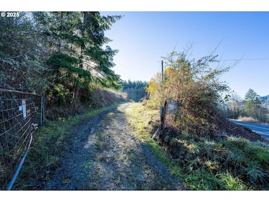
- Secluded Lot
About This Home
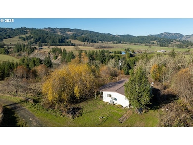
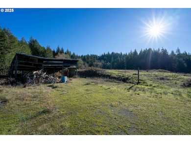
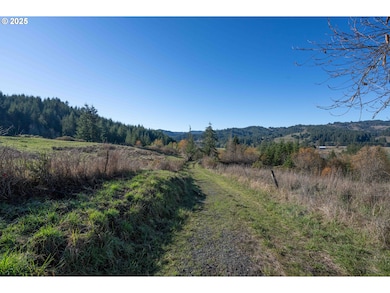
AMAZING OPPORTUNITY TO OWN APPROX. 1,900' OF SOUTH FORK COQUILLE RIVER FRONTAGE ON APPROX. 37.55 +/- ACRES! Approx. 6.8 +/- Acres of Level River Frontage Provide Seclusion & Scenery for a plethora of Outdoor Activities! The remaining 30.75 +/- ACRES boasts Old Growth Timber & some Pasture that formerly was Home to the Previous Owners' Horse! Two Manufactured Homes are on the property, 1978 & 1979 Year Built, mainly left in place for a New Owner to use to their benefit. Spring Water System & Septic Conditions UKNOWN. Tranquil, Peaceful & Secluded - the Ideal Property with a Plethora of Uses to Fit YOUR IDEAS!
Listing Agent
Pacific Properties Brokerage Phone: 541-740-2778 License #201227582 Listed on: 03/03/2025
Property Details
Home Type
- Manufactured Home With Land
Est. Annual Taxes
- $1,049
Year Built
- Built in 1978
Lot Details
- 37.55 Acre Lot
- River Front
- Gated Home
- Secluded Lot
- Level Lot
- Cleared Lot
Property Views
- Mountain
- Valley
Home Design
- Fixer Upper
- Pillar, Post or Pier Foundation
- Metal Siding
Interior Spaces
- 2,066 Sq Ft Home
- 1-Story Property
- Aluminum Window Frames
- Family Room
- Living Room
- Dining Room
- Crawl Space
Bedrooms and Bathrooms
- 3 Bedrooms
- 2 Full Bathrooms
Parking
- Carport
- Driveway
- RV Access or Parking
Schools
- Myrtle Crest Elementary School
- Myrtle Point Middle School
- Powers High School
Farming
- Farm
Utilities
- No Cooling
- Forced Air Heating System
- Spring water is a source of water for the property
- Electric Water Heater
- Septic Tank
Community Details
- No Home Owners Association
Listing and Financial Details
- Assessor Parcel Number 1321600
Map
Home Values in the Area
Average Home Value in this Area
Property History
| Date | Event | Price | List to Sale | Price per Sq Ft |
|---|---|---|---|---|
| 12/01/2025 12/01/25 | Pending | -- | -- | -- |
| 10/18/2025 10/18/25 | Price Changed | $399,000 | -6.1% | $193 / Sq Ft |
| 03/03/2025 03/03/25 | For Sale | $425,000 | -- | $206 / Sq Ft |
Source: Regional Multiple Listing Service (RMLS)
MLS Number: 24348970
Disclaimer: Certain information contained herein is derived from information provided by parties other than Homes.com. All information provided is deemed reliable, but is not guaranteed to be accurate and should be independently verified.
![]() The content relating to real estate for sale on this web site comes in part from the IDX program of the RMLS™ of Portland, Oregon. Real estate listings held by brokerage firms other than Ten-X are marked with the RMLS™ logo, and detailed information about these properties includes the names of the listing brokers. Listing content is copyright © 2025 RMLS™, Portland, Oregon. Some properties which appear for sale on this web site may subsequently have sold or may no longer be available. All information provided is deemed reliable but is not guaranteed and should be independently verified.
The content relating to real estate for sale on this web site comes in part from the IDX program of the RMLS™ of Portland, Oregon. Real estate listings held by brokerage firms other than Ten-X are marked with the RMLS™ logo, and detailed information about these properties includes the names of the listing brokers. Listing content is copyright © 2025 RMLS™, Portland, Oregon. Some properties which appear for sale on this web site may subsequently have sold or may no longer be available. All information provided is deemed reliable but is not guaranteed and should be independently verified.
