Estimated Value: $236,000 - $334,000
3
Beds
1
Bath
1,415
Sq Ft
$193/Sq Ft
Est. Value
About This Home
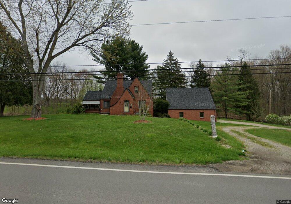
This home is located at 4528 Mogadore Rd, Kent, OH 44240 and is currently estimated at $272,904, approximately $192 per square foot. 4528 Mogadore Rd is a home located in Portage County with nearby schools including Brimfield Elementary School, Field Middle School, and Field High School.
Ownership History
Date
Name
Owned For
Owner Type
Purchase Details
Closed on
Sep 18, 2003
Sold by
Weakland James R and Weakland Noma A
Bought by
Lowther Shawn R and Tymcio Christie L
Current Estimated Value
Home Financials for this Owner
Home Financials are based on the most recent Mortgage that was taken out on this home.
Original Mortgage
$124,000
Outstanding Balance
$55,959
Interest Rate
6.44%
Mortgage Type
Purchase Money Mortgage
Estimated Equity
$216,945
Purchase Details
Closed on
Jun 22, 1987
Bought by
Weakland James R
Create a Home Valuation Report for This Property
The Home Valuation Report is an in-depth analysis detailing your home's value as well as a comparison with similar homes in the area
Home Values in the Area
Average Home Value in this Area
Purchase History
| Date | Buyer | Sale Price | Title Company |
|---|---|---|---|
| Lowther Shawn R | $155,000 | Franklin Mills Title | |
| Weakland James R | -- | -- |
Source: Public Records
Mortgage History
| Date | Status | Borrower | Loan Amount |
|---|---|---|---|
| Open | Lowther Shawn R | $124,000 |
Source: Public Records
Tax History
| Year | Tax Paid | Tax Assessment Tax Assessment Total Assessment is a certain percentage of the fair market value that is determined by local assessors to be the total taxable value of land and additions on the property. | Land | Improvement |
|---|---|---|---|---|
| 2024 | $3,590 | $75,220 | $17,470 | $57,750 |
| 2023 | $3,562 | $60,130 | $10,920 | $49,210 |
| 2022 | $3,572 | $60,130 | $10,920 | $49,210 |
| 2021 | $3,482 | $60,130 | $10,920 | $49,210 |
| 2020 | $3,058 | $47,640 | $10,920 | $36,720 |
| 2019 | $3,018 | $47,640 | $10,920 | $36,720 |
| 2018 | $2,376 | $44,420 | $10,920 | $33,500 |
| 2017 | $2,376 | $44,420 | $10,920 | $33,500 |
| 2016 | $2,369 | $44,420 | $10,920 | $33,500 |
| 2015 | $2,320 | $44,420 | $10,920 | $33,500 |
| 2014 | $2,212 | $44,420 | $10,920 | $33,500 |
| 2013 | $2,161 | $44,420 | $10,920 | $33,500 |
Source: Public Records
Map
Nearby Homes
- 0 Progress Blvd Unit LotWP001
- 4595 Creekside Dr
- 32 Picadilly Ct
- 146 Reserve Dr
- 124 Tallmadge Rd
- 112 Tallmadge Rd
- 1079 Carol Ln
- 3929 Lor Ron St
- 4545 State Route 43
- 294 Milton Dr
- 3880 Selnik Rd
- 4360 Beal Dr
- 0 Middlebury Rd
- 895 East Ave
- 1233 Cedar Ridge Rd
- 5096 Spruce Knoll Run
- 5088 Spruce Knoll Run
- 410 Beryl Dr
- 726 Hughey Dr
- 0 East Ave
- 4505 Mogadore Rd
- 4529 Mogadore Rd
- 4547 Mogadore Rd
- 4558 Mogadore Rd
- 4471 Mogadore Rd
- 4592 Mogadore Rd
- 4631 Mogadore Rd
- 4521 Sunnybrook Rd
- 4501 Sunnybrook Rd
- 4672 Mogadore Rd
- 4378 Mogadore Rd
- 4620 Crystal Pkwy
- 4364 Mogadore Rd
- 456 Howe Rd
- 474 Howe Rd
- 496 Howe Rd
- 512 Howe Rd
- 4528 Sunnybrook Rd
- 4486 Sunnybrook Rd
- 4354 Mogadore Rd
Your Personal Tour Guide
Ask me questions while you tour the home.