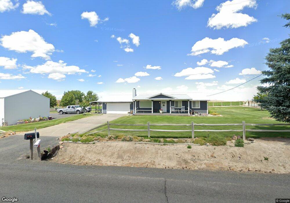
45285 Best Rd Pendleton, OR 97801
Estimated Value: $497,000 - $519,000
3
Beds
3
Baths
1,422
Sq Ft
$358/Sq Ft
Est. Value
About This Home
This home is located at 45285 Best Rd, Pendleton, OR 97801 and is currently estimated at $509,132, approximately $358 per square foot. 45285 Best Rd is a home located in Umatilla County with nearby schools including McKay Creek Elementary School, Sunridge Middle School, and Pendleton High School.
Ownership History
Date
Name
Owned For
Owner Type
Purchase Details
Closed on
Oct 29, 2013
Sold by
Miller Marilyn K
Bought by
Monagle Dawn D and Monagle John P
Current Estimated Value
Purchase Details
Closed on
May 27, 2011
Sold by
Williams Nathan D and Williams Star M
Bought by
Woodcock Leslie J and Miller Marilyn K
Home Financials for this Owner
Home Financials are based on the most recent Mortgage that was taken out on this home.
Original Mortgage
$203,000
Interest Rate
4.84%
Mortgage Type
New Conventional
Purchase Details
Closed on
May 27, 2009
Sold by
Burns Debra Mccoy
Bought by
Williams Nathan D and Williams Star M
Home Financials for this Owner
Home Financials are based on the most recent Mortgage that was taken out on this home.
Original Mortgage
$188,000
Interest Rate
4.8%
Mortgage Type
New Conventional
Create a Home Valuation Report for This Property
The Home Valuation Report is an in-depth analysis detailing your home's value as well as a comparison with similar homes in the area
Purchase History
| Date | Buyer | Sale Price | Title Company |
|---|---|---|---|
| Monagle Dawn D | $256,000 | Pioneer Title Co | |
| Woodcock Leslie J | $253,750 | Pioneer Title Co | |
| Williams Nathan D | $235,000 | Amerititle |
Source: Public Records
Mortgage History
| Date | Status | Borrower | Loan Amount |
|---|---|---|---|
| Previous Owner | Woodcock Leslie J | $203,000 | |
| Previous Owner | Williams Nathan D | $188,000 |
Source: Public Records
Tax History
| Year | Tax Paid | Tax Assessment Tax Assessment Total Assessment is a certain percentage of the fair market value that is determined by local assessors to be the total taxable value of land and additions on the property. | Land | Improvement |
|---|---|---|---|---|
| 2025 | $2,754 | $245,560 | $95,050 | $150,510 |
| 2023 | $2,642 | $231,470 | $89,590 | $141,880 |
| 2022 | $2,491 | $224,730 | $0 | $0 |
| 2021 | $2,288 | $200,720 | $84,450 | $116,270 |
| 2020 | $2,203 | $194,880 | $82,000 | $112,880 |
| 2018 | $2,183 | $183,700 | $77,300 | $106,400 |
| 2017 | $2,130 | $178,350 | $75,050 | $103,300 |
| 2016 | $2,087 | $173,160 | $72,860 | $100,300 |
| 2015 | $2,074 | $158,480 | $66,670 | $91,810 |
| 2014 | $1,971 | $158,480 | $66,670 | $91,810 |
Source: Public Records
Map
Nearby Homes
- 0000 County 1031 Rd
- 70349 Lakeside Rd
- 70981 SW Douglas Dr
- 71642 SW Park Ln
- 0 SW 2nd St Unit 263926795
- 1616 SW 2nd St
- 000 Motanic Rd
- 0 SW Quinney Place
- 1829 SW Athens Ave
- 1209 SW Zeta Ct
- 1394 Tutuilla Rd
- 1314 SW 11th Ct
- 1300 SW 10th Ct
- 1741 SW 18th St
- 73426 Memory Ln
- 45315 Trail Dr
- 3 Tutuilla Rd
- 42997 Haney Ln
- 0 SW Quinney Ln Unit 24414661
- 17 SE Kirk Ave
Your Personal Tour Guide
Ask me questions while you tour the home.